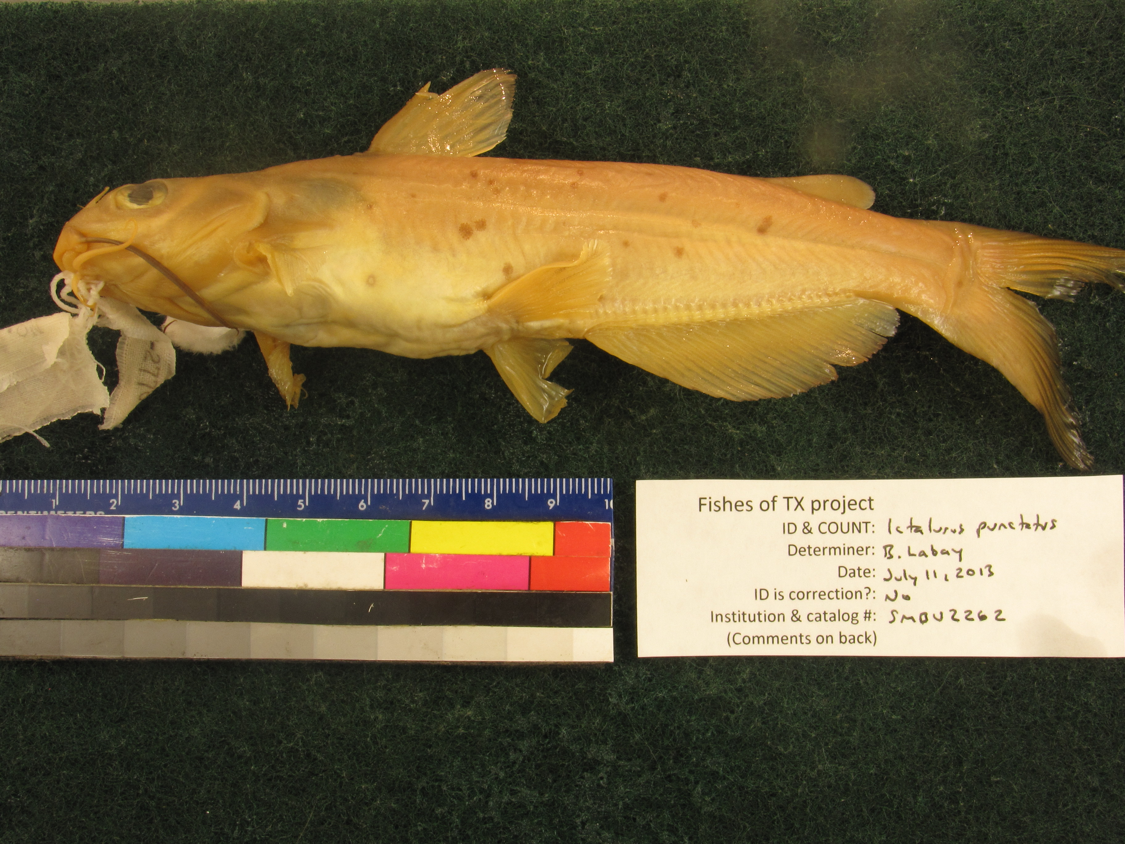
SMBU_2262
Not suspect, examinedPhotos
Map
Location
30.91976° N, 99.78259° W
(± 4840.9
m)
Taxonomy
GenusIctalurus
Speciespunctatus
Specimen
Num Specimens0
Collection Event
CollectorHendricks, Fred S.
Collected Date1969.5.10
Geography
DrainageColorado
CountryUnited States
StateTexas
CountyMenard
Locality3 mi I of Menard
Record Source
Source
Strecker Museum
(type: specimens)
Institution
Strecker Museum
(type: museum)
Curator
Anita Benedict
Record Added
May 13, 2010
Record Last Modified
June 22, 2022
Data Processing Track
Track 2
From Data Set Received
04/2009 to 10/2010
Identification
Suspect Notes
None
Count
No data
Current Determination
Determiner
Ben Labay
Determination Date
July 11, 2013
Determination Type
specimen examination
Identification Comments
Specimen examined and Id'ed for FoTX project. | anal fin ray count: 28-29
Identification Confidence
High
Collecting Event
Collected
May 10, 1969
Collector(s)
Collecting Event ID
1585
Field Notes
There are no field notes available.
Locality
Region
Edwards Plateau
Jurisdiction
Menard, Texas
Name
3 miles from Menard
Hydrography
Texas-Gulf Region
Lower Colorado-San Bernard Coastal
Middle Colorado-Concho
San Saba
Elm Creek-San Saba River
Menard Irrigation Company Canal-San Saba River
Captive
no
Locality Photos
No locality photos available.
flag (suspect/examine)
suspect: noexamination: yes
date
date_range: 5/10/1969-5/10/1969
collectors
collectors: Hendricks, Fred S.
collectors
collectors: Fred S. Hendricks
date
date_range: 5/10/1969-5/10/1969
staff comment
ID Status: Not flagged for specimen examination. By default we accept donor specimen determinations (after synonymization to our taxonomy). If georeferenced to TX this record has been considered in spatial context with other occurences of this species and accepted as correct.
ID Comments: NAGeoref Remark: Can't be sure of direction. Point is placed at Menard geographic center and extent runs 3 miles out.
georeference
Error: 4840.90675197923
Remarks: Can't be sure of direction. Point is placed at Menard geographic center and extent runs 3 miles out.
Locality: 3 miles from MenardCoordinates: 30.919763348;-99.782593342Georeferencer: AECGeographic note: Inland USA TexasCan't be sure of direction. Point is placed at Menard geographic center and extent runs 3 miles out.
Comments On SMBU_2262