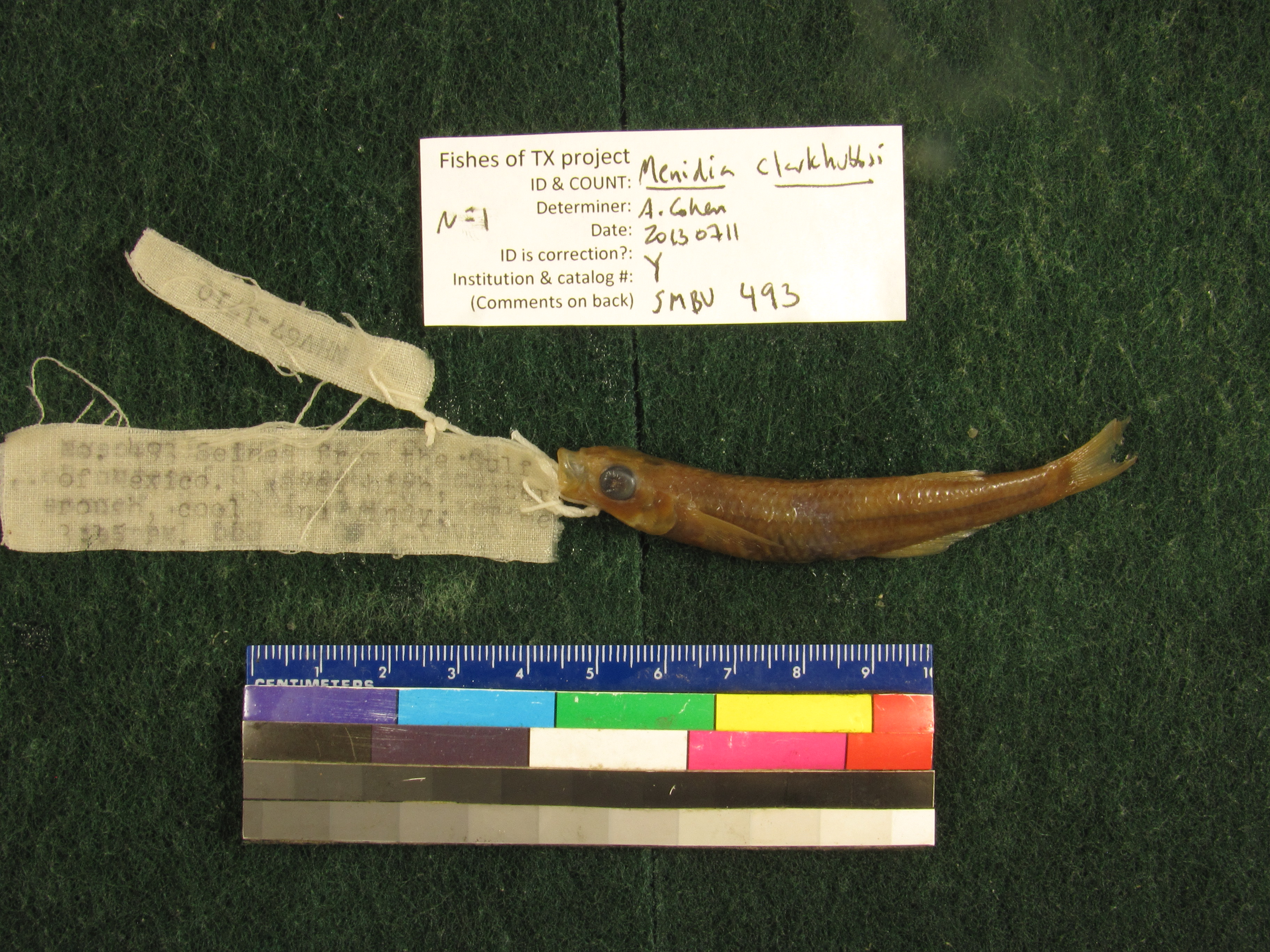
SMBU_493
Not suspect, examinedPhotos
Map
Location
29.19253° N, 94.98088° W
(± 1537.7
m)
Taxonomy
GenusFundulus
Speciesolivaceus
Specimen
Num Specimens0
Collection Event
CollectorMonroe, Molly; Jacquet, Edward
Collected Date1967.5.6
Geography
DrainageSan Jacinto-Brazos
CountryUnited States
StateTexas
CountyGalveston
Locality14 mi SW of Galveston, Jamaica Beach, Costal Road
Record Source
Source
Strecker Museum
(type: specimens)
Institution
Strecker Museum
(type: museum)
Curator
Anita Benedict
Record Added
May 13, 2010
Record Last Modified
June 22, 2022
Data Processing Track
Track 2
From Data Set Received
04/2009 to 10/2010
Identification
Suspect Notes
None
Count
No data
Current Determination
Determiner
Ben Labay
Determination Date
July 11, 2013
Determination Type
specimen examination
Identification Comments
Specimen examined and Id'ed for FoTX project. | 8 dorsal rays; elongate swim bladder
Identification Confidence
High
Collecting Event
Collected
May 6, 1967
Collector(s)
Collecting Event ID
7825
Field Notes
There are no field notes available.
Locality
Region
Gulf Coast Prairies & Marshes
Jurisdiction
Galveston, Texas
Name
Jamaica Beach, Galveston Island
Hydrography
Texas-Gulf Region
Galveston Bay-San Jacinto
Galveston Bay-Sabine Lake
West Galveston Bay
Halls Bayou
Halls Bayou
Captive
no
Locality Photos
No locality photos available.
flag (suspect/examine)
suspect: noexamination: yes
flag (suspect/examine)
mark examined and not suspect
date
date_range: 5/6/1967-5/6/1967
collectors
collectors: Monroe, Molly Jacquet, Edward
collectors
collectors: Molly Monroe, Edward Jacquet
staff comment
ID Status: This lot in need of examination, but not yet examined. Work in progress.
Georef Annotation: Boundaries of Jamaica Beach found at site: http://en.wikipedia.org/wiki/File:JamaicaBeachTXMap.gif
date
date_range: 5/6/1967-5/6/1967
flag (suspect/examine)
suspect flag — We wish to examine this specimen for ID verification
georeference
Error: 1537.66662240615
Remarks: Boundaries of Jamaica Beach found at site: http://en.wikipedia.org/wiki/File:JamaicaBeachTXMap.gif
Locality: Jamaica Beach, Galveston IslandCoordinates: 29.192525023;-94.980881491Georeferencer: MJCGeographic note: Marine USA TexasBoundaries of Jamaica Beach found at site: http://en.wikipedia.org/wiki/File:JamaicaBeachTXMap.gif
Comments On SMBU_493