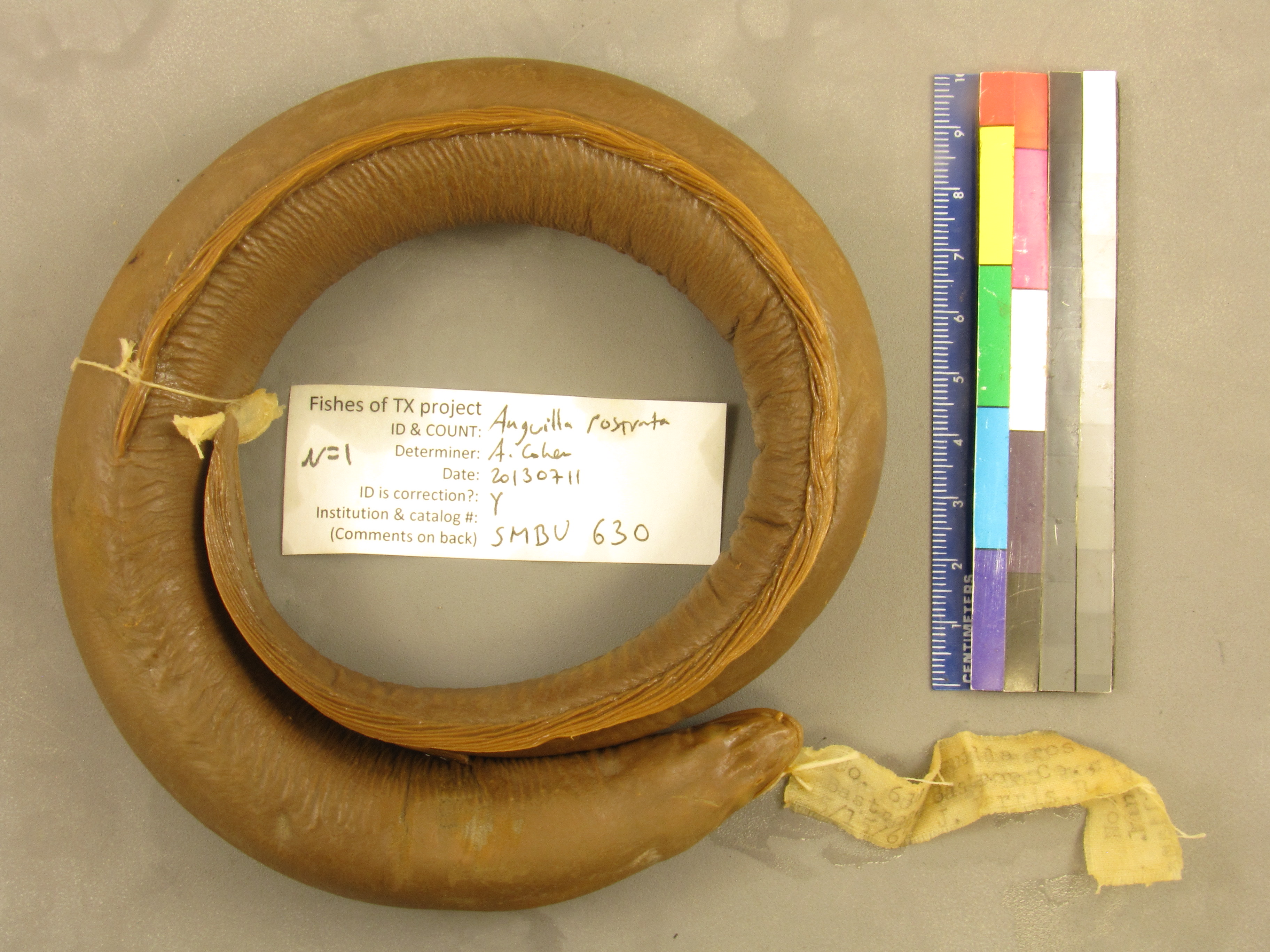
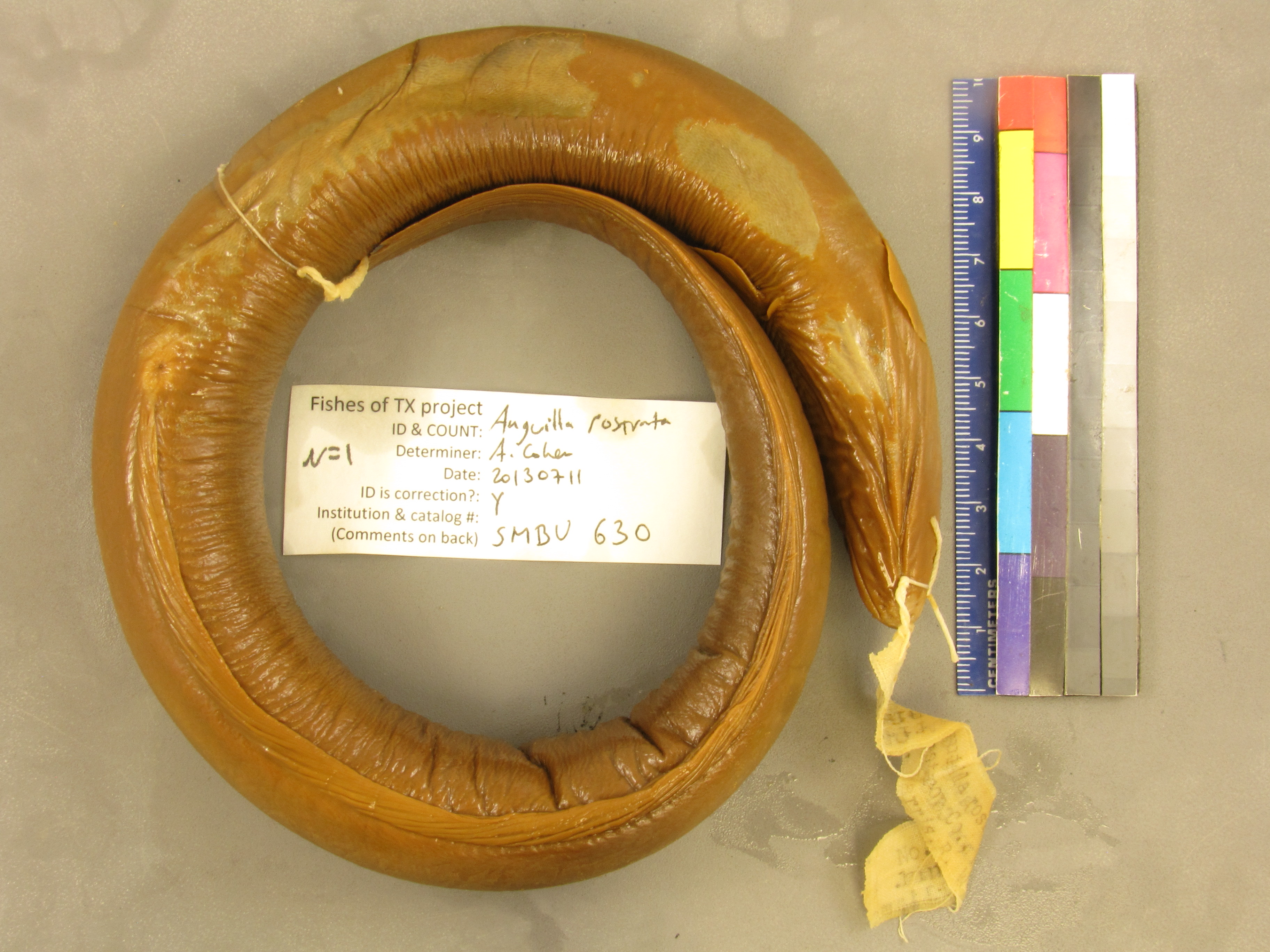
SMBU_630
Not suspect, examined
American Eel –
Anguilla rostrata
Photos
Map
Location
30.06468° N, 97.25789° W
(± 4926.2
m)
Taxonomy
GenusAnguilla
Speciesrostrata
Specimen
Num Specimens0
Collection Event
CollectorFarris, J.; Williams, Robert L.
Collected Date1965.5.15
Geography
CountryUnited States
StateTexas
CountyBastrop
Locality5 mi SE of Bastrop
Record Source
Source
Strecker Museum
(type: specimens)
Institution
Strecker Museum
(type: museum)
Curator
Anita Benedict
Record Added
May 13, 2010
Record Last Modified
June 22, 2022
Data Processing Track
Track 2
From Data Set Received
04/2009 to 10/2010
Identification
Suspect Notes
None
Count
No data
Current Determination
Determiner
Adam Cohen
Determination Date
July 11, 2013
Determination Type
specimen examination
Identification Comments
Specimen examined and Id'ed for FoTX project.
Identification Confidence
High
Collecting Event
Collected
May 15, 1965
Collector(s)
Collecting Event ID
231
Field Notes
There are no field notes available.
Locality
Region
Oak Woods & Prairies
Jurisdiction
Bastrop, Texas
Name
5 miles Southeast of Bastrop
Hydrography
USGS HUC
Texas-Gulf Region
Lower Colorado-San Bernard Coastal
Lower Colorado
Lower Colorado-Cummins
Alum Creek-Colorado River
Little Piney Creek-Colorado River
HydroBASINS
7518
751810
75181019
7518101905
751810190500
Captive
no
Locality Photos
No locality photos available.
flag (suspect/examine)
suspect: noexamination: yes
date
date_range: 5/15/1965-5/15/1965
collectors
collectors: Farris, J. Williams, Robert L.
collectors
collectors: J. Farris, Robert L. Williams
date
date_range: 5/15/1965-5/15/1965
staff comment
ID Status: Not flagged for specimen examination. By default we accept donor specimen determinations (after synonymization to our taxonomy). If georeferenced to TX this record has been considered in spatial context with other occurences of this species and accepted as correct.
ID Comments: NAGeoref Remark: measured by air
georeference
Error: 4926.20198397886Remarks: measured by airLocality: 5 miles Southeast of BastropCoordinates: 30.064675664;-97.257886909Georeferencer: BJLGeographic note: Inland USA Texas
measured by air
Comments On SMBU_630