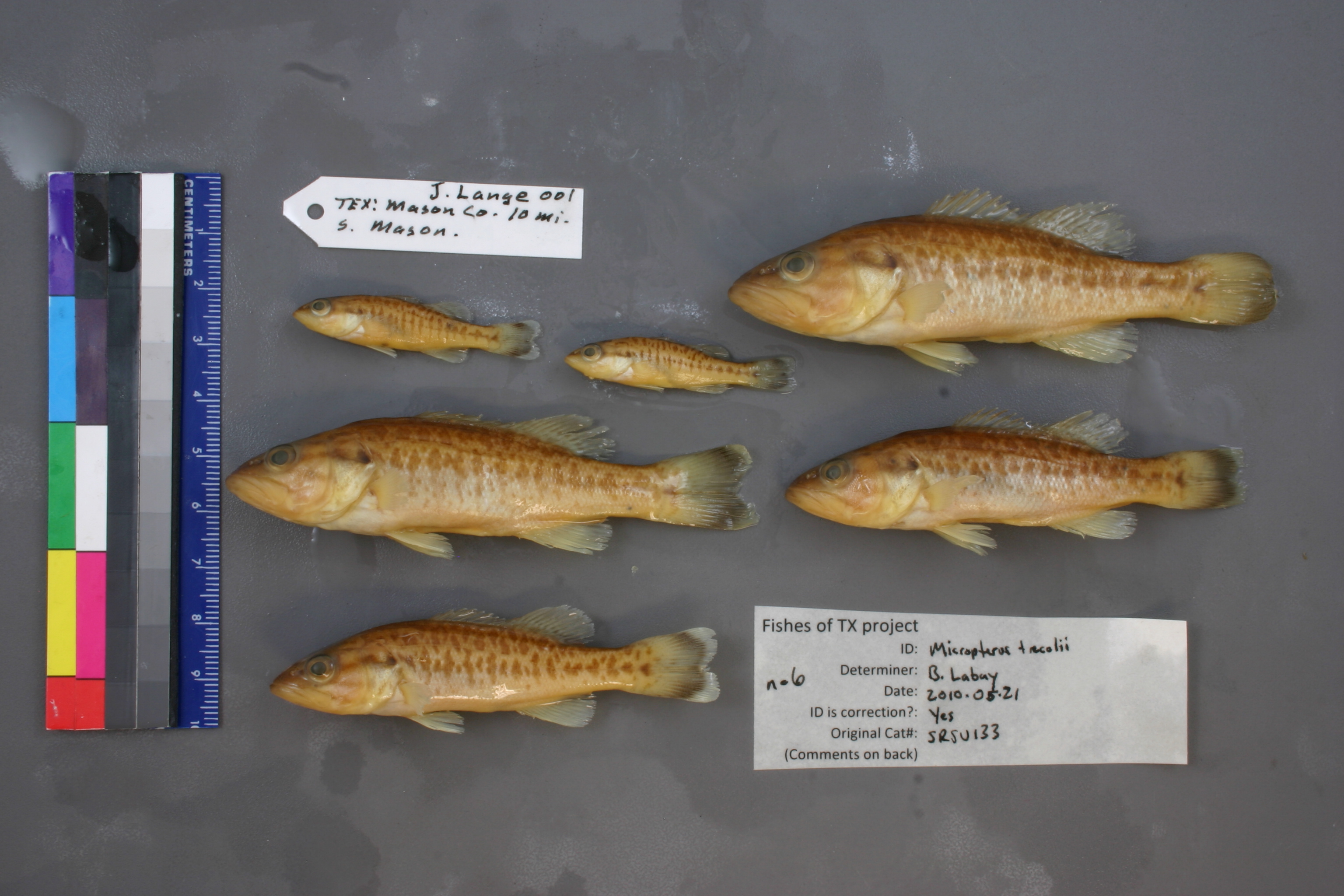
SRSU_133
Not suspect, examined
Guadalupe Bass –
Micropterus treculii
Photos
Map
Location
30.60388° N, 99.23055° W
(± 13840.4
m)
Taxonomy
GenusMicropterus
Speciespunctulatus
Specimen
Num Specimens6
Collection Event
CollectorJEL
Collected Date1974.8.4
Geography
CountryUnited States
StateTexas
CountyMason
Locality10 mi S of Mason
Record Source
Source
Sul Ross State University
(type: specimens)
Institution
Sul Ross State University
(type: university)
Curator
Chris Ritzi
Record Added
May 13, 2010
Record Last Modified
June 22, 2022
Data Processing Track
Track 1
From Data Set Received
11/1997 to 05/2006
Identification
Suspect Notes
None
Count
6
Current Determination
Determiner
Ben Labay
Determination Date
May 21, 2010
Determination Type
specimen examination
Identification Comments
ID complete
Identification Confidence
High
Collecting Event
Collected
Aug. 4, 1974
Collector(s)
Collecting Event ID
2934
Field Notes
There are no field notes available.
Locality
Region
Llano Uplift
Jurisdiction
Mason, Texas
Name
10 miles south of Mason
Hydrography
USGS HUC
Texas-Gulf Region
Lower Colorado-San Bernard Coastal
Middle Colorado-Llano
Llano
Comanche Creek-Llano River
Schep Creek-Llano Creek
HydroBASINS
7518
751820
75182030
7518203003
751820300300
Captive
no
Locality Photos
No locality photos available.
flag (suspect/examine)
suspect: noexamination: yes
date
date_range: 8/4/1974-8/4/1974
collectors
collectors: J.E.L.
collectors
collectors: J.E.L.
date
date_range: 8/4/1974-8/4/1974
staff comment
ID Status: Specimen examined and ID'ed for FoTX projectGeoref Remark: Measured by airID Confidence: high
georeference
Error: 13840.3583999406Remarks: Measured by airLocality: 10 miles south of MasonCoordinates: 30.603884547;-99.230548397Georeferencer: AECGeographic note: Inland USA Texas
Measured by air
Comments On SRSU_133