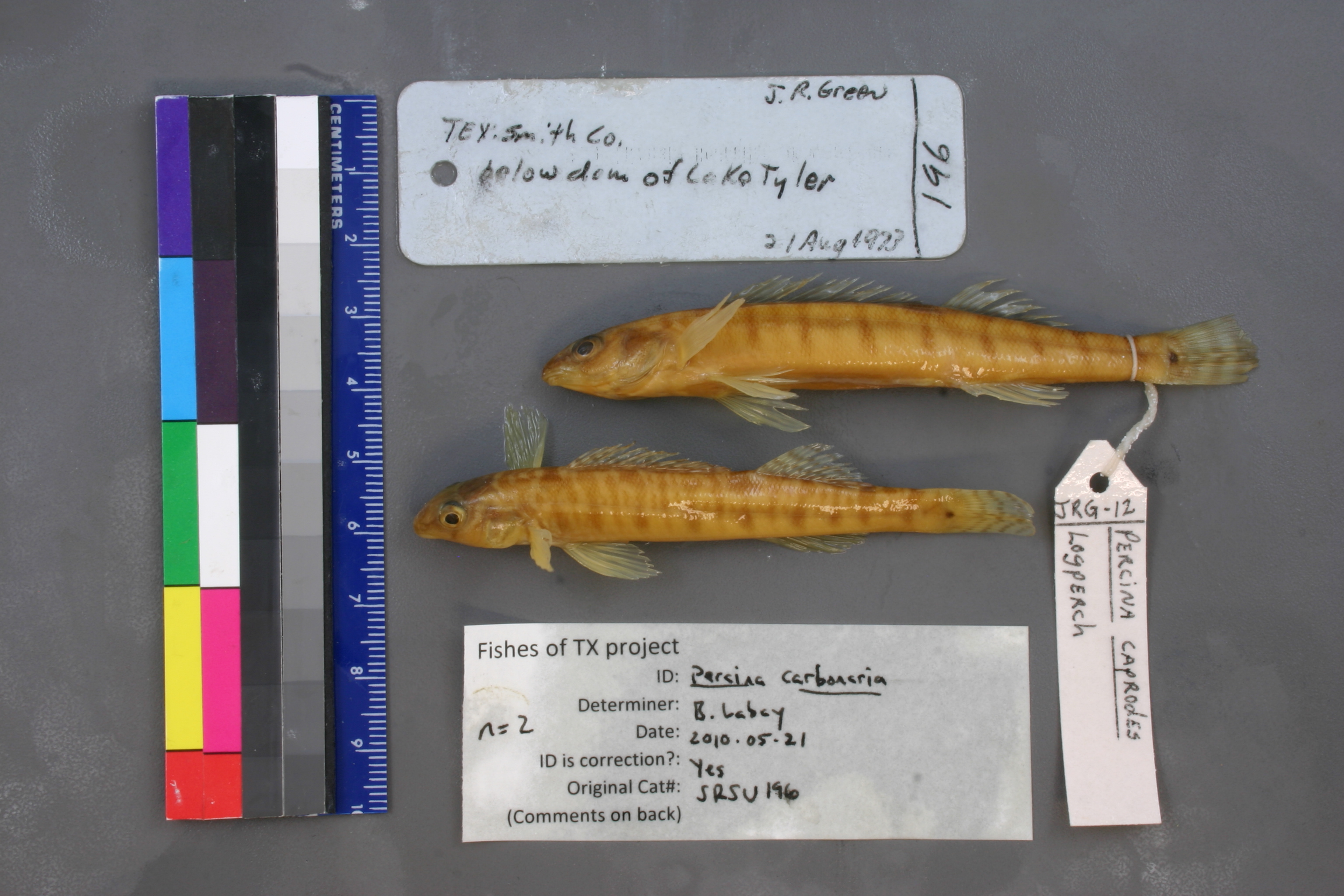
SRSU_196
Suspect, pending examination
Texas Logperch –
Percina carbonaria
Photos
Map
Location
32.20772° N, 95.17091° W
(± 845.8
m)
Taxonomy
GenusPercina
Speciescaprodes
Specimen
Num Specimens1
Collection Event
CollectorJ.R. Green
Collected Date1973.8.21
Geography
CountryUnited States
StateTexas
CountySmith
LocalityBelow dam of Lake Tyler
Record Source
Source
Sul Ross State University
(type: specimens)
Institution
Sul Ross State University
(type: university)
Curator
Chris Ritzi
Record Added
May 13, 2010
Record Last Modified
June 22, 2022
Data Processing Track
Track 1
From Data Set Received
11/1997 to 05/2006
Identification
Suspect Notes
None
Count
1
Current Determination
Determiner
Ben Labay
Determination Date
May 21, 2010
Determination Type
specimen examination
Identification Comments
ID complete
Identification Confidence
High
Collecting Event
Collected
Aug. 21, 1973
Collector(s)
Collecting Event ID
3103
Field Notes
There are no field notes available.
Locality
Region
Piney Woods
Jurisdiction
Smith, Texas
Name
Spillway of Tyler Lake
Hydrography
USGS HUC
Texas-Gulf Region
Neches
Neches
Upper Angelina
West Mud Creek-Mud Creek
Blackhawk Creek-Mud Creek
HydroBASINS
7512
751204
75120468
7512046802
751204680200
Captive
no
Locality Photos
No locality photos available.
flag (suspect/examine)
note: suspect record needs to be examinedExamination: Pending
flag (suspect/examine)
suspect: yesexamination: pending
flag (suspect/examine)
mark as unexamined (or perhaps we now wish to re-examine) and suspect
staff comment
We've examined this specimen but more research is needed. May need to re-examine specimen and/or associated data.
date
date_range: 8/21/1973-8/21/1973
collectors
collectors: Green, J.R.
collectors
collectors: J.R. Green
date
date_range: 8/21/1973-8/21/1973
staff comment
ID Status: Specimen examined and ID'ed for FoTX projectGeoref Remark: extent covers spillway bay and a section of Prairie CreekID Confidence: high
flag (suspect/examine)
suspect flag — We've examined the specimens from this lot and remain suspicious of this record since it is an outlier given the current ID. Further research into this record is needed.
georeference
Error: 845.751420003383Remarks: extent covers spillway bay and a section of Prairie CreekLocality: Spillway of Tyler LakeCoordinates: 32.207722485;-95.170907432Georeferencer: BJLGeographic note: Inland USA Texas
extent covers spillway bay and a section of Prairie Creek
Comments On SRSU_196