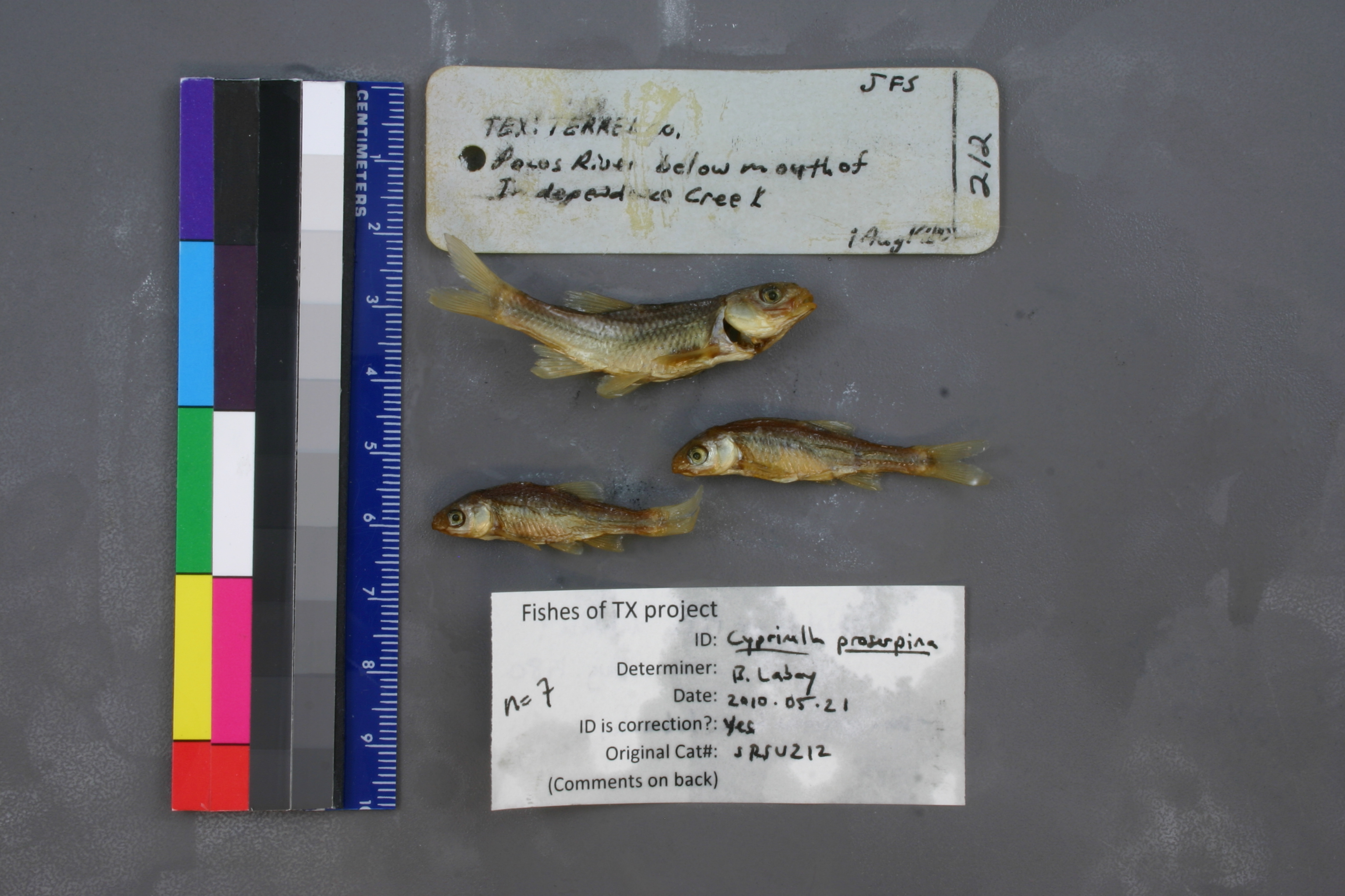
SRSU_212
Not suspect, examinedPhotos
Map
Location
30.42864° N, 101.73649° W
(± 2105.0
m)
Taxonomy
GenusOpsopoeodus
Speciesemiliae
Specimen
Num Specimens7
Collection Event
CollectorJFS
Collected Date1980.8.1
Geography
CountryUnited States
StateTexas
CountyTerrell
LocalityPecos River below mouth of Ind
Record Source
Source
Sul Ross State University
(type: specimens)
Institution
Sul Ross State University
(type: university)
Curator
Chris Ritzi
Record Added
May 13, 2010
Record Last Modified
June 22, 2022
Data Processing Track
Track 1
From Data Set Received
11/1997 to 05/2006
Identification
Suspect Notes
None
Count
7
Current Determination
Determiner
Ben Labay
Determination Date
May 21, 2010
Determination Type
specimen examination
Identification Comments
ID complete | some with tubercles
Identification Confidence
High
Collecting Event
Collected
Aug. 1, 1980
Collector(s)
Collecting Event ID
5095
Field Notes
There are no field notes available.
Locality
Region
Trans Pecos
Jurisdiction
Terrell, Texas
Name
Pecos River downstream of Independence Creek
Hydrography
Rio Grande Region
Lower Pecos
Lower Pecos
Lower Pecos
Geddis Canyon-Pecos River
Indian Canyon-Pecos River
Captive
no
Locality Photos
No locality photos available.
flag (suspect/examine)
suspect: noexamination: yes
date
date_range: 8/1/1980-8/1/1980
collectors
collectors: J.F.S.
collectors
collectors: J.F.S.
date
date_range: 8/1/1980-8/1/1980
staff comment
ID Status: Specimen examined and ID'ed for FoTX projectID Comments: some with tubercles
Georef Remark: Reach runs from Independence Creek downstream to a point halfway to Richland Canyon.
ID Confidence: high
georeference
Error: 2105.02195199097
Remarks: Reach runs from Independence Creek downstream to a point halfway to Richland Canyon.
Locality: Pecos River downstream of Independence CreekCoordinates: 30.428644426;-101.73649123Georeferencer: AECGeographic note: Inland USA TexasReach runs from Independence Creek downstream to a point halfway to Richland Canyon.
Comments On SRSU_212