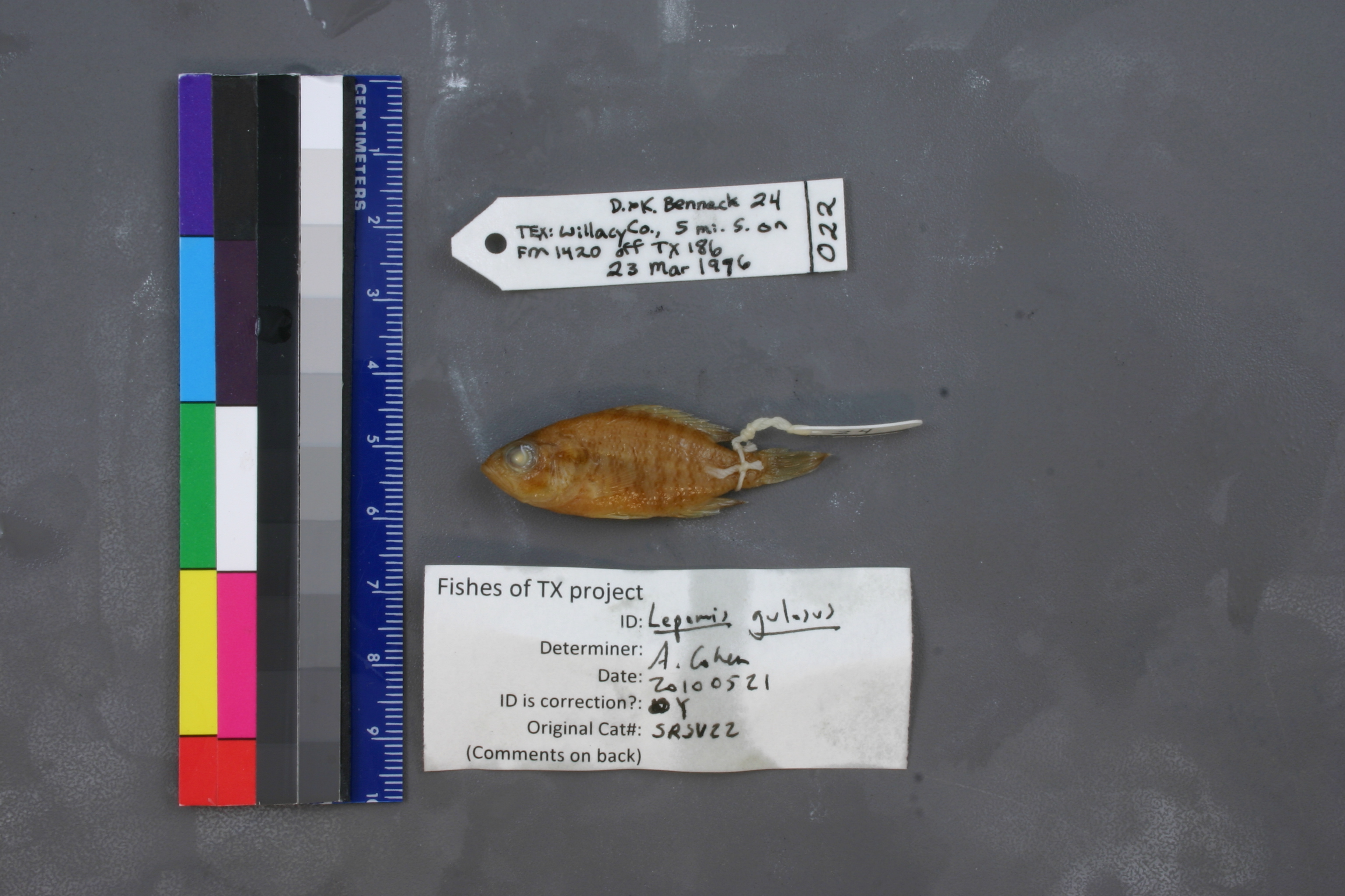
SRSU_22
Not suspect, examinedPhotos
Map
Location
26.41529° N, 97.59938° W
(± 1652.8
m)
Taxonomy
GenusLepomis
Speciessymmetricus
Specimen
Num Specimens1
Collection Event
CollectorDan and Karen Bennac
Collected Date1976.3.23
Geography
CountryUnited States
StateTexas
CountyWillacy
Locality5 mi S on FM 1420 off Tex 186
Record Source
Source
Sul Ross State University
(type: specimens)
Institution
Sul Ross State University
(type: university)
Curator
Chris Ritzi
Record Added
May 13, 2010
Record Last Modified
June 22, 2022
Data Processing Track
Track 1
From Data Set Received
11/1997 to 05/2006
Identification
Suspect Notes
None
Count
1
Current Determination
Determiner
Adam Cohen
Determination Date
May 21, 2010
Determination Type
specimen examination
Identification Comments
ID complete
Identification Confidence
High
Collecting Event
Collected
March 23, 1976
Collector(s)
Collecting Event ID
3013
Field Notes
There are no field notes available.
Locality
Region
South Texas Brush Country
Jurisdiction
Willacy, Texas
Name
Unspecified pond on SH 1420, 5 miles south of SH 186
Hydrography
Texas-Gulf Region
Nueces-Southwestern Texas Coastal
Southwestern Texas Coastal
South Laguna Madre
East Main Drain-Laguna Madre
East Main Drain-Laguna Madre
Captive
no
Locality Photos
No locality photos available.
flag (suspect/examine)
suspect: noexamination: yes
date
date_range: 3/23/1976-3/23/1976
collectors
collectors: Bennac, Dan Bennac, Karen
collectors
collectors: Dan Bennac, Karen Bennac
date
date_range: 3/23/1976-3/23/1976
staff comment
ID Status: Specimen examined and ID'ed for FoTX projectGeoref Remark: Measured by SH 1420ID Confidence: high
georeference
Error: 1652.79628799291Remarks: Measured by SH 1420Locality: Unspecified pond on SH 1420, 5 miles south of SH 186Coordinates: 26.415285218;-97.599378037Georeferencer: AECGeographic note: Inland USA Texas
Measured by SH 1420
Comments On SRSU_22