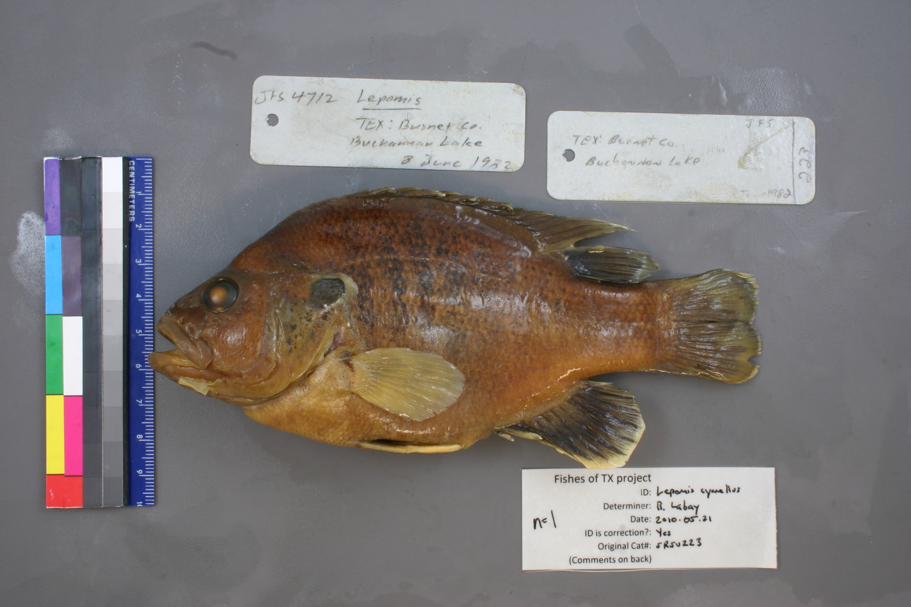
SRSU_223
Not suspect, examinedPhotos
Map
Location
30.84061° N, 98.41128° W
(± 9870.1
m)
Taxonomy
GenusLepomis
Specimen
Num Specimens1
Collection Event
CollectorJFS
Collected Date1982.6.8
Geography
CountryUnited States
StateTexas
CountyBurnet
LocalityBuchannan Lake
Record Source
Source
Sul Ross State University
(type: specimens)
Institution
Sul Ross State University
(type: university)
Curator
Chris Ritzi
Record Added
May 13, 2010
Record Last Modified
June 22, 2022
Data Processing Track
Track 1
From Data Set Received
11/1997 to 05/2006
Identification
Suspect Notes
None
Count
1
Current Determination
Determiner
Ben Labay
Determination Date
May 21, 2010
Determination Type
specimen examination
Identification Comments
ID complete
Identification Confidence
High
Collecting Event
Collected
June 8, 1982
Collector(s)
Collecting Event ID
3314
Field Notes
There are no field notes available.
Locality
Region
Llano Uplift
Jurisdiction
Burnet, Texas
Name
Lake Buchanan
Hydrography
Texas-Gulf Region
Lower Colorado-San Bernard Coastal
Middle Colorado-Llano
Buchanan-Lyndon B. Johnson Lakes
Colorado River-Lake Buchanan
Lake Buchanan
Captive
no
Locality Photos
No locality photos available.
flag (suspect/examine)
suspect: noexamination: yes
date
date_range: 6/8/1982-6/8/1982
collectors
collectors: J.F.S.
collectors
collectors: J.F.S.
date
date_range: 6/8/1982-6/8/1982
staff comment
ID Status: Specimen examined and ID'ed for FoTX projectGeoref Remark: Area in Burnet CountyID Confidence: high
georeference
Error: 9870.10675195765Remarks: Area in Burnet CountyLocality: Lake BuchananCoordinates: 30.840608658;-98.411278149Georeferencer: AECGeographic note: Inland USA Texas
Area in Burnet County
Comments On SRSU_223