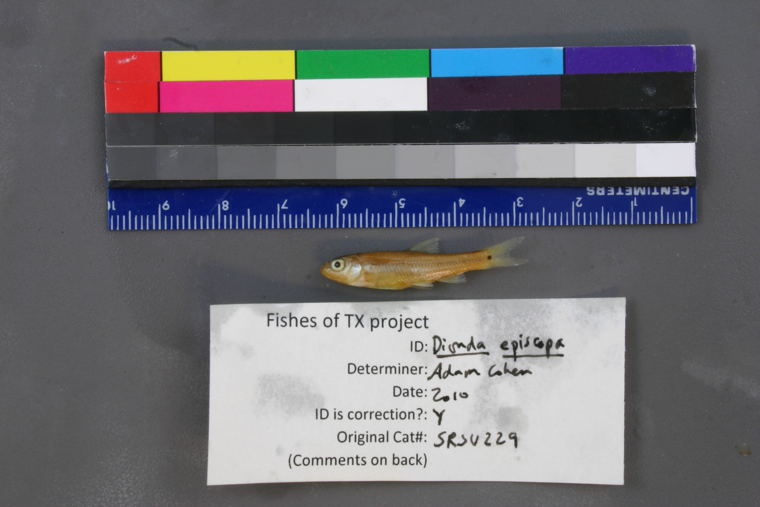
SRSU_229(1)
Not suspect, not examinedPhotos
Map
Location
30.45223° N, 101.73449° W
(± 1678.5
m)
Taxonomy
GenusNotropis
Speciesjemezanus
Specimen
Num Specimens6
Collection Event
Collected Date1980.8.2
Geography
CountryUnited States
StateTexas
CountyTerrell
LocalityIndependance Creek 1 mi from P
Record Source
Source
Sul Ross State University
(type: specimens)
Institution
Sul Ross State University
(type: university)
Curator
Chris Ritzi
Record Added
June 22, 2011
Record Last Modified
June 22, 2022
Data Processing Track
Track 1
From Data Set Received
11/1997 to 05/2006
Identification
Suspect Notes
None
Count
6
Current Determination
Determiner
Unknown
Determination Date
July 11, 2022
Determination Type
taxonomic adjustment
Identification Comments
Determination found in FoTX database and determined to be the most recent determination. However, since the date of determination is not recorded in the database we hereby assign the date of our determination reconciliation effort, which makes it the most recent determination for this record.
Identification Confidence
Unknown
Previous Determination
Determiner
Adam Cohen
Determination Date
May 21, 2010
Determination Type
specimen examination
Identification Comments
ID complete
Identification Confidence
High
Collecting Event
Collected
Aug. 2, 1980
Collector(s)
Collecting Event ID
2917
Field Notes
There are no field notes available.
Locality
Region
Trans Pecos
Jurisdiction
Terrell, Texas
Name
Independence Creek 1 mile upstream of Pecos River
Hydrography
Rio Grande Region
Lower Pecos
Lower Pecos
Independence
Lower Independence Creek
North Canyon-Independence Creek
Captive
no
Locality Photos
No locality photos available.
flag (suspect/examine)
suspect: noexamination: no
date
date_range: 8/2/1980-8/2/1980
collectors
collectors: J.F.S.
collectors
collectors: J.F.S.
date
date_range: 8/2/1980-8/2/1980
staff comment
ID Status: Specimen examined and ID'ed for FoTX projectGeoref Remark: Measured by stream. P is assumed to refer to Pecos River.ID Confidence: high
georeference
Error: 1678.5457919928Remarks: Measured by stream. P is assumed to refer to Pecos River.Locality: Independence Creek 1 mile upstream of Pecos RiverCoordinates: 30.452233666;-101.73449126Georeferencer: AECGeographic note: Inland USA Texas
Measured by stream. P is assumed to refer to Pecos River.
Comments On SRSU_229(1)