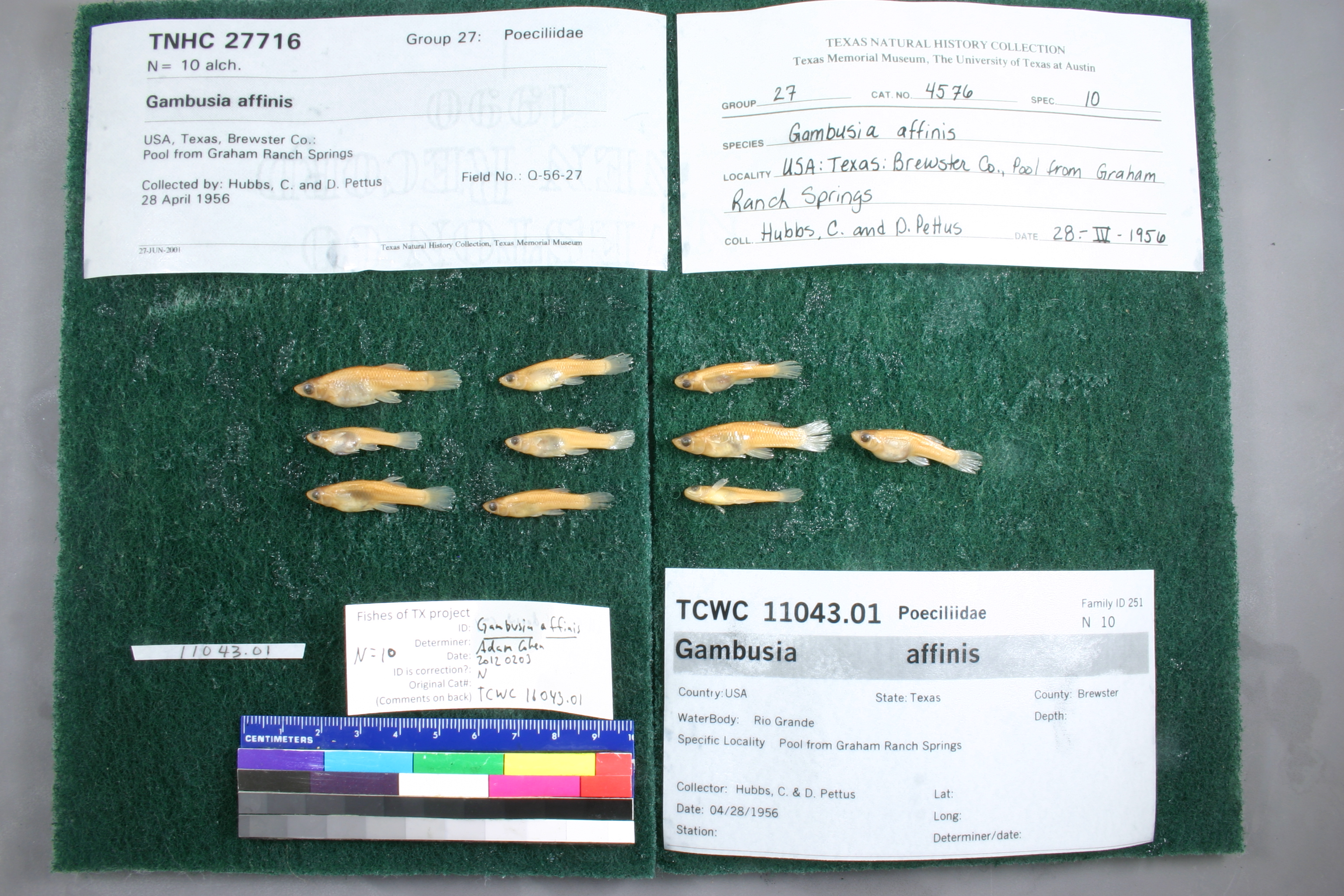
TCWC_11043.01
Not suspect, examinedPhotos
Map
Location
29.17853° N, 102.95301° W
(± 43.7
m)
Taxonomy
GenusGambusia
Speciesaffinis
Specimen
Num Specimens10
Collection Event
CollectorHubbs, C. & D. Pettus
Collected Date1956.4.28
Geography
CountryUnited States
StateTexas
CountyBrewster
LocalityRio Grande; Pool from Graham Ranch Springs
Record Source
Source
Texas Cooperative Wildlife Collections
(type: specimens)
Institution
Texas Cooperative Wildlife Collections
(type: museum)
Curator
Kevin W. Conway
Record Added
May 13, 2010
Record Last Modified
June 22, 2022
Data Processing Track
Track 2
From Data Set Received
04/2009 to 10/2010
Identification
Suspect Notes
None
Count
10
Current Determination
Determiner
Adam Cohen
Determination Date
Feb. 3, 2012
Determination Type
specimen examination
Identification Comments
Specimen examined and Id'ed for FoTX project. | all females; 6 dorsal rays (3)
Identification Confidence
High
Collecting Event
Collected
April 28, 1956
Collector(s)
Collecting Event ID
7577
Field Notes
There are no field notes available.
Locality
Region
Trans Pecos
Jurisdiction
Brewster, Texas
Name
Graham Ranch Springs
Hydrography
Rio Grande Region
Rio Grande-Amistad
Rio Grande-Amistad
Big Bend
Heath Creek-Rio Grande
Ernst Ridge-Rio Grande
Captive
no
Locality Photos
No locality photos available.
HUC 12
130402052404
Georeferencing Remarks
According to the Gambusia Geigei Recovery Plan \"Graham Ranch Spring\" is synonomous with \"Spring 4\", \"Campground Spring\" and \"Pumphouse Spring\". The location for this locality was translated into Terrain Navigator from a map on the recover plan document.
Georeferencing Annotation
—
Has not been Georeferenced because
—
flag (suspect/examine)
suspect: noexamination: yes
flag (suspect/examine)
mark examined and not suspect
staff comment
not currently verified
date
date_range: 4/28/1956-4/28/1956
collectors
collectors: Hubbs, Clark Pettus, D.
collectors
collectors: Clark Hubbs, D. Pettus
staff comment
ID Status: This lot in need of examination, but not yet examined. Work in progress.
Georef Remark: According to the Gambusia Geigei Recovery Plan 'Graham Ranch Spring' is synonomous with 'Spring 4', 'Campground Spring' and 'Pumphouse Spring'. The location for this locality was translated into Terrain Navigator from a map on the recover plan document.
date
date_range: 4/28/1956-4/28/1956
flag (suspect/examine)
suspect flag — We wish to examine this specimen
staff comment
not currently verified
georeference
Error: 43.667
Remarks: According to the Gambusia Geigei Recovery Plan 'Graham Ranch Spring' is synonomous with 'Spring 4', 'Campground Spring' and 'Pumphouse Spring'. The location for this locality was translated into Terrain Navigator from a map on the recover plan document.
Locality: Graham Ranch SpringsCoordinates: 29.178533153;-102.953007275Georeferencer: AECGeographic note: Inland USA TexasAccording to the Gambusia Geigei Recovery Plan 'Graham Ranch Spring' is synonomous with 'Spring 4', 'Campground Spring' and 'Pumphouse Spring'. The location for this locality was translated into Terrain Navigator from a map on the recover plan document.
Comments On TCWC_11043.01