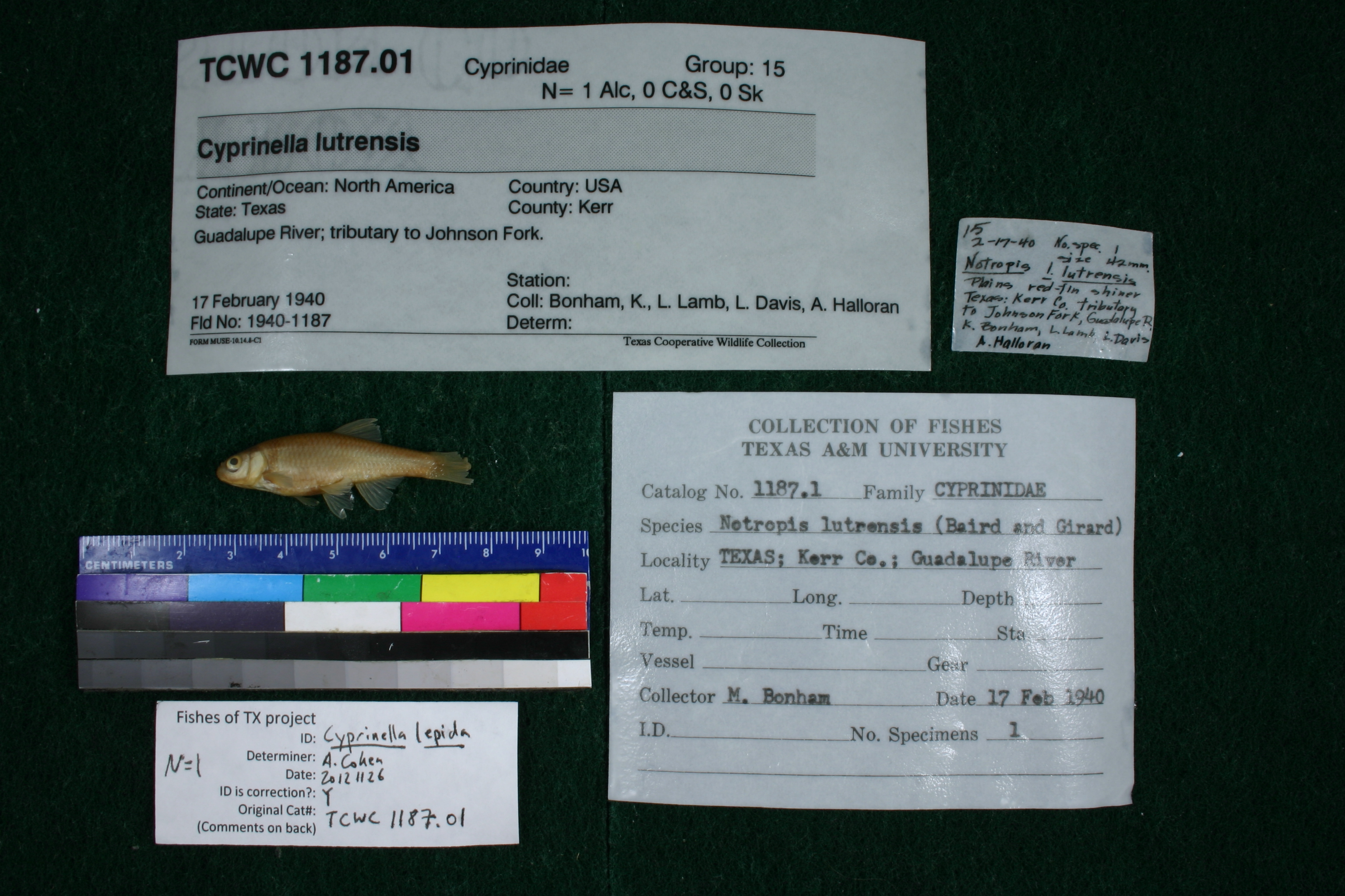
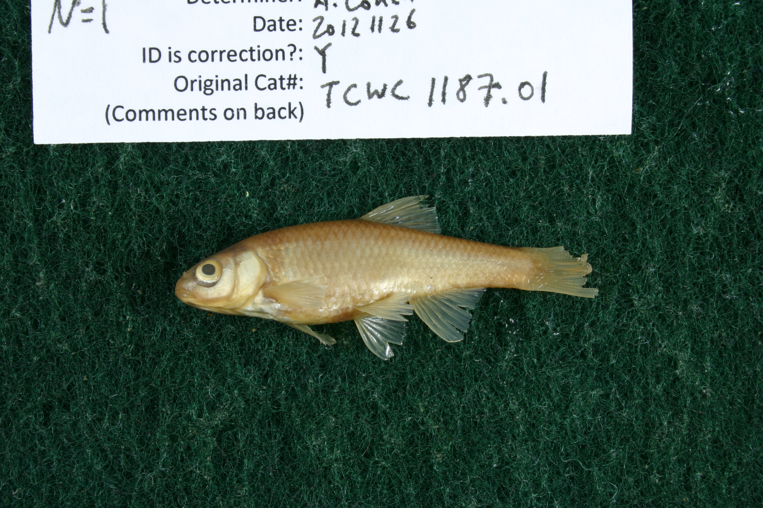
TCWC_1187.01
Not suspect, examinedPhotos
Map
Location
30.09763° N, 99.26007° W
(± 1863.6
m)
Taxonomy
GenusCyprinella
Specieslutrensis
Specimen
Num Specimens1
Collection Event
CollectorBonham, K., L. Lamb, L. Davis, A. Halloran
Collected Date1940.2.17
Geography
CountryUnited States
StateTexas
CountyKerr
LocalityGuadalupe River; Guadalupe River: tributary to Johnson Fork, 1.3 mi above Ingram turnoff.
Record Source
Source
Texas Cooperative Wildlife Collections
(type: specimens)
Institution
Texas Cooperative Wildlife Collections
(type: museum)
Curator
Kevin W. Conway
Record Added
May 13, 2010
Record Last Modified
June 22, 2022
Data Processing Track
Track 2
From Data Set Received
04/2009 to 10/2010
Identification
Suspect Notes
None
Count
1
Current Determination
Determiner
Unknown
Determination Date
July 26, 2022
Determination Type
taxonomic adjustment
Identification Comments
Geography-based change. We previously identified this as as C. lepida based on weak morphological evidence and the fact that other authors recognized C. lepida from the upper Guadalupe. FoTX (consensus meeting attendees) decided that there is not sufficient genetic support for determinations of C. lepida. in the upper Guadalupe.
Identification Confidence
Unknown
Previous Determination
Determiner
Adam Cohen
Determination Date
Nov. 26, 2012
Determination Type
specimen examination
Identification Comments
Specimen examined and Id'ed for FoTX project. | ID based on shape of snout
Identification Confidence
High
Collecting Event
Collected
Feb. 17, 1940
Collector(s)
Collecting Event ID
3966
Field Notes
There are no field notes available.
Locality
Region
Edwards Plateau
Jurisdiction
Kerr, Texas
Name
Unspecified tributary to Johnson Creek, 1.3 miles north of Ingram turnoff
Hydrography
Texas-Gulf Region
Central Texas Coastal
Guadalupe
Upper Guadalupe
Headwaters Guadalupe River
Lower Johnson creek
Captive
no
Locality Photos
No locality photos available.
HUC 12
121002010111
Georeferencing Remarks
There are two possible turnoffs that this could be referring to. Both are considered and the most likely possibility puts the point at Henderson Branch. Point is placed at Henderson Branch and SH 27 and extent runs to Brushy Creek at SH 27.
Georeferencing Annotation
—
Has not been Georeferenced because
—
flag (suspect/examine)
suspect: noexamination: yes
taxonomy/determination note
call C. lepida, Adam will add determinations
date
date_range: 2/17/1940-2/17/1940
collectors
collectors: Bonham, Kelshaw Lamb, L. Davis, L.L. Halloran, A.
staff comment
ID Status: Not flagged for specimen examination. By default we accept donor specimen determinations (after synonymization to our taxonomy). If georeferenced to TX this record has been considered in spatial context with other occurences of this species and accepted as correct.
ID Comments: NAGeoref Remark: There are two possible turnoffs that this could be referring to. Both are considered and the most likely possibility puts the point at Henderson Branch. Point is placed at Henderson Branch and SH 27 and extent runs to Brushy Creek at SH 27.
collectors
collectors: Kelshaw Bonham, L. Lamb, L.L. Davis, A. Halloran
date
date_range: 2/17/1940-2/17/1940
georeference
Error: 1863.620351992
Remarks: There are two possible turnoffs that this could be referring to. Both are considered and the most likely possibility puts the point at Henderson Branch. Point is placed at Henderson Branch and SH 27 and extent runs to Brushy Creek at SH 27.
Locality: Unspecified tributary to Johnson Creek, 1.3 miles north of Ingram turnoffCoordinates: 30.097630891;-99.260067766Georeferencer: AECGeographic note: Inland USA TexasThere are two possible turnoffs that this could be referring to. Both are considered and the most likely possibility puts the point at Henderson Branch. Point is placed at Henderson Branch and SH 27 and extent runs to Brushy Creek at SH 27.
Comments On TCWC_1187.01