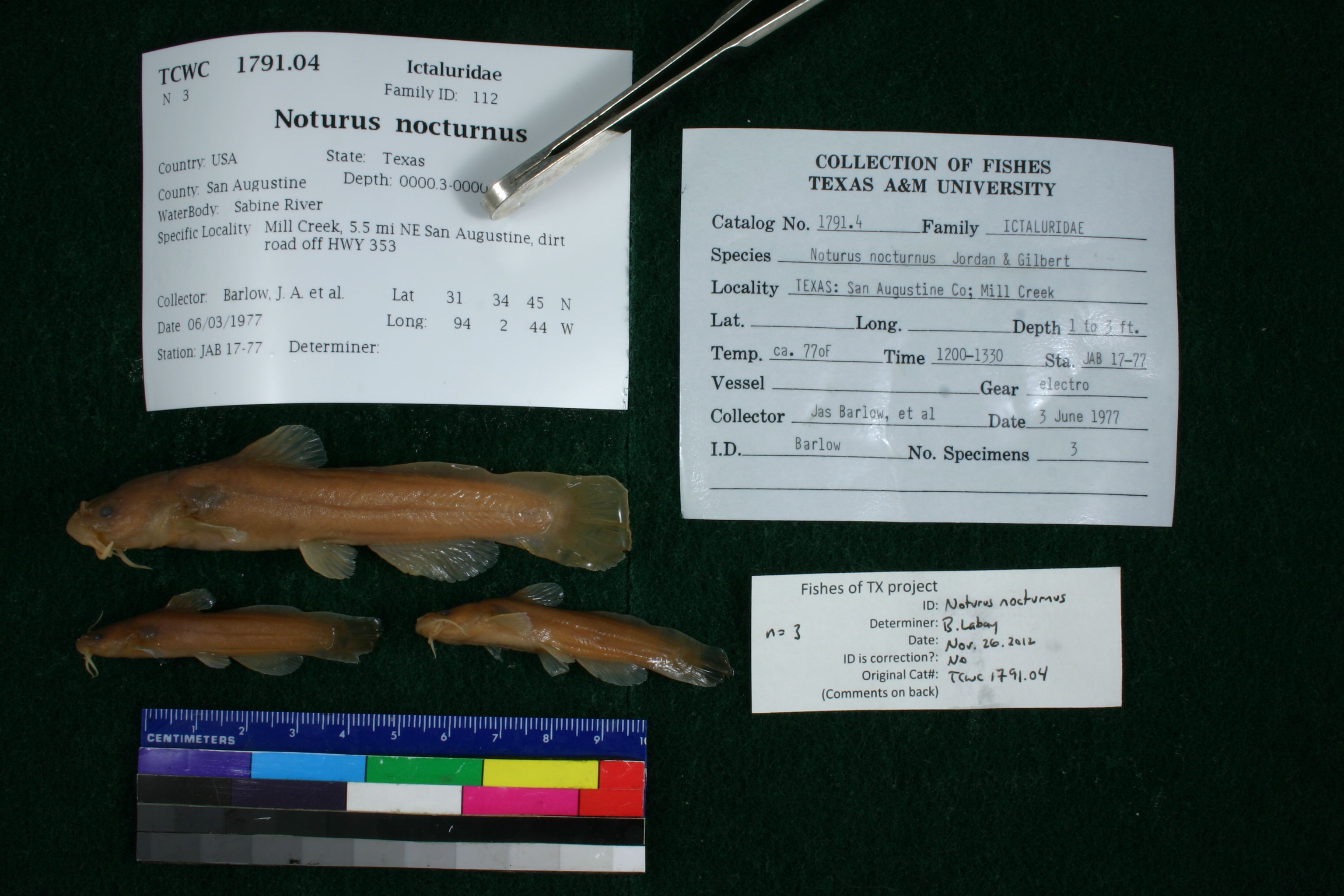
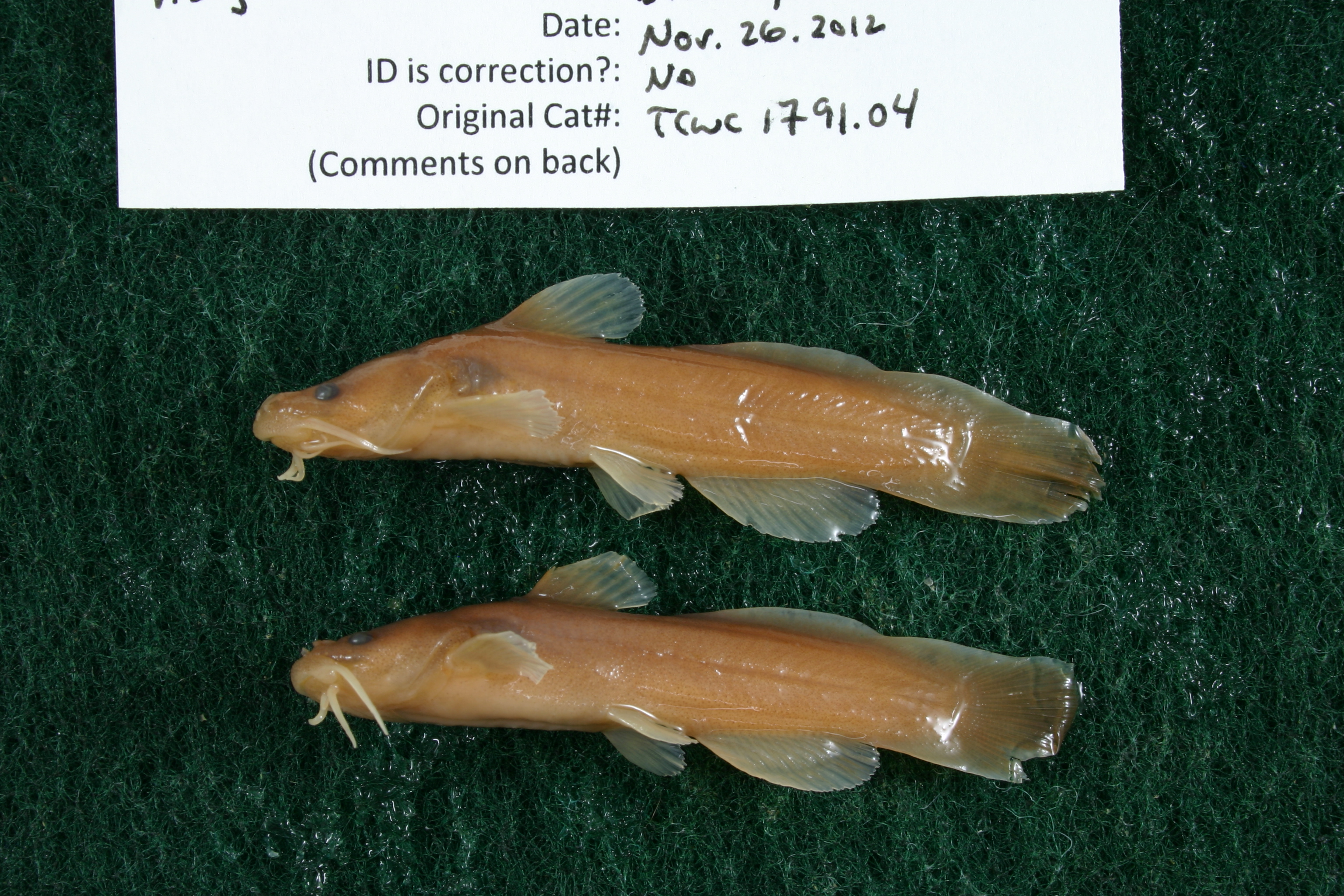
TCWC_1791.04
Not suspect, examinedPhotos
Map
Location
31.58277° N, 94.03573° W
(± 43.7
m)
Taxonomy
GenusNoturus
Speciesnocturnus
Specimen
Num Specimens3
Collection Event
CollectorBarlow, J. A. et al.
Collected Date1977.6.3
Geography
CountryUnited States
StateTexas
CountySan Augustine
LocalitySabine River; Mill Creek, 5.5 mi NE San Augustine, dirt road off HWY 353
Record Source
Source
Texas Cooperative Wildlife Collections
(type: specimens)
Institution
Texas Cooperative Wildlife Collections
(type: museum)
Curator
Kevin W. Conway
Record Added
May 13, 2010
Record Last Modified
June 22, 2022
Data Processing Track
Track 2
From Data Set Received
04/2009 to 10/2010
Identification
Suspect Notes
None
Count
3
Current Determination
Determiner
Ben Labay
Determination Date
Nov. 26, 2012
Determination Type
specimen examination
Identification Comments
Specimen examined and Id'ed for FoTX project. | all with underslung mouth; 1 with anal ray count: 16
Identification Confidence
High
Collecting Event
Collected
June 3, 1977
Collector(s)
Collecting Event ID
5309
Field Notes
There are no field notes available.
Locality
Region
Piney Woods
Jurisdiction
San Augustine, Texas
Name
Mill Creek at Patroon Road
Hydrography
Texas-Gulf Region
Sabine
Sabine
Toledo Bend Reservoir
Patroon Bayou
Lick Creek-Patroon Bayou
Captive
no
Locality Photos
No locality photos available.
flag (suspect/examine)
suspect: noexamination: yes
date
date_range: 6/3/1977-6/3/1977
collectors
collectors: Barlow, J.A.
collectors
collectors: J.A. Barlow
date
date_range: 6/3/1977-6/3/1977
staff comment
ID Status: Not flagged for specimen examination. By default we accept donor specimen determinations (after synonymization to our taxonomy). If georeferenced to TX this record has been considered in spatial context with other occurences of this species and accepted as correct.
ID Comments: NAGeoref Remark: Dirt road is assumed to be Patroon Road according to Google Earth.
georeference
Error: 43.652Remarks: Dirt road is assumed to be Patroon Road according to Google Earth.Locality: Mill Creek at Patroon RoadCoordinates: 31.582772337;-94.035726812Georeferencer: AECGeographic note: Inland USA Texas
Dirt road is assumed to be Patroon Road according to Google Earth.
Comments On TCWC_1791.04