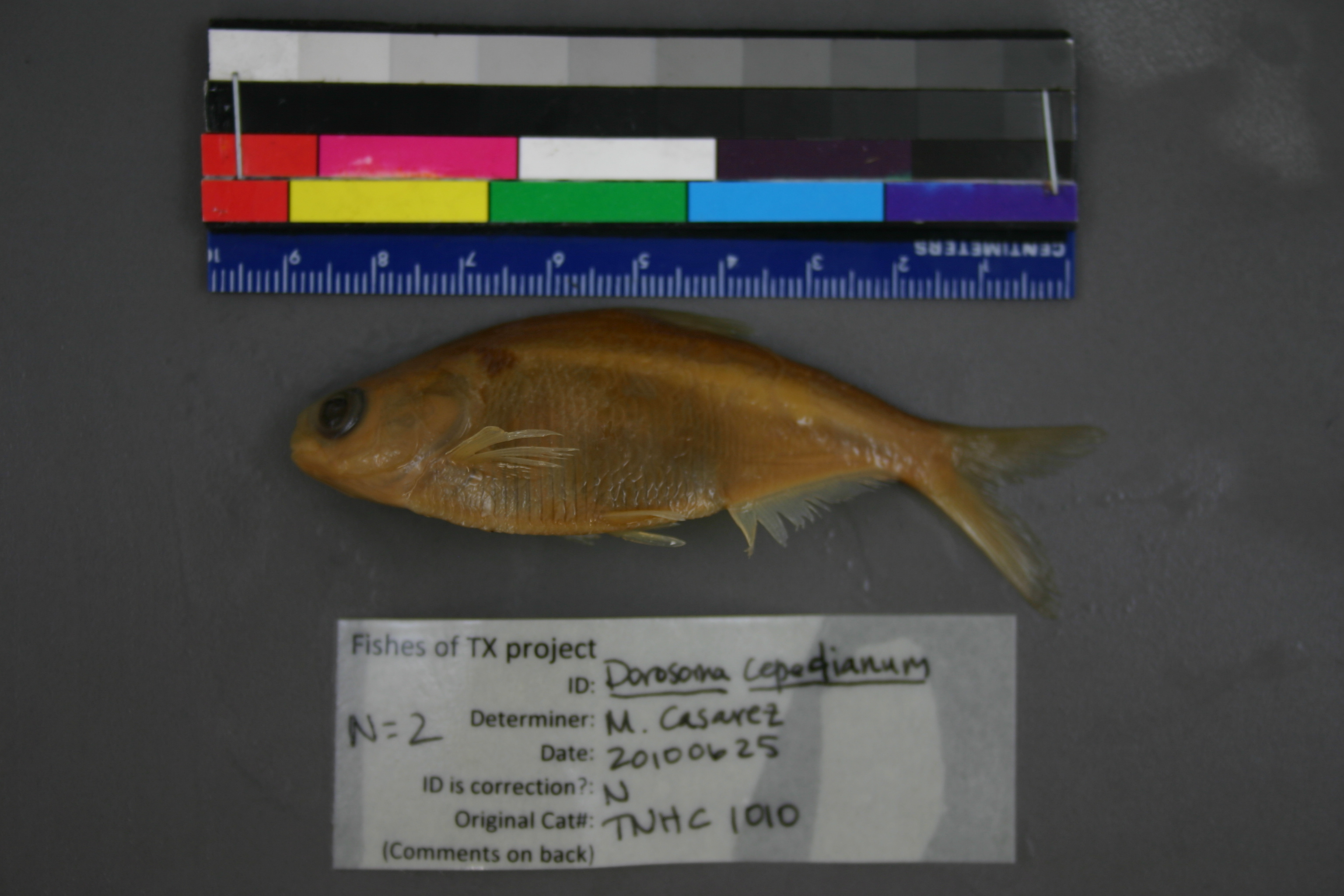
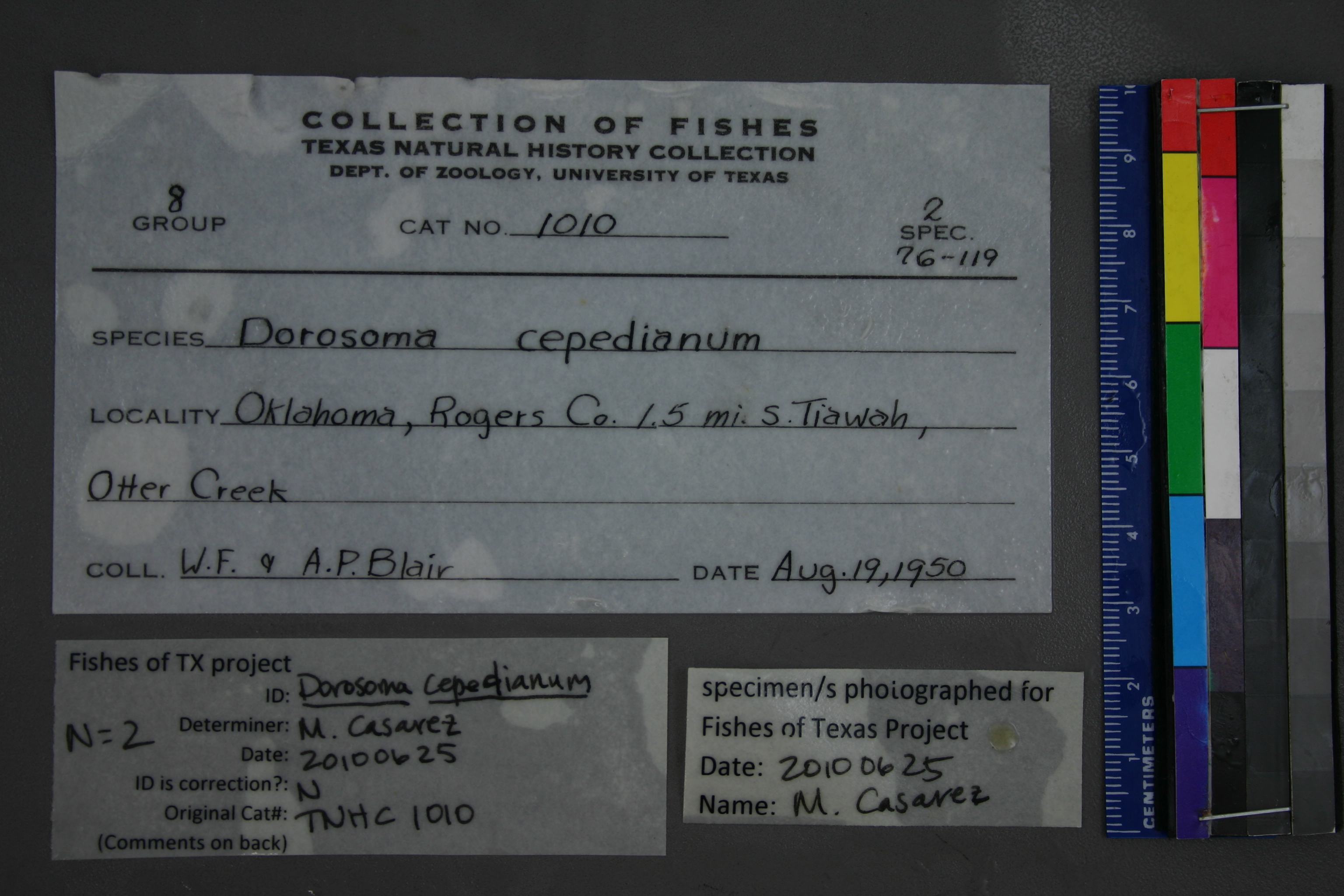
TNHCi_1010
Not suspect, examinedPhotos
Map
Location
36.24237° N, 95.55607° W
(± 90
m)
Taxonomy
FamilyClupeidae
GenusDorosoma
Speciescepedianum
Specimen
Num Specimens2
Collection Event
CollectorBlair, W. F. and A. P. Blair
Collected Date1950.8.19-1950.8.19
Field NumberZ1007
Geography
DrainageWaterBody: Arkansas
CountryUSA
StateOklahoma
CountyCherokee
Locality1.5 mi. S Tiawah Otter Creek
Other
Min Sl76
Max Sl119
QuestionableNo
CurrentYes
SalinityF
Record Source
Source
Texas Natural History Collections
(type: specimens)
Institution
Texas Natural History Collections
(type: museum)
Curator
Dean Hendrickson
Record Added
April 23, 2015
Record Last Modified
March 23, 2026
Data Processing Track
Track 2
From Data Set Received
04/2009 to 10/2010
Identification
Suspect Notes
None
Count
2
Current Determination
Determiner
Melissa Casarez
Determination Date
June 25, 2010
Determination Type
specimen examination
Identification Comments
Specimen examined and Id'ed for FoTX project. | ID notes: ; MinSL(mm): 74.64; MaxSL(mm): 122.19; Jar: 8 oz; Specimen condition: good, but larger specimen's body is highly curved; Mutations: none; Count Male: ; Count female: ; Extern parasites: n
Identification Confidence
High
Collecting Event
Collected
Aug. 19, 1950
Collector(s)
Collecting Event ID
31073
Field Notes
There are no field notes available.
Locality
Jurisdiction
Rogers, Oklahoma
Name
Unknown
Hydrography
Arkansas-White-Red Region
Neosho-Verdigris
Verdigris
Lower Verdigris
Dog Creek
Otter Creek-Dog Creek
Captive
no
Locality Photos
No locality photos available.
georeference
Error: 90
Remarks: Georeference error, notes (if available) and coordinates extracted from GBIF (Sept2017) for FoTX Project.
Coordinates: -95.556068, 36.242368Georeference error, notes (if available) and coordinates extracted from GBIF (Sept2017) for FoTX Project.
flag (suspect/examine)
suspect: noexamination: yes
date
date_range: 8/19/1950-8/19/1950
date
date_range: 8\19\1950-8\19\1950
collectors
collectors: Blair, W. Frank Blair, Albert P.
Comments On TNHCi_1010