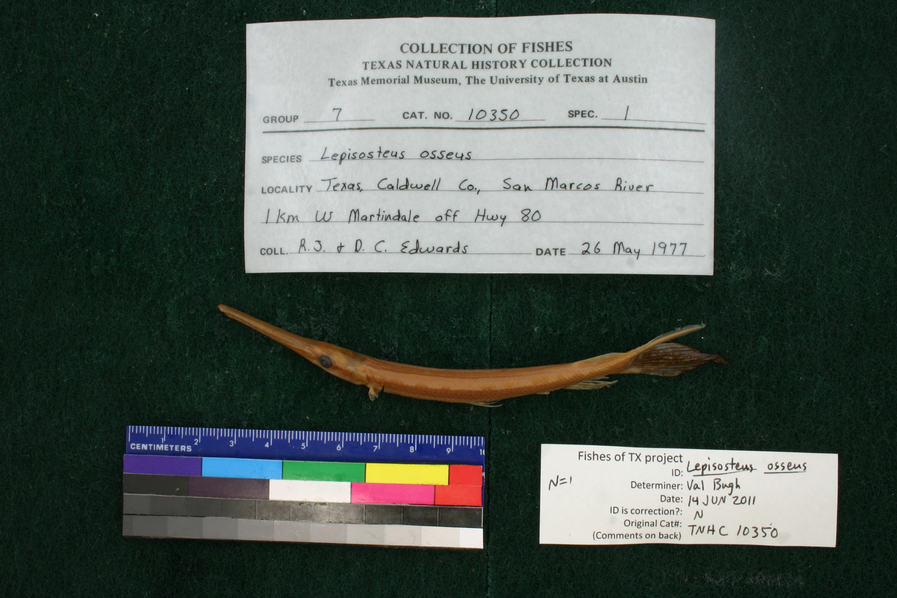
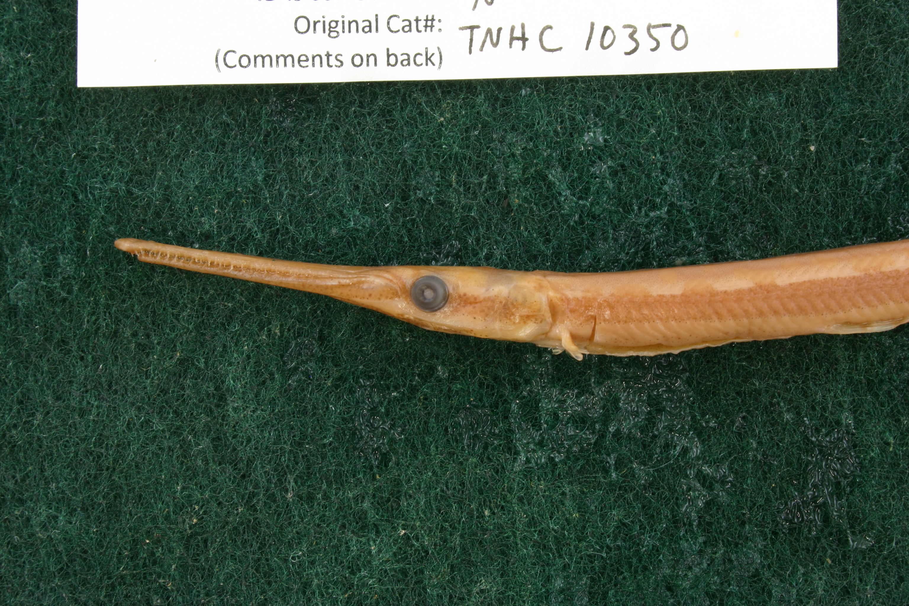
TNHCi_10350
Not suspect, examinedPhotos
Map
Location
29.84348° N, 97.85461° W
(± 3553.4
m)
Taxonomy
GenusLepisosteus
Speciesosseus
Specimen
Num Specimens1
Collection Event
CollectorEdwards, R.; Edwards, D.
Collected Date1977.5.25
Geography
DrainageGuadalupe
CountryUnited States
StateTexas
CountyCaldwell
LocalitySan Marcos River 1 km W Martindale off Highway 80
Record Source
Source
Texas Natural History Collections
(type: specimens)
Institution
Texas Natural History Collections
(type: museum)
Curator
Dean Hendrickson
Record Added
May 13, 2010
Record Last Modified
March 23, 2026
Data Processing Track
Track 2
From Data Set Received
04/2009 to 10/2010
Identification
Suspect Notes
None
Count
1
Current Determination
Determiner
Valerie Gawenda Bugh
Determination Date
June 14, 2011
Determination Type
specimen examination
Identification Comments
Specimen examined and Id'ed for FoTX project. | ID notes: lateral line scales: 57; *note for SL measurements that gar have heterocercal tails - all length measurements are based on SL and are approximate; MinSL(mm): 115.49; MaxSL(mm): ; Jar: 8 oz; Specimen condition: good; Mutations: none; Count Male: ; Count female: ; Extern parasites: n
Identification Confidence
Medium
Collecting Event
Collected
May 26, 1977
Collector(s)
Collecting Event ID
11117
Field Notes
There are no field notes available.
Locality
Region
Blackland Prairies
Jurisdiction
Caldwell, Texas
Name
San Marco River 1 km West of Martindale off of SH80
Hydrography
Texas-Gulf Region
Central Texas Coastal
Guadalupe
San Marcos
Upper San Marcos River
Morrison Creek-San Marcos River
Captive
no
Locality Photos
No locality photos available.
flag (suspect/examine)
suspect: noexamination: yes
date
date_range: 5/26/1977-5/26/1977
collectors
collectors: Edwards, Robert John Edwards, Deb C.
collectors
collectors: R. Edwards, Deb C. Edwards
date
date_range: 5/25/1977-5/25/1977
staff comment
ID Status: Not flagged for specimen examination. By default we accept donor specimen determinations (after synonymization to our taxonomy). If georeferenced to TX this record has been considered in spatial context with other occurences of this species and accepted as correct.
ID Comments: NAGeoref Remark: Measured north of Martindale 1 km from SH80/SH142 intersection, used extent of Martindale
georeference
Error: 3553.43155198475
Remarks: Measured north of Martindale 1 km from SH80/SH142 intersection, used extent of Martindale
Locality: San Marco River 1 km West of Martindale off of SH80Coordinates: 29.843481938;-97.854611557Georeferencer: BJLGeographic note: Inland USA TexasMeasured north of Martindale 1 km from SH80/SH142 intersection, used extent of Martindale
Comments On TNHCi_10350