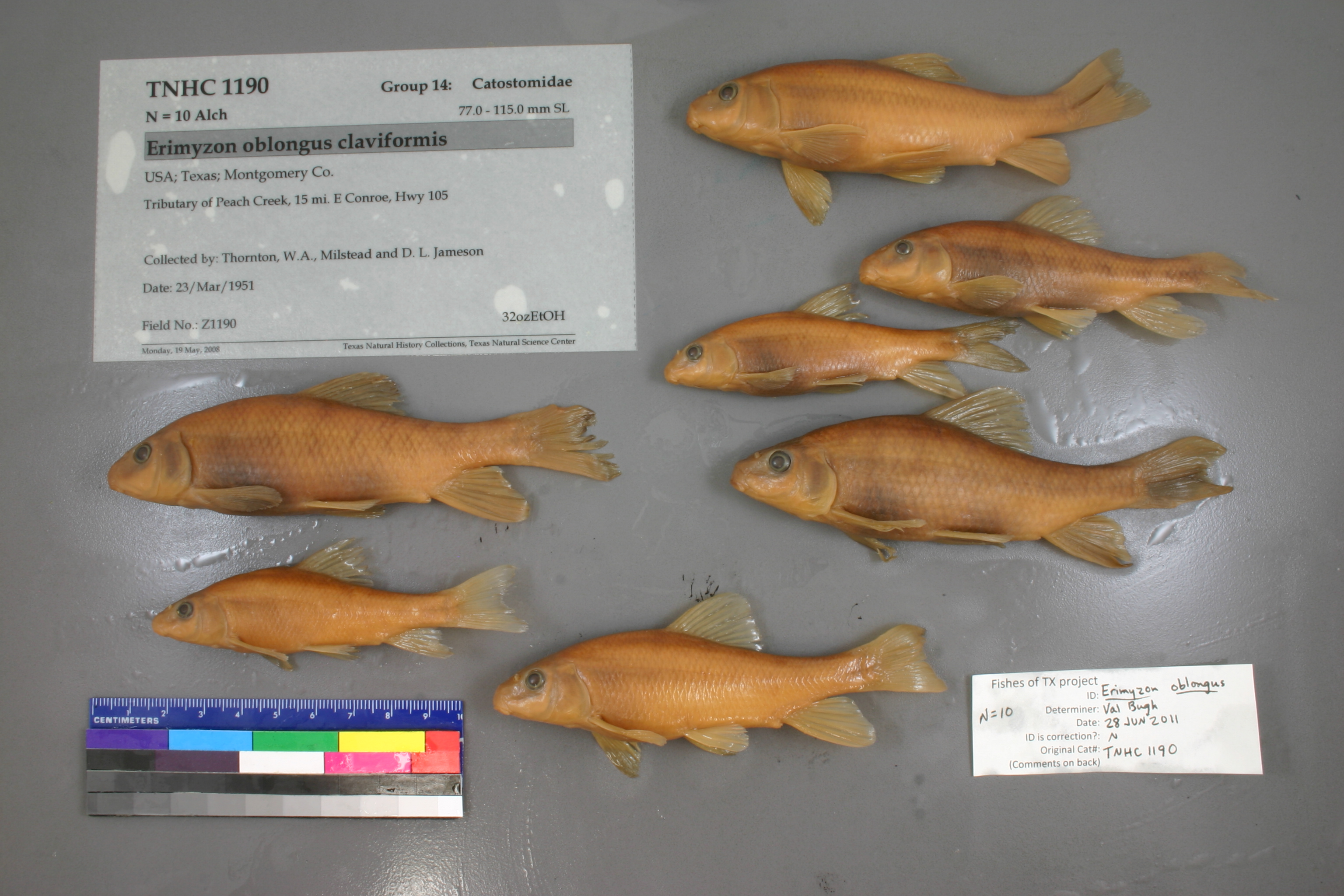
TNHCi_1190
Not suspect, examinedPhotos
Map
Location
30.32583° N, 95.20794° W
(± 5001.8
m)
Taxonomy
GenusErimyzon
Speciesoblongus
Hybrid Speciesclaviformis
Specimen
Num Specimens12
Collection Event
CollectorThornton, W.A., Milstead and D. L. Jameson
Collected Date1951.3.22
Geography
DrainageSan Jacinto
CountryUnited States
StateTexas
CountyMontgomery
LocalityTributary of Peach Creek, 15 mi. E Conroe, Hwy 105
Record Source
Source
Texas Natural History Collections
(type: specimens)
Institution
Texas Natural History Collections
(type: museum)
Curator
Dean Hendrickson
Record Added
May 13, 2010
Record Last Modified
March 23, 2026
Data Processing Track
Track 2
From Data Set Received
04/2009 to 10/2010
Identification
Suspect Notes
None
Count
12
Current Determination
Determiner
Unknown
Determination Date
July 11, 2022
Determination Type
taxonomic adjustment
Identification Comments
Determination found in FoTX database and determined to be the most recent determination. However, since the date of determination is not recorded in the database we hereby assign the date of our determination reconciliation effort, which makes it the most recent determination for this record.
Identification Confidence
Unknown
Previous Determination
Determiner
Valerie Gawenda Bugh
Determination Date
June 28, 2011
Determination Type
specimen examination
Identification Comments
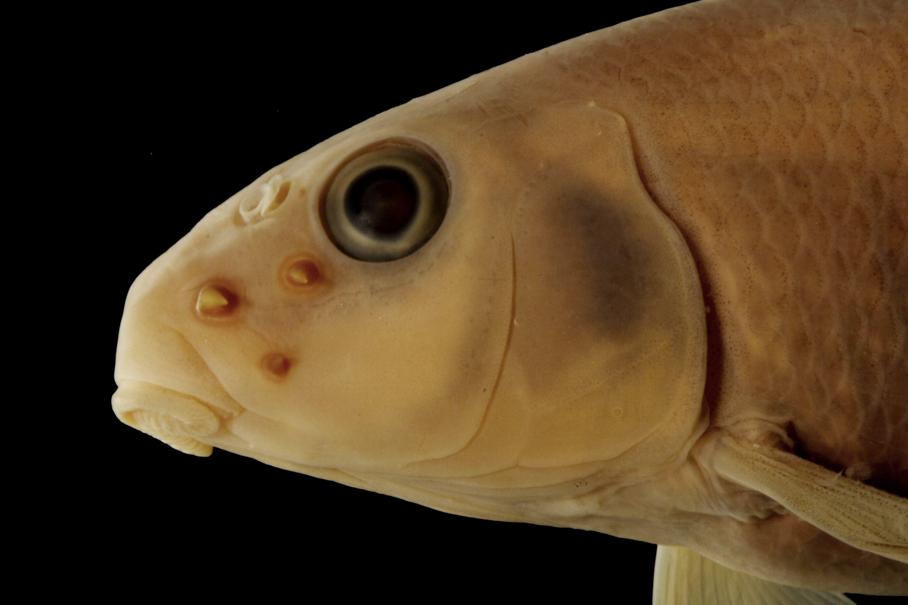
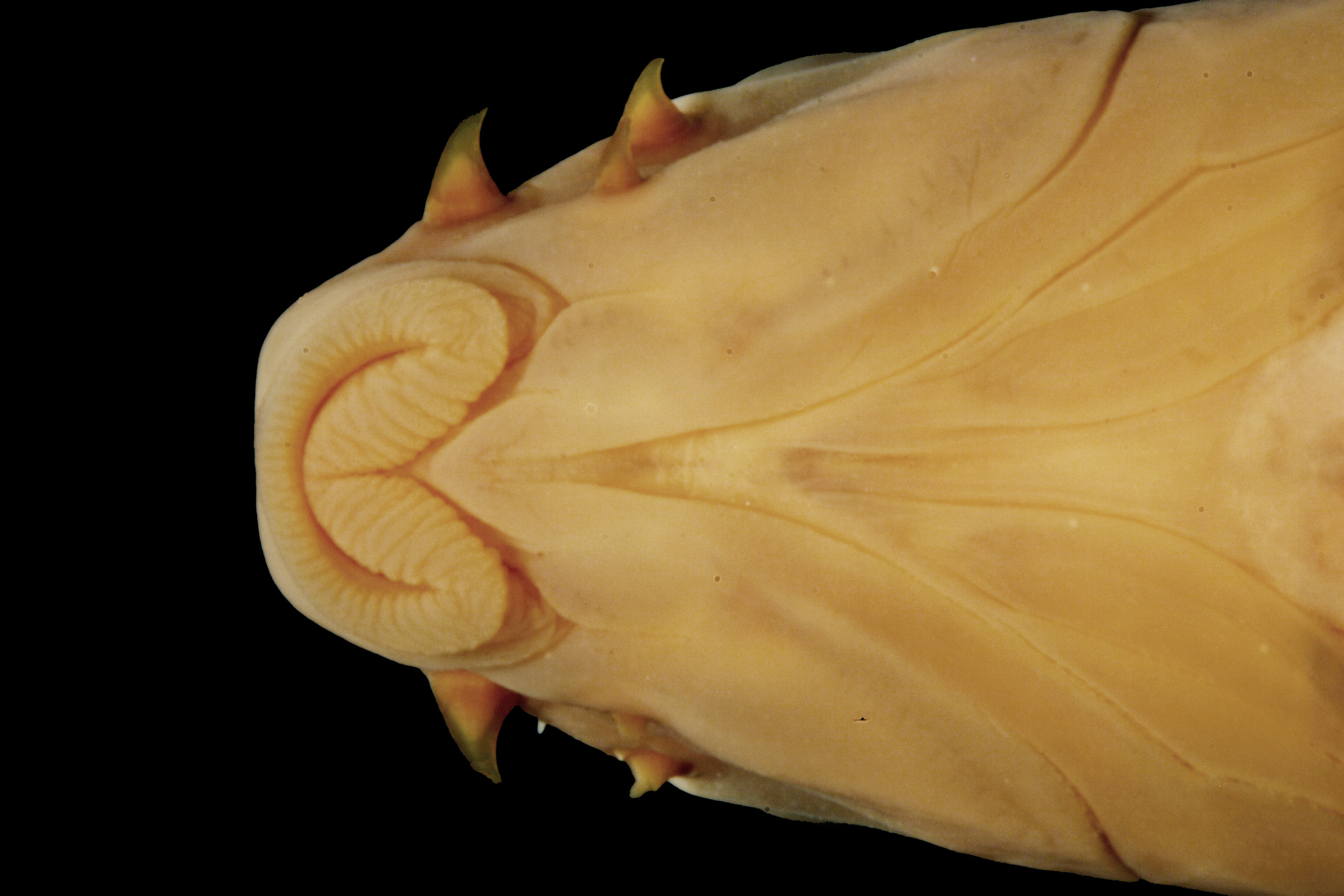
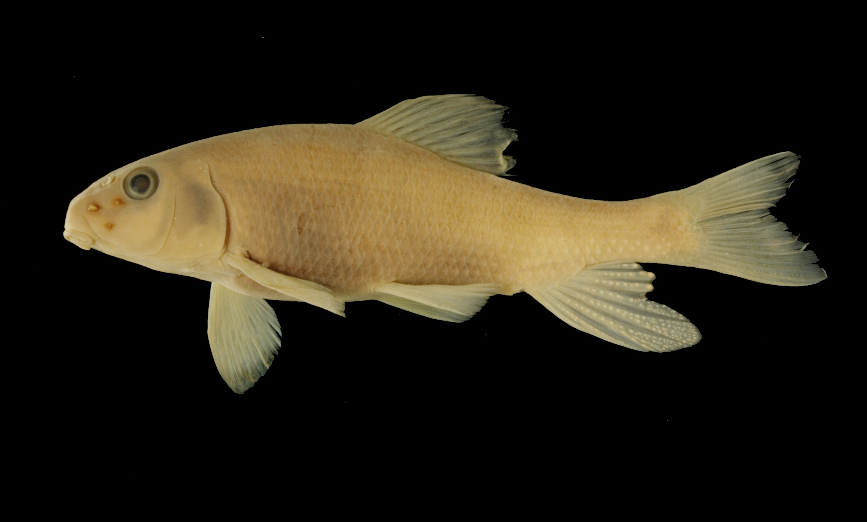
Specimen examined and Id'ed for FoTX project. | ID notes: lateral scales: 44; MinSL(mm): 76.16; MaxSL(mm): 106.77; Jar: 32 oz; Specimen condition: good; Mutations: none; Count Male: ; Count female: ; Extern parasites: n
Identification Confidence
High
Collecting Event
Collected
March 23, 1951
Collector(s)
Collecting Event ID
11360
Field Notes
There are no field notes available.
Locality
Region
Piney Woods
Jurisdiction
Montgomery, Texas
Name
Unspecified tributary of Peach Creek on SH 105, 15 miles east of Conroe
Hydrography
Texas-Gulf Region
Galveston Bay-San Jacinto
San Jacinto
East Fork San Jacinto
Peach Creek-Caney Creek
Jayhawker Creek
Captive
no
Locality Photos
No locality photos available.
flag (suspect/examine)
suspect: noexamination: yes
date
date_range: 3/23/1951-3/23/1951
collectors
collectors: Thornton, W.A. Milstead, W.W. Jameson, D.L.
collectors
collectors: W.A. Thornton, W.W. Milstead, D.L. Jameson
date
date_range: 3/22/1951-3/22/1951
staff comment
ID Status: Not flagged for specimen examination. By default we accept donor specimen determinations (after synonymization to our taxonomy). If georeferenced to TX this record has been considered in spatial context with other occurences of this species and accepted as correct.
ID Comments: NAGeoref Remark: Measured by SH 105
georeference
Error: 5001.84115197854Remarks: Measured by SH 105Locality: Unspecified tributary of Peach Creek on SH 105, 15 miles east of ConroeCoordinates: 30.325830161;-95.20793509Georeferencer: AECGeographic note: Inland USA Texas
Measured by SH 105
Comments On TNHCi_1190