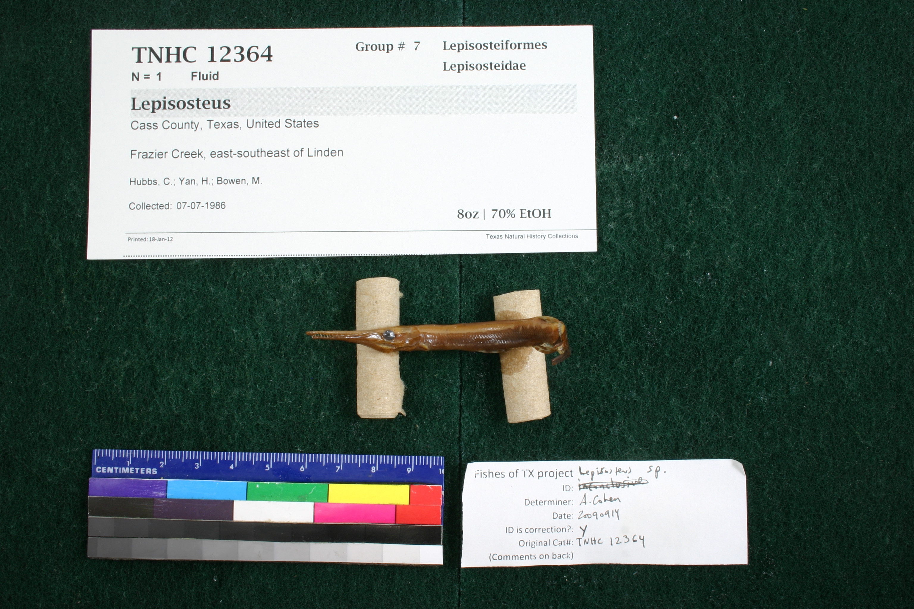
TNHCi_12364
Not suspect, examinedPhotos
Map
Location
32.94982° N, 94.17651° W
(± 9226.4
m)
Taxonomy
GenusLepisosteus
Speciesplatostomus
Specimen
Num Specimens1
Collection Event
CollectorHubbs, C.S.; Yan, H.Y.; Bowen, M.
Collected Date1986.7.6
Geography
DrainageRed
CountryUnited States
StateTexas
CountyCass
LocalityFrazier Creek, 11 mi. ESE Linden
Record Source
Source
Texas Natural History Collections
(type: specimens)
Institution
Texas Natural History Collections
(type: museum)
Curator
Dean Hendrickson
Record Added
May 13, 2010
Record Last Modified
March 23, 2026
Data Processing Track
Track 2
From Data Set Received
04/2009 to 10/2010
Identification
Suspect Notes
None
Count
1
Current Determination
Determiner
Adam Cohen
Determination Date
Feb. 11, 2016
Determination Type
specimen examination
Identification Comments
ID complete | juvenile without scales; 37 preanal myomeres
Identification Confidence
Unknown
Collecting Event
Collected
July 7, 1986
Collector(s)
Collecting Event ID
7641
Field Notes
Locality
Region
Piney Woods
Jurisdiction
Cass, Texas
Name
Frazier Creek, east-southeast of Linden
Hydrography
Arkansas-White-Red Region
Red-Sulphur
Big Cypress-Sulphur
Caddo Lake
Jim Bayou-Frazier Creek
Leek Creek-Frazier Creek
Captive
no
Locality Photos
No locality photos available.
flag (suspect/examine)
note: Previously examined and can't resolve to species level. ID cannot be made to species level at this time
Examination: Examined
flag (suspect/examine)
suspect: noexamination: yes
date
date_range: 7/7/1986-7/7/1986
collectors
collectors: Hubbs, Clark Yan, H.Y. Bowen, M.
staff comment
ID Status: Specimen examined and ID'ed for FoTX projectID Comments: juvenile without scales; 37 preanal myomeres
Georef Remark: Reach is defined from Cass County Line upstream to line drawn east out of Linden geographic center.
collectors
collectors: Clark Hubbs, H.Y. Yan, M. Bowen
date
date_range: 7/6/1986-7/6/1986
georeference
Error: 9226.36915196041
Remarks: Reach is defined from Cass County Line upstream to line drawn east out of Linden geographic center.
Locality: Frazier Creek, east-southeast of LindenCoordinates: 32.949822622;-94.176512595Georeferencer: AECGeographic note: Inland USA TexasReach is defined from Cass County Line upstream to line drawn east out of Linden geographic center.
Comments On TNHCi_12364