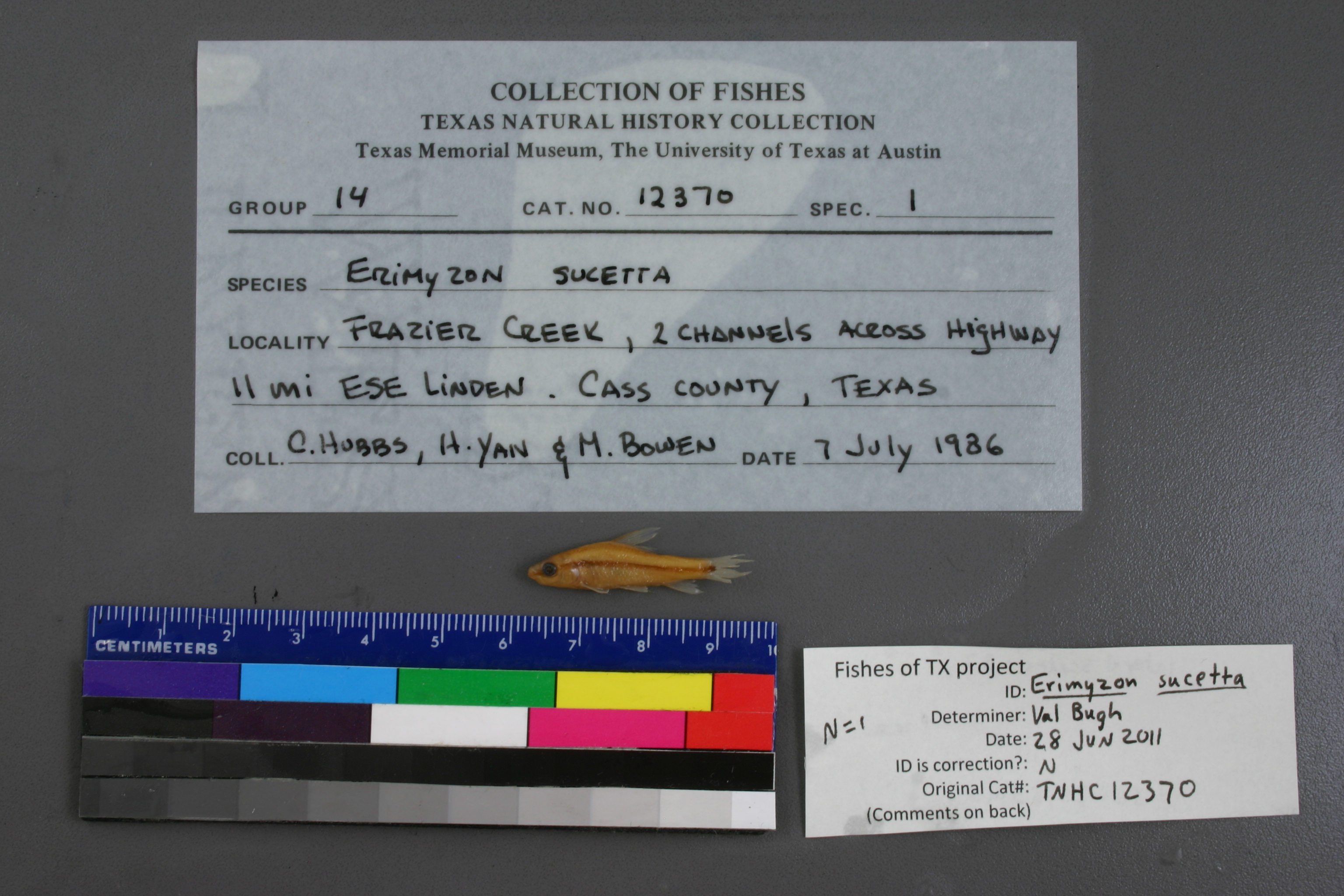
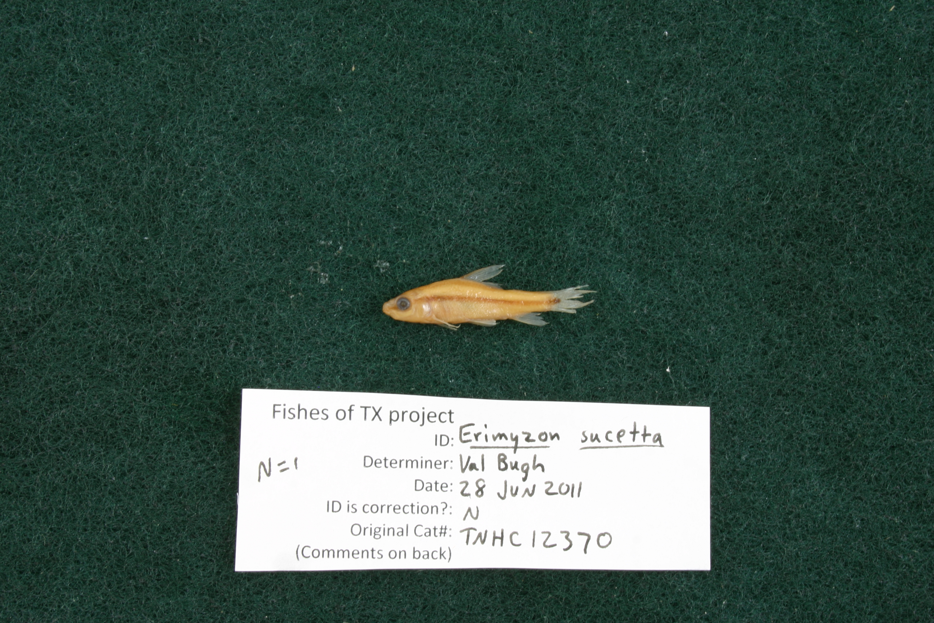
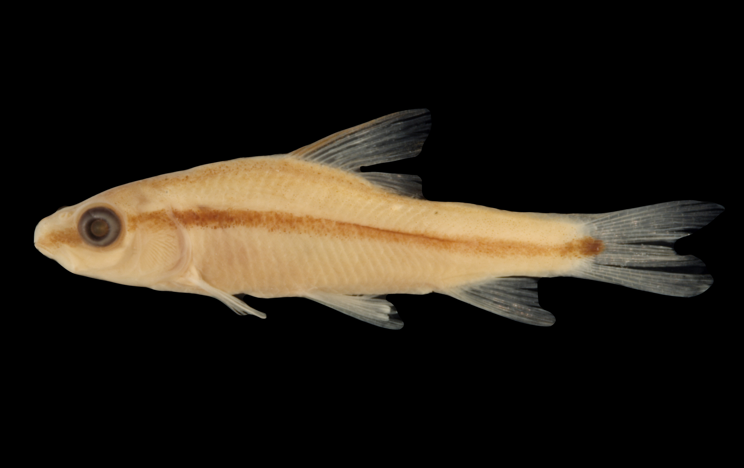
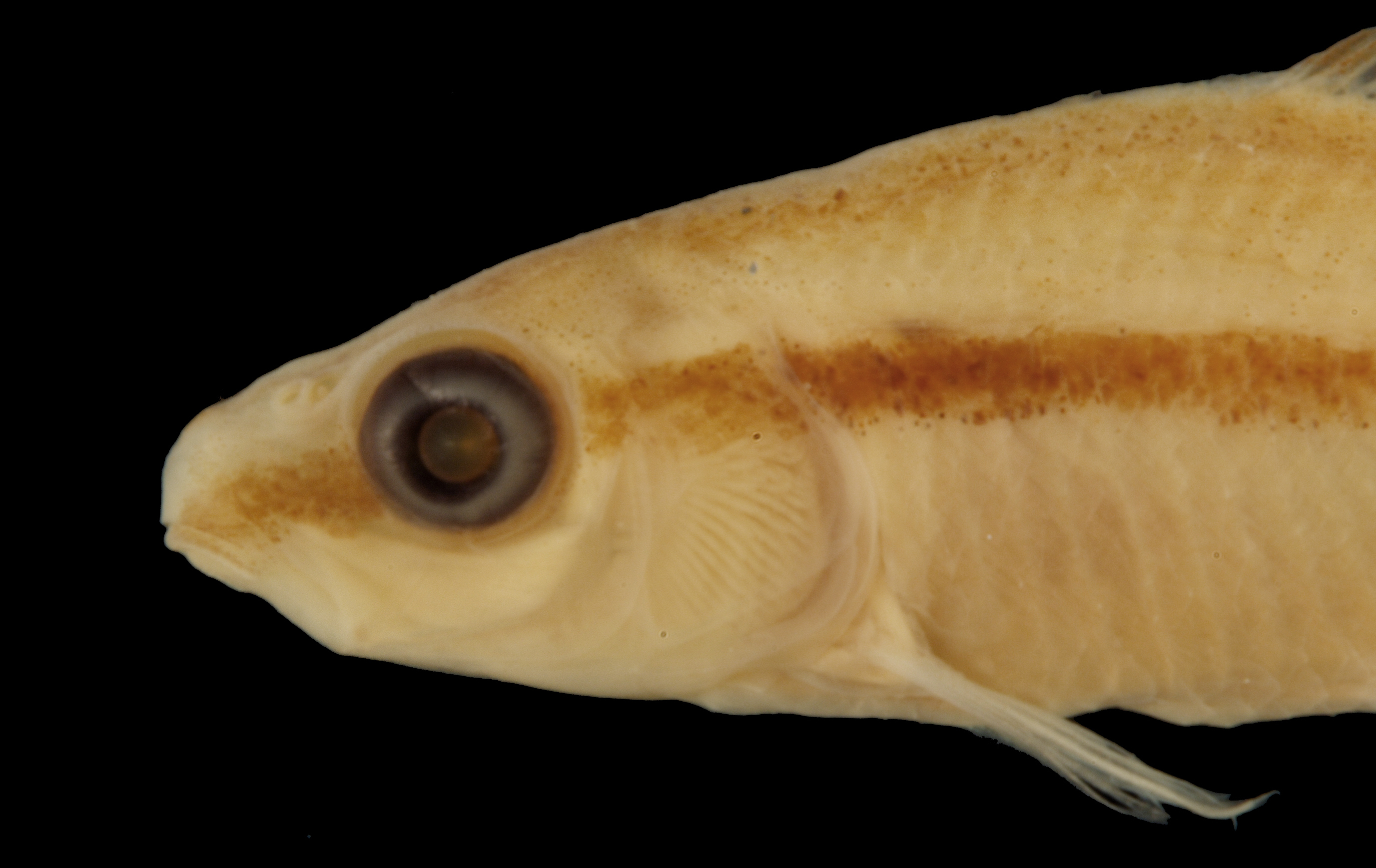
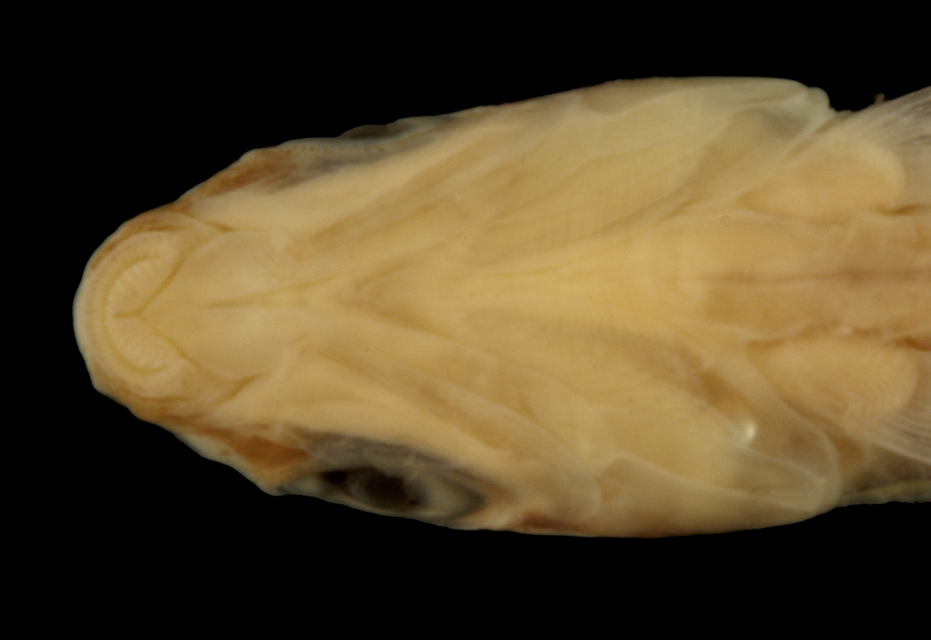
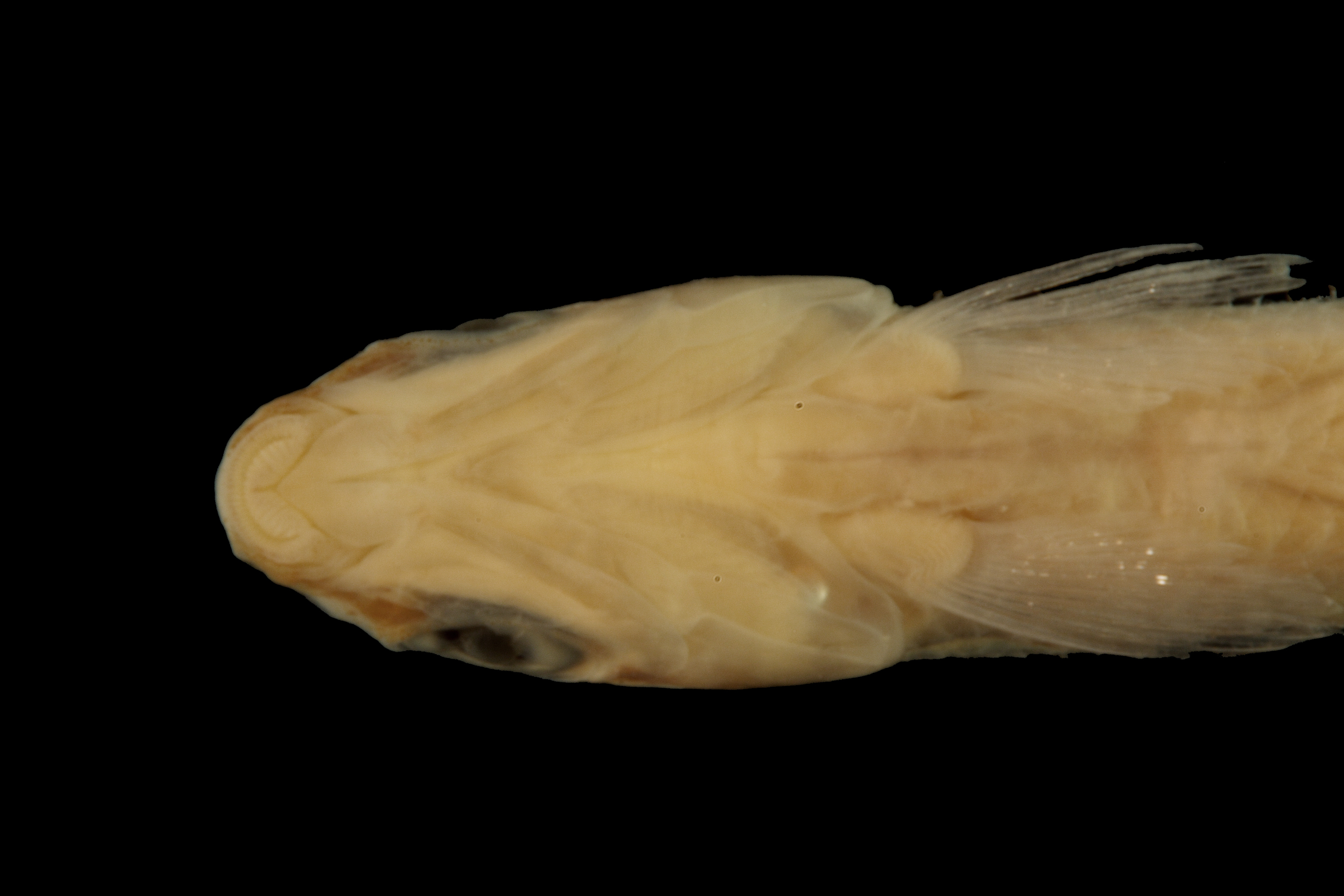
TNHCi_12370
Not suspect, examinedPhotos
Map
Location
32.94982° N, 94.17651° W
(± 9226.4
m)
Taxonomy
GenusErimyzon
Speciessucetta
Specimen
Num Specimens1
Collection Event
CollectorHubbs, C.S.; Yan, H.Y.; Bowen, M.
Collected Date1986.7.6
Geography
DrainageRed
CountryUnited States
StateTexas
CountyCass
LocalityFrazier Creek, 11 mi. ESE Linden
Record Source
Source
Texas Natural History Collections
(type: specimens)
Institution
Texas Natural History Collections
(type: museum)
Curator
Dean Hendrickson
Record Added
May 13, 2010
Record Last Modified
March 23, 2026
Data Processing Track
Track 2
From Data Set Received
04/2009 to 10/2010
Identification
Suspect Notes
None
Count
1
Current Determination
Determiner
Valerie Gawenda Bugh
Determination Date
Feb. 11, 2016
Determination Type
specimen examination
Identification Comments
Specimen examined and Id'ed for FoTX project. | ID notes: lateral scales: 37; MinSL(mm): 25.83; MaxSL(mm): ; Jar: 8 oz; Specimen condition: good; Mutations: none; Count Male: ; Count female: ; Extern parasites: n
Identification Confidence
High
Collecting Event
Collected
July 7, 1986
Collector(s)
Collecting Event ID
7641
Field Notes
Locality
Region
Piney Woods
Jurisdiction
Cass, Texas
Name
Frazier Creek, east-southeast of Linden
Hydrography
Arkansas-White-Red Region
Red-Sulphur
Big Cypress-Sulphur
Caddo Lake
Jim Bayou-Frazier Creek
Leek Creek-Frazier Creek
Captive
no
Locality Photos
No locality photos available.
flag (suspect/examine)
suspect: noexamination: yes
date
date_range: 7/7/1986-7/7/1986
collectors
collectors: Hubbs, Clark Yan, H.Y. Bowen, M.
collectors
collectors: Clark Hubbs, H.Y. Yan, M. Bowen
date
date_range: 7/6/1986-7/6/1986
staff comment
ID Status: Not flagged for specimen examination. By default we accept donor specimen determinations (after synonymization to our taxonomy). If georeferenced to TX this record has been considered in spatial context with other occurences of this species and accepted as correct.
ID Comments: NAGeoref Remark: Reach is defined from Cass County Line upstream to line drawn east out of Linden geographic center.
georeference
Error: 9226.36915196041
Remarks: Reach is defined from Cass County Line upstream to line drawn east out of Linden geographic center.
Locality: Frazier Creek, east-southeast of LindenCoordinates: 32.949822622;-94.176512595Georeferencer: AECGeographic note: Inland USA TexasReach is defined from Cass County Line upstream to line drawn east out of Linden geographic center.
Comments On TNHCi_12370