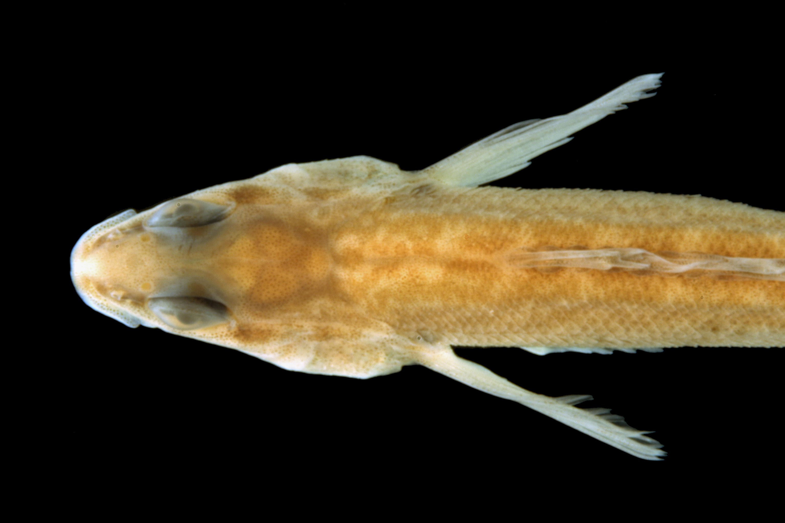
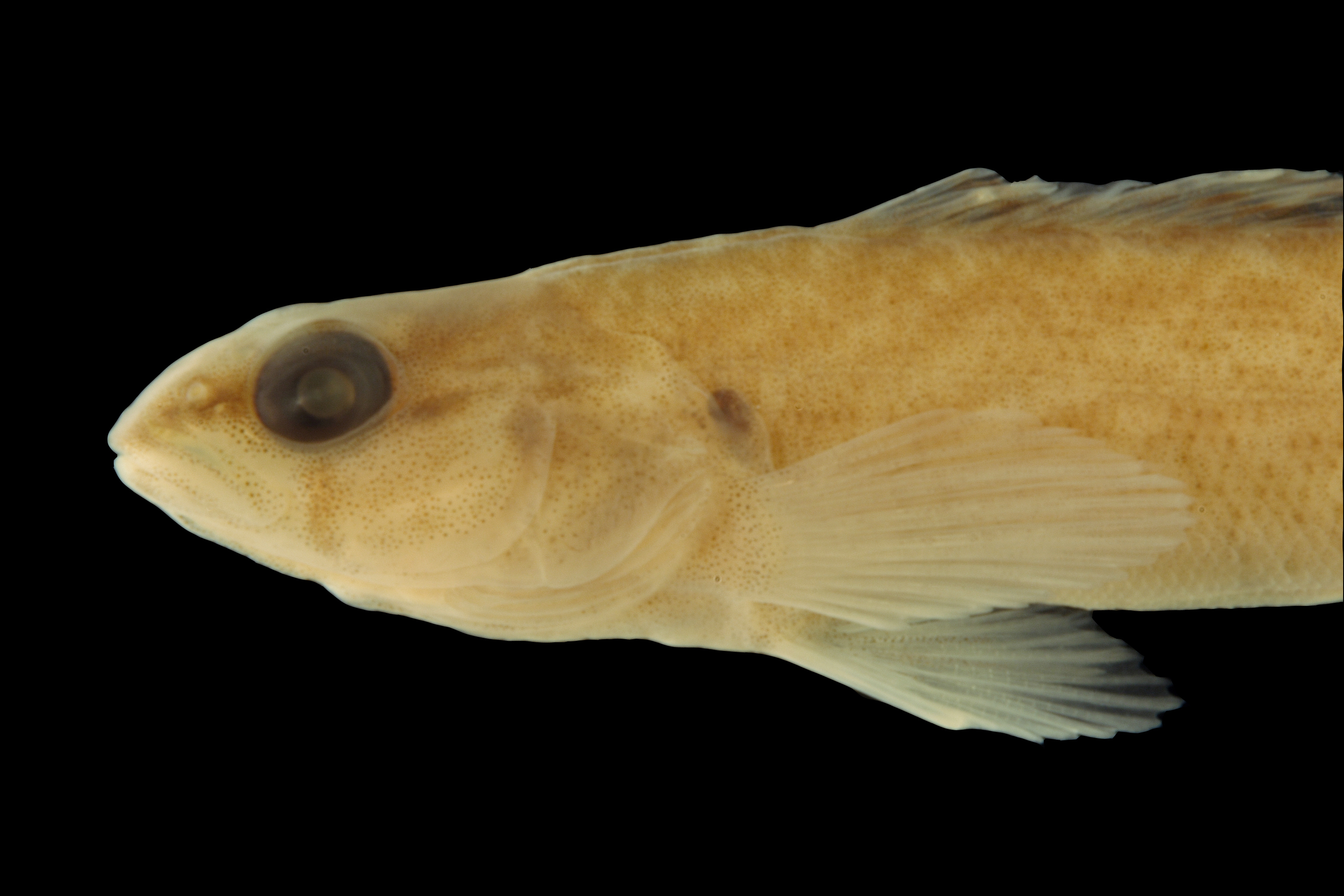
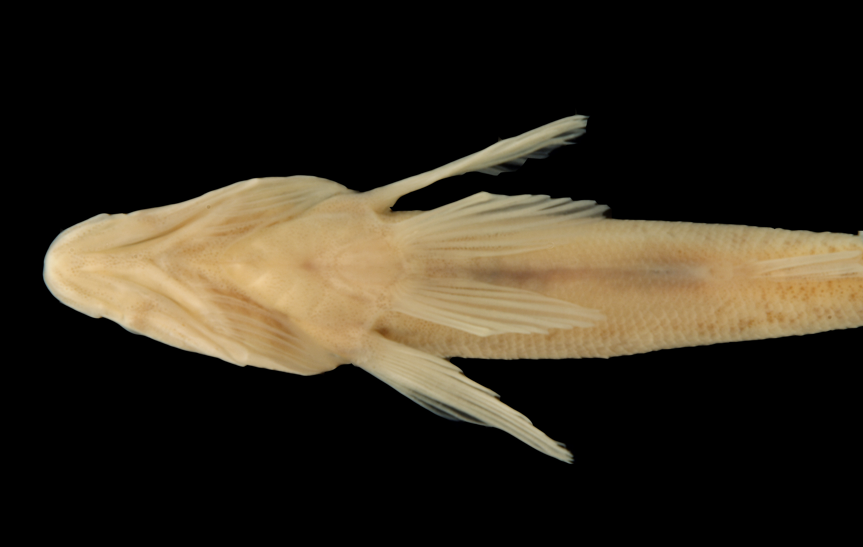
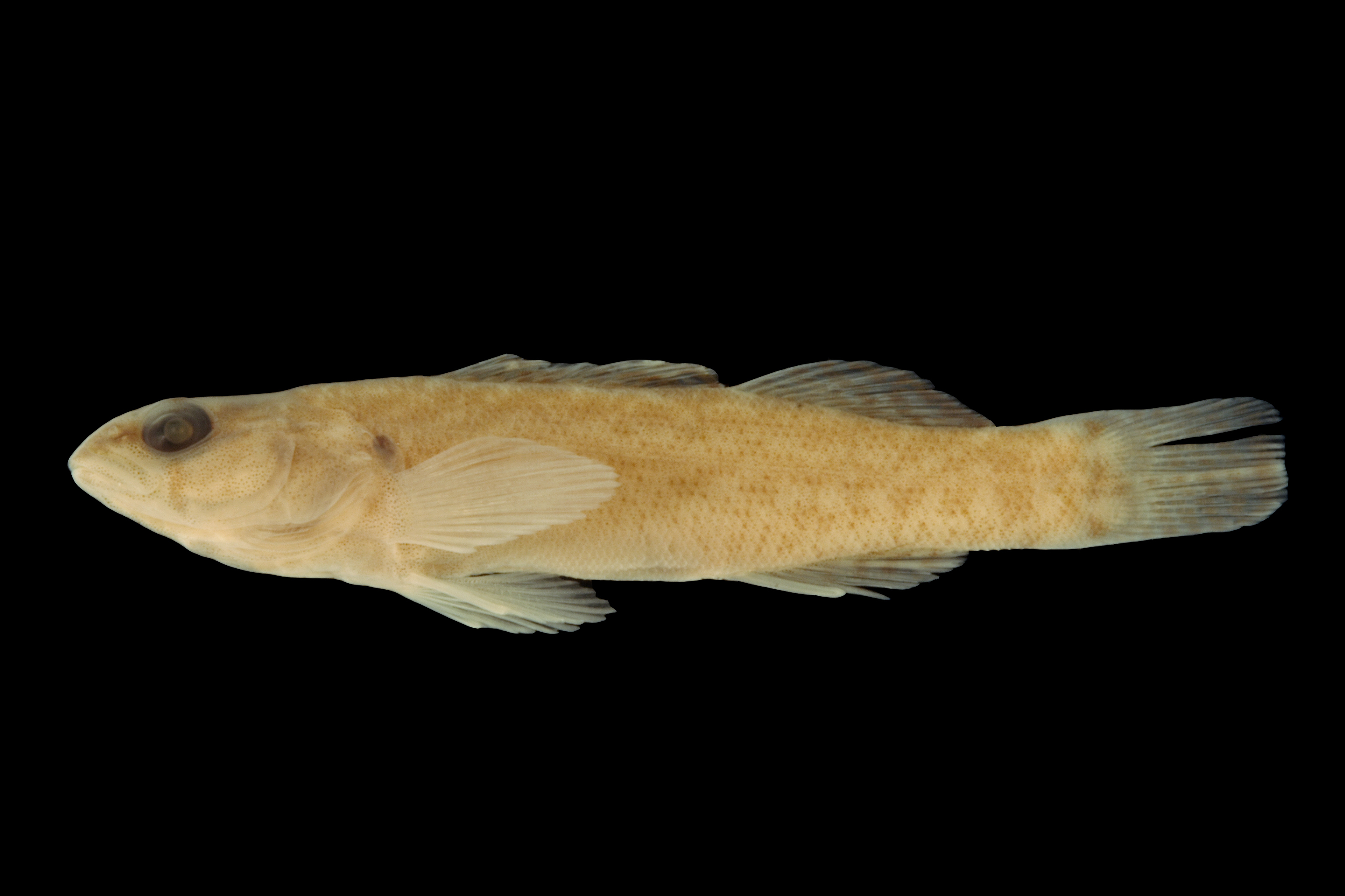
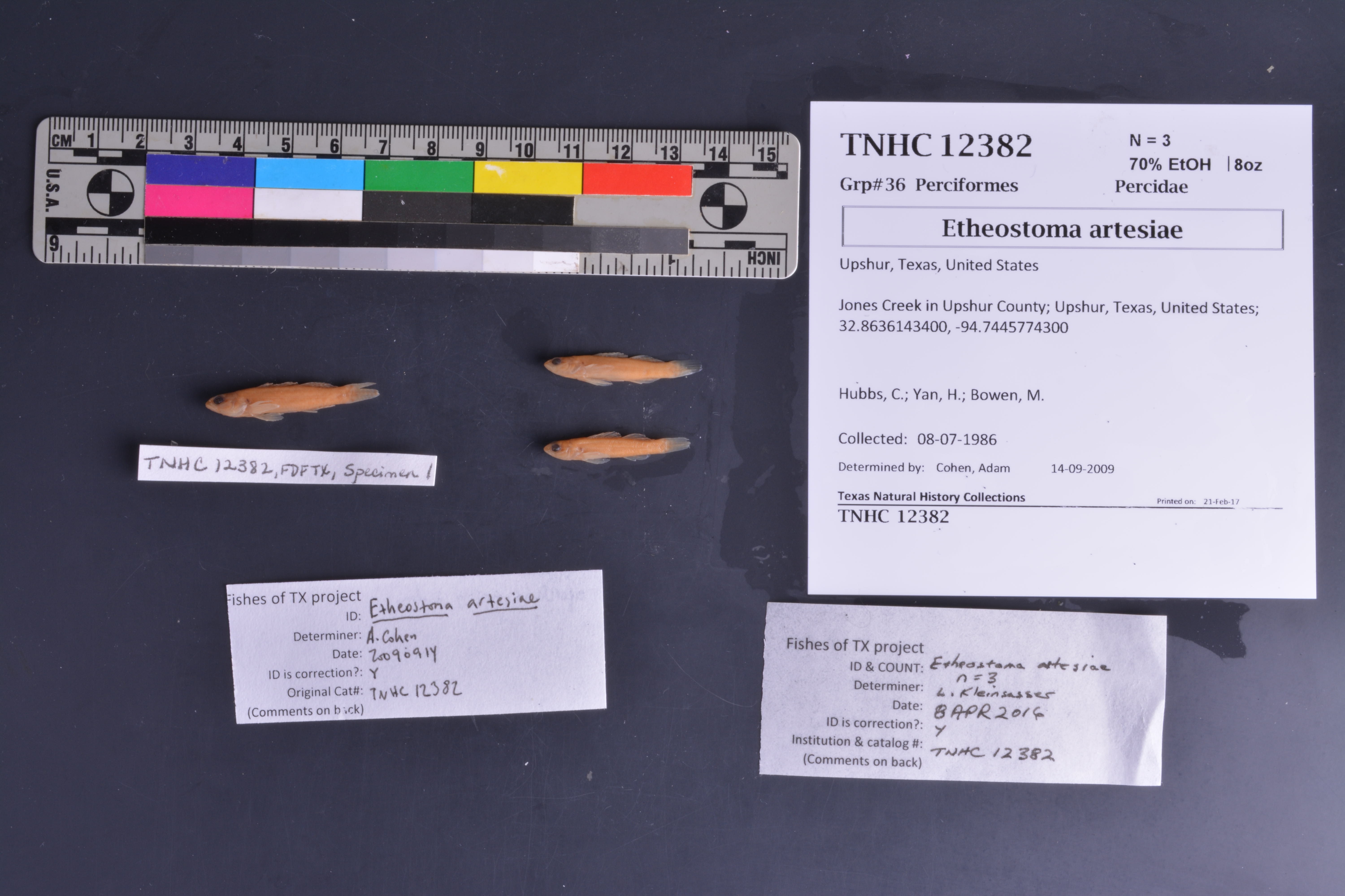
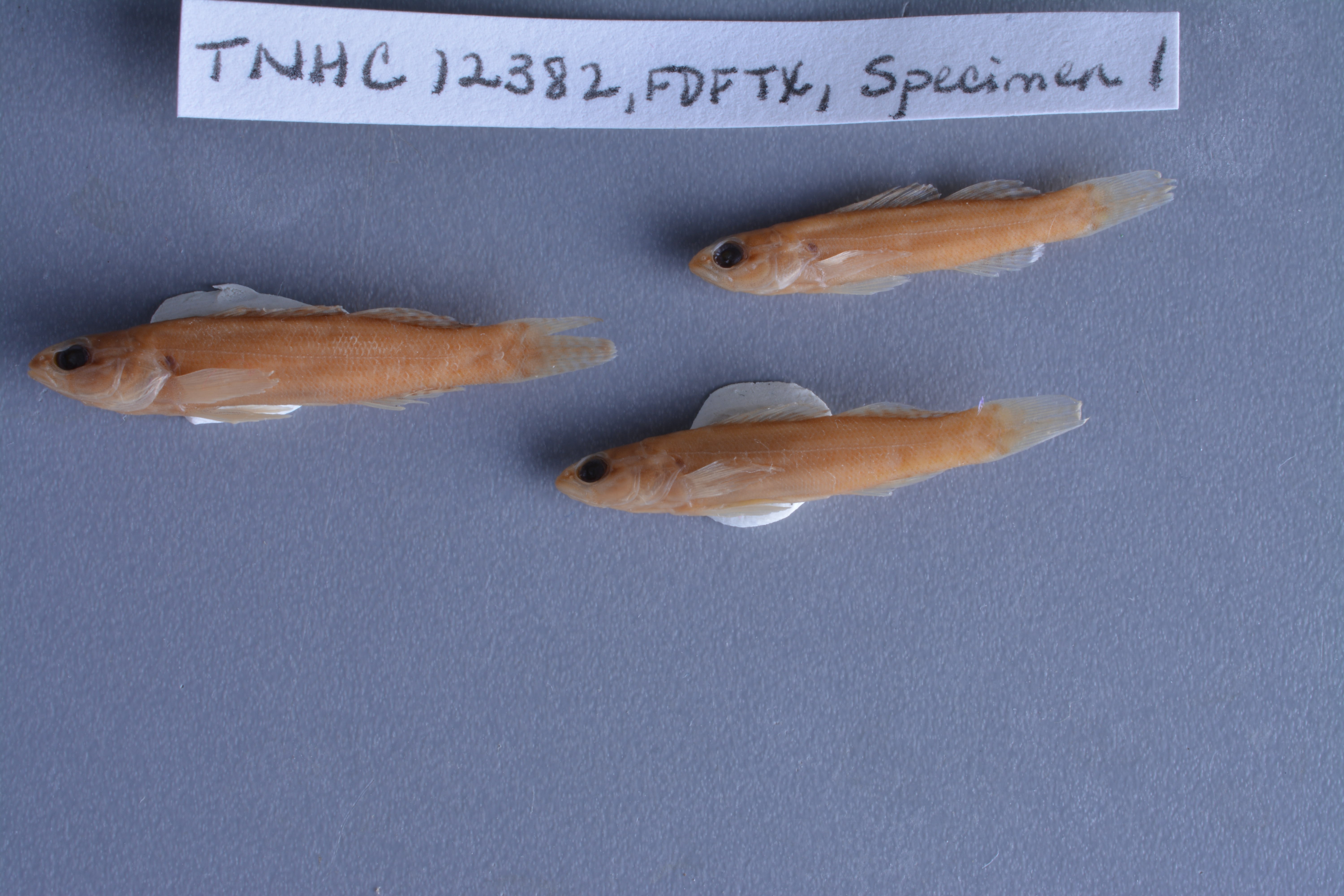
TNHCi_12382
Not suspect, examinedPhotos
Map
Location
32.86361° N, 94.74458° W
(± 3553.4
m)
Taxonomy
GenusEtheostoma
Speciesradiosum
Specimen
Num Specimens3
Collection Event
CollectorHubbs, C.S.; Yan, H.Y.; Bowen, M.
Collected Date1986.7.7
Geography
DrainageRed
CountryUnited States
StateTexas
CountyUpshur
LocalityJones Creek, 16 mi. NE Gilmer
Record Source
Source
Texas Natural History Collections
(type: specimens)
Institution
Texas Natural History Collections
(type: museum)
Curator
Dean Hendrickson
Record Added
May 13, 2010
Record Last Modified
March 23, 2026
Data Processing Track
Track 2
From Data Set Received
04/2009 to 10/2010
Identification
Suspect Notes
None
Count
3
Current Determination
Determiner
Leroy J. Kleinsasser
Determination Date
Feb. 11, 2016
Determination Type
specimen examination
Identification Comments
ID complete
Identification Confidence
High
Collecting Event
Collected
July 8, 1986
Collector(s)
Collecting Event ID
7675
Field Notes
Locality
Region
Piney Woods
Jurisdiction
Upshur, Texas
Name
Jones Creek in Upshur County
Hydrography
Arkansas-White-Red Region
Red-Sulphur
Big Cypress-Sulphur
Lake O'the Pines
Alley Creek-Big Cypress Creek
Jones Creek-Big Cypress Creek
Captive
no
Locality Photos
No locality photos available.
flag (suspect/examine)
suspect: noexamination: yes
date
date_range: 7/8/1986-7/8/1986
collectors
collectors: Hubbs, Clark Yan, H.Y. Bowen, M.
collectors
collectors: Clark Hubbs, H.Y. Yan, M. Bowen
date
date_range: 7/7/1986-7/7/1986
staff comment
ID Status: Specimen examined and ID'ed for FoTX projectID Comments: opercle is mostly scaled (as per Fishes of AK)
Georef Remark: entire creek falls between lines drawn NE and ENE of Gilmer center, extent covers entire creek
georeference
Error: 3553.43155198475
Remarks: entire creek falls between lines drawn NE and ENE of Gilmer center, extent covers entire creek
Locality: Jones Creek in Upshur CountyCoordinates: 32.863614341;-94.744577428Georeferencer: BJLGeographic note: Inland USA Texasentire creek falls between lines drawn NE and ENE of Gilmer center, extent covers entire creek
Comments On TNHCi_12382