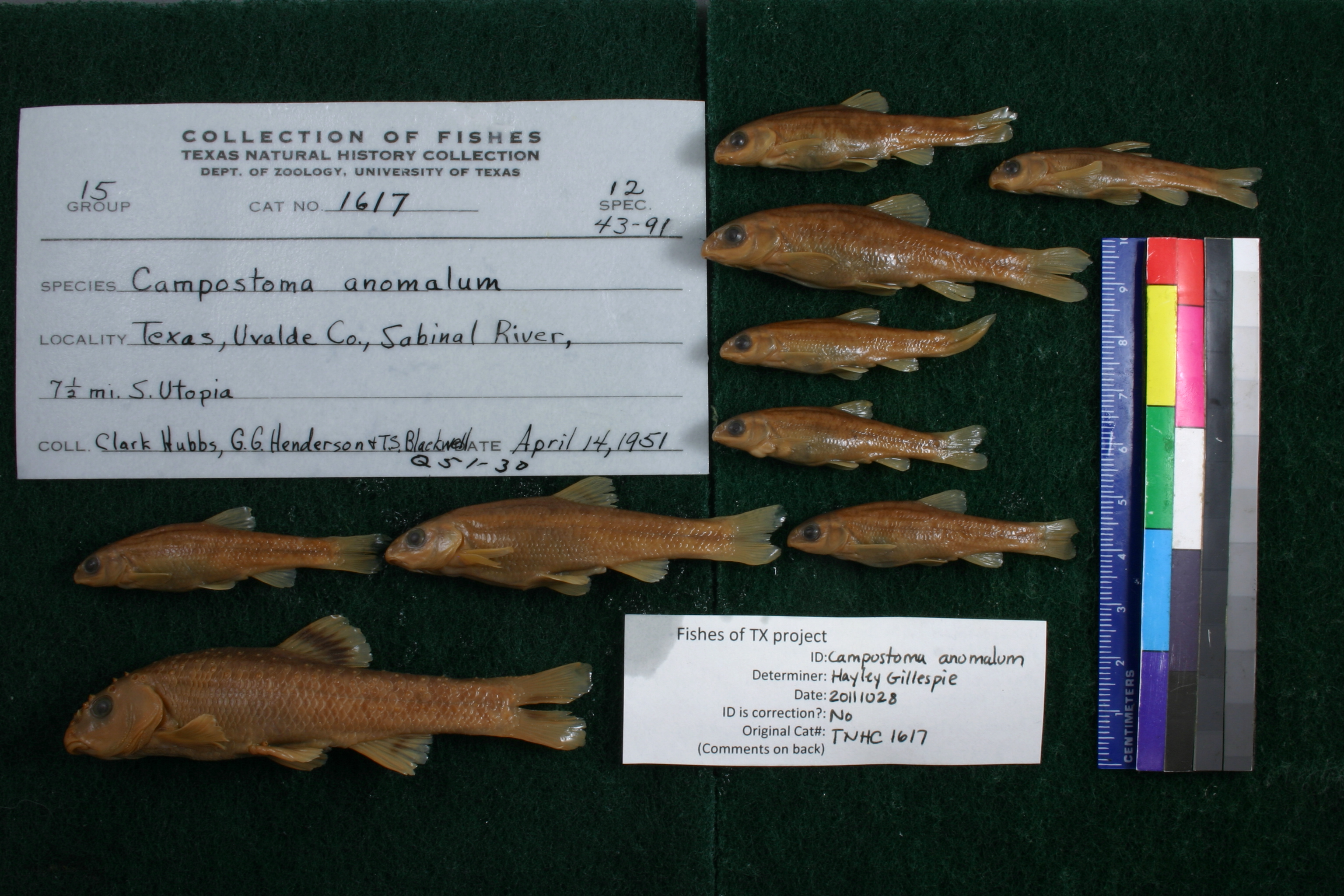
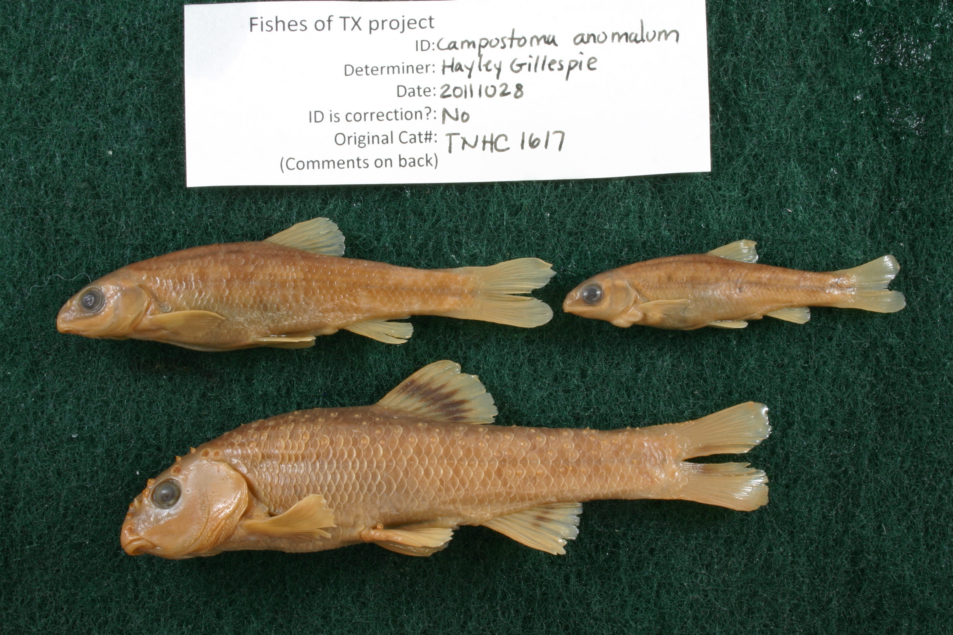
TNHCi_1617
Not suspect, examinedPhotos
Map
Location
29.51677° N, 99.50827° W
(± 1454.8
m)
Taxonomy
GenusCampostoma
Speciesanomalum
Specimen
Num Specimens12
Collection Event
CollectorHubbs, C.S.; et al.
Collected Date1951.4.13
Geography
DrainageNueces
CountryUnited States
StateTexas
CountyUvalde
LocalitySabinal River, 7.5 mi. S Utopia
Record Source
Source
Texas Natural History Collections
(type: specimens)
Institution
Texas Natural History Collections
(type: museum)
Curator
Dean Hendrickson
Record Added
May 13, 2010
Record Last Modified
March 23, 2026
Data Processing Track
Track 2
From Data Set Received
04/2009 to 10/2010
Identification
Suspect Notes
None
Count
12
Current Determination
Determiner
Jennifer Hayley Gillespie
Determination Date
Feb. 11, 2016
Determination Type
specimen examination
Identification Comments
Specimen examined and Id'ed for FoTX project. | ID notes: one specimen with double left pectoral fin. Rays 16 top, 12 bottom. One specimen with lump at base of left pectoral fin. Several with relatively thin cartilaginous ridges on lower lip.; MinSL(mm): 43.7; MaxSL(mm): 81.73; Jar: 8 oz; Specimen condition: good; Mutations: one specimen with double left pectoral fin; Count Male: 2 with breeding tubercles; Count female: ; Extern parasites: n
Identification Confidence
High
Collecting Event
Collected
April 14, 1951
Collector(s)
Collecting Event ID
6981
Field Notes
There are no field notes available.
Locality
Region
Edwards Plateau
Jurisdiction
Uvalde, Texas
Name
Sabinal River, 7.5 miles south of Utopia
Hydrography
Texas-Gulf Region
Nueces-Southwestern Texas Coastal
Nueces
Upper Frio
Upper Sabinal River
Onion Creek-Sabinal River
Captive
no
Locality Photos
No locality photos available.
flag (suspect/examine)
suspect: noexamination: yes
date
date_range: 4/14/1951-4/14/1951
collectors
collectors: Hubbs, Clark Hubbs, Catherine S.
collectors
collectors: Clark Hubbs, Catherine S. Hubbs
date
date_range: 4/13/1951-4/13/1951
staff comment
ID Status: Not flagged for specimen examination. By default we accept donor specimen determinations (after synonymization to our taxonomy). If georeferenced to TX this record has been considered in spatial context with other occurences of this species and accepted as correct.
ID Comments: NAGeoref Remark: Measured by SH 187
georeference
Error: 1454.84697599376Remarks: Measured by SH 187Locality: Sabinal River, 7.5 miles south of UtopiaCoordinates: 29.516769727;-99.508272461Georeferencer: AECGeographic note: Inland USA Texas
Measured by SH 187
Comments On TNHCi_1617