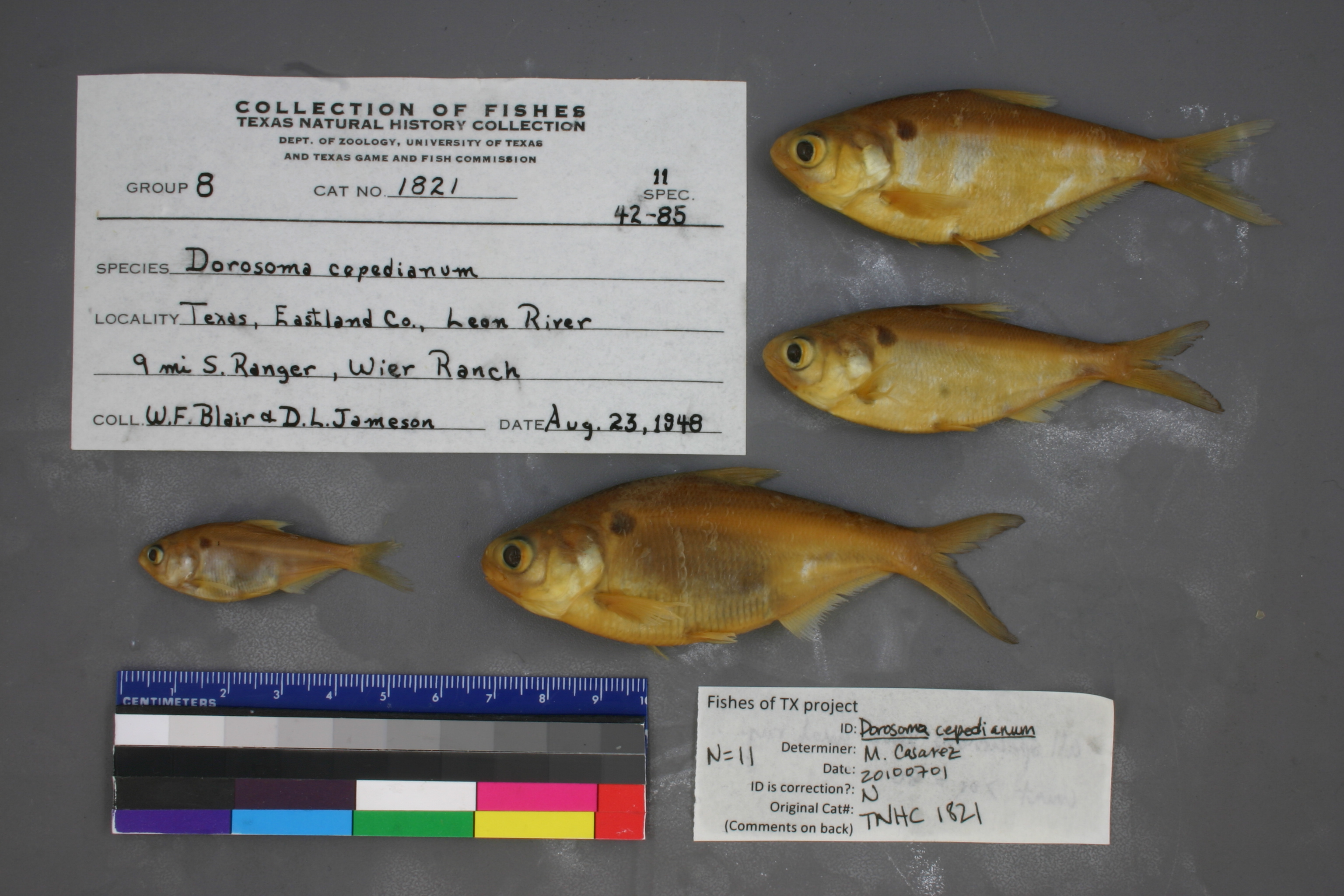
TNHCi_1821
Not suspect, examinedPhotos
Map
Location
32.36443° N, 98.67887° W
(± 10031.0
m)
Taxonomy
GenusDorosoma
Speciescepedianum
Specimen
Num Specimens11
Collection Event
CollectorBlair, W.F.; et al.
Collected Date1948.8.22
Geography
DrainageBrazos
CountryUnited States
StateTexas
CountyEastland
LocalityLeon River, 9 mi. S Ranger, Weir Ranch
Record Source
Source
Texas Natural History Collections
(type: specimens)
Institution
Texas Natural History Collections
(type: museum)
Curator
Dean Hendrickson
Record Added
May 13, 2010
Record Last Modified
March 23, 2026
Data Processing Track
Track 2
From Data Set Received
04/2009 to 10/2010
Identification
Suspect Notes
None
Count
11
Current Determination
Determiner
Melissa Casarez
Determination Date
Feb. 11, 2016
Determination Type
specimen examination
Identification Comments
Specimen examined and Id'ed for FoTX project. | ID notes: all specimens have anal ray count > or = 30; MinSL(mm): 40.78; MaxSL(mm): 82.53; Jar: 8 oz; Specimen condition: good; Mutations: none; Count Male: ; Count female: ; Extern parasites: y
Identification Confidence
High
Collecting Event
Collected
Aug. 23, 1948
Collector(s)
Collecting Event ID
10267
Field Notes
There are no field notes available.
Locality
Region
Rolling Plains
Jurisdiction
Eastland, Texas
Name
Leon River south of Ranger
Hydrography
Texas-Gulf Region
Lower Brazos
Little
Leon
South Fork Leon River-Leon River
Lake Leon-Leon River
Captive
no
Locality Photos
No locality photos available.
flag (suspect/examine)
suspect: noexamination: yes
date
date_range: 8/23/1948-8/23/1948
collectors
collectors: Blair, W. Frank Jameson, D.L.
collectors
collectors: W. Frank Blair
date
date_range: 8/22/1948-8/22/1948
staff comment
ID Status: Not flagged for specimen examination. By default we accept donor specimen determinations (after synonymization to our taxonomy). If georeferenced to TX this record has been considered in spatial context with other occurences of this species and accepted as correct.
ID Comments: NAGeoref Remark: Can't find Weir Ranch. Point placed on river at point due south of Ranger and extent runs to line drawn southwest out of Ranger geographic center.
georeference
Error: 10031.041151957
Remarks: Can't find Weir Ranch. Point placed on river at point due south of Ranger and extent runs to line drawn southwest out of Ranger geographic center.
Locality: Leon River south of RangerCoordinates: 32.36443201;-98.678869169Georeferencer: AECGeographic note: Inland USA TexasCan't find Weir Ranch. Point placed on river at point due south of Ranger and extent runs to line drawn southwest out of Ranger geographic center.
Comments On TNHCi_1821