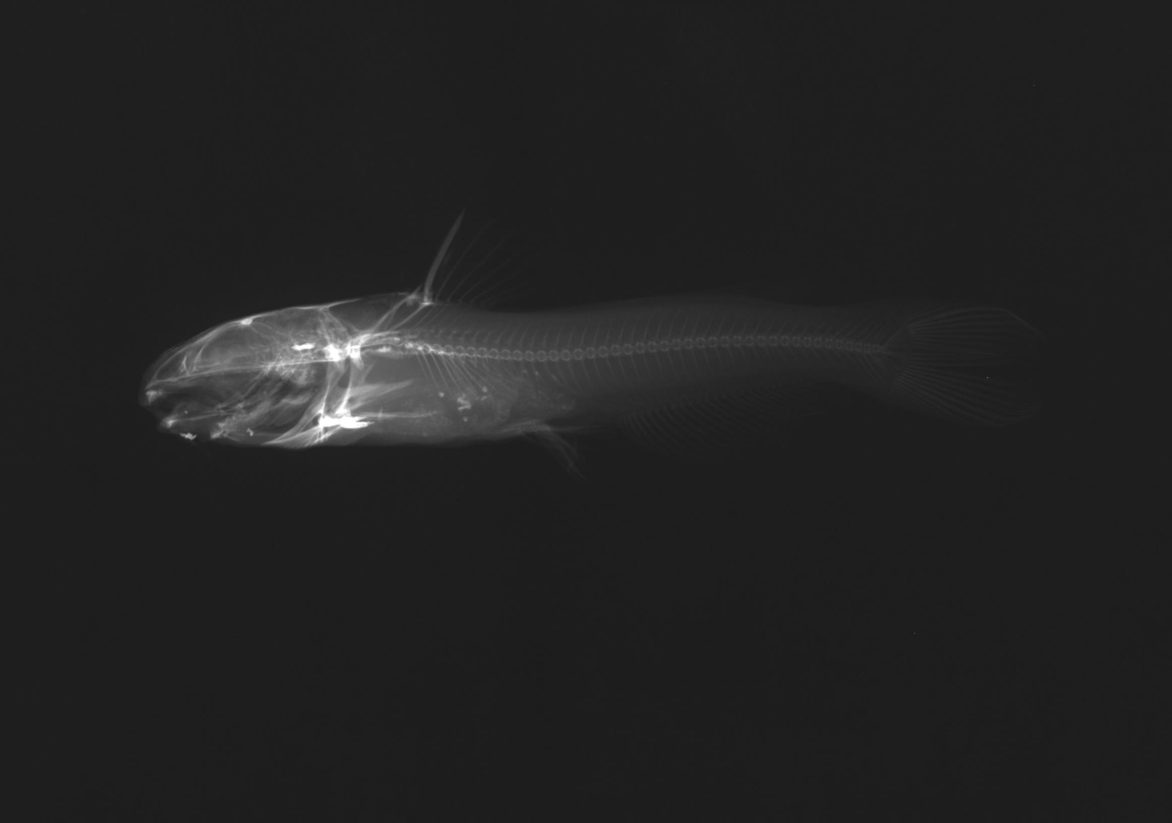
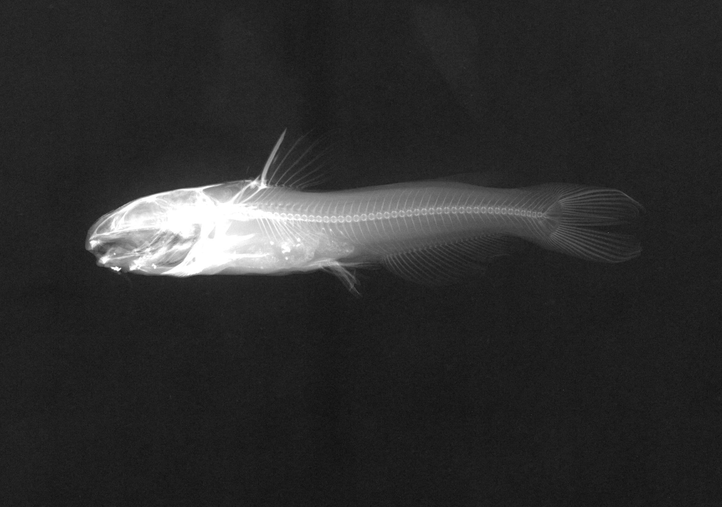
TNHCi_1842
Not suspect, not examinedPhotos
Map
Location
29.81625° N, 99.77430° W
(± 2780.9
m)
Taxonomy
GenusIctalurus
Speciespunctatus
Specimen
Num Specimens1
Collection Event
CollectorHubbs, C.S.; Henderson, W.D.
Collected Date1951.4.14
Geography
DrainageNueces
CountryUnited States
StateTexas
CountyReal
LocalityFrio River, 7 mi. N Leakey
Record Source
Source
Texas Natural History Collections
(type: specimens)
Institution
Texas Natural History Collections
(type: museum)
Curator
Dean Hendrickson
Record Added
May 13, 2010
Record Last Modified
March 23, 2026
Data Processing Track
Track 2
From Data Set Received
04/2009 to 10/2010
Identification
Suspect Notes
None
Count
1
Current Determination
Determiner
Fishes of Texas staff
Determination Date
Unknown
Determination Type
Unspecified
Identification Comments
None
Identification Confidence
Unknown
Collecting Event
Collected
April 15, 1951
Collector(s)
Collecting Event ID
1987
Field Notes
There are no field notes available.
Locality
Region
Edwards Plateau
Jurisdiction
Real, Texas
Name
West Frio River, 7 miles north of Leakey
Hydrography
Texas-Gulf Region
Nueces-Southwestern Texas Coastal
Nueces
Upper Frio
West Frio River
Lower West Frio River
Captive
no
Locality Photos
No locality photos available.
flag (suspect/examine)
suspect: noexamination: no
date
date_range: 4/15/1951-4/15/1951
collectors
collectors: Hubbs, Clark Henderson, W.D. Riggs, Carl D.
collectors
collectors: Clark Hubbs, W.D. Henderson
date
date_range: 4/14/1951-4/14/1951
staff comment
ID Status: Not flagged for specimen examination. By default we accept donor specimen determinations (after synonymization to our taxonomy). If georeferenced to TX this record has been considered in spatial context with other occurences of this species and accepted as correct.
ID Comments: NAGeoref Remark: Measured by SH 336Georef Annotation: Should be West Frio River not Frio River
georeference
Error: 2780.94643198807Remarks: Measured by SH 336 Should be West Frio River not Frio RiverLocality: West Frio River, 7 miles north of LeakeyCoordinates: 29.816249126;-99.774299969Georeferencer: AECGeographic note: Inland USA Texas
Measured by SH 336 Should be West Frio River not Frio River
Comments On TNHCi_1842