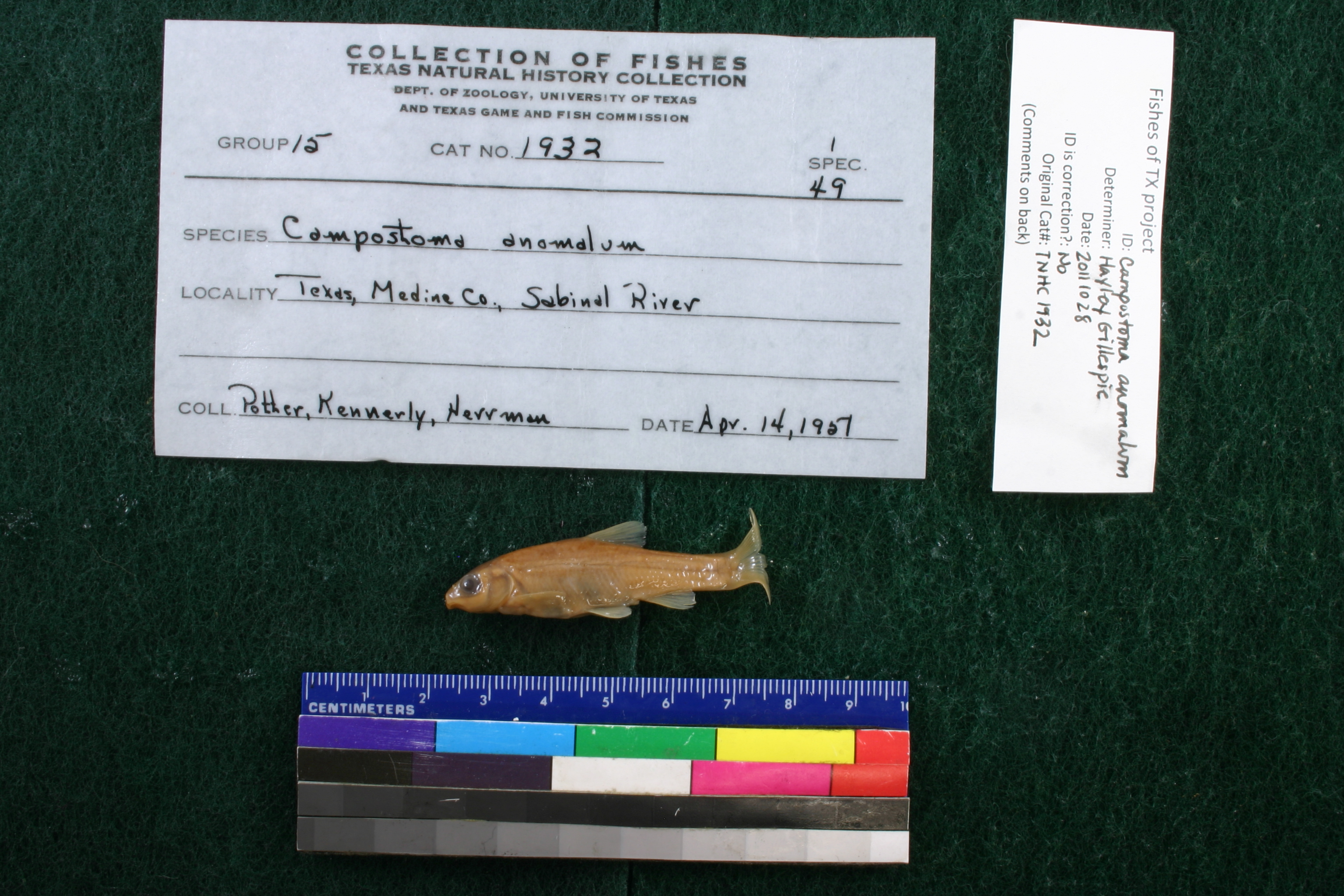
TNHCi_1932
Not suspect, examinedPhotos
Map
Location
29.56636° N, 99.51801° W
(± 1918.3
m)
Taxonomy
GenusCampostoma
Speciesanomalum
Specimen
Num Specimens1
Collection Event
CollectorPotter and Kennerly
Collected Date1951.4.13
Geography
DrainageNueces
CountryUnited States
StateTexas
CountyMedina
LocalitySabinal River, 17.5 mi. N Sabinal, FM 187
Record Source
Source
Texas Natural History Collections
(type: specimens)
Institution
Texas Natural History Collections
(type: museum)
Curator
Dean Hendrickson
Record Added
May 13, 2010
Record Last Modified
March 23, 2026
Data Processing Track
Track 2
From Data Set Received
04/2009 to 10/2010
Identification
Suspect Notes
None
Count
1
Current Determination
Determiner
Jennifer Hayley Gillespie
Determination Date
Feb. 11, 2016
Determination Type
specimen examination
Identification Comments
Specimen examined and Id'ed for FoTX project. | ID notes: ; MinSL(mm): 46.68; MaxSL(mm): ; Jar: 8 oz; Specimen condition: good; Mutations: none; Count Male: ; Count female: ; Extern parasites: n
Identification Confidence
High
Collecting Event
Collected
April 14, 1951
Collector(s)
Collecting Event ID
7617
Field Notes
There are no field notes available.
Locality
Region
Edwards Plateau
Jurisdiction
Uvalde, Texas
Name
Sabinal River, 17.5 miles north of Sabinal via SH 187
Hydrography
Texas-Gulf Region
Nueces-Southwestern Texas Coastal
Nueces
Upper Frio
Upper Sabinal River
Little Creek-Sabinal River
Captive
no
Locality Photos
No locality photos available.
flag (suspect/examine)
suspect: noexamination: yes
date
date_range: 4/14/1951-4/14/1951
collectors
collectors: Potter, Kennerly, T.E.
collectors
collectors: Potter, T.E. Kennerly
date
date_range: 4/13/1951-4/13/1951
staff comment
ID Status: Not flagged for specimen examination. By default we accept donor specimen determinations (after synonymization to our taxonomy). If georeferenced to TX this record has been considered in spatial context with other occurences of this species and accepted as correct.
ID Comments: NAGeoref Remark: Point is placed on the river at this distance from the geographic center of Sabinal.
georeference
Error: 1918.33804799177
Remarks: Point is placed on the river at this distance from the geographic center of Sabinal.
Locality: Sabinal River, 17.5 miles north of Sabinal via SH 187Coordinates: 29.566358034;-99.518012839Georeferencer: AECGeographic note: Inland USA TexasPoint is placed on the river at this distance from the geographic center of Sabinal.
Comments On TNHCi_1932