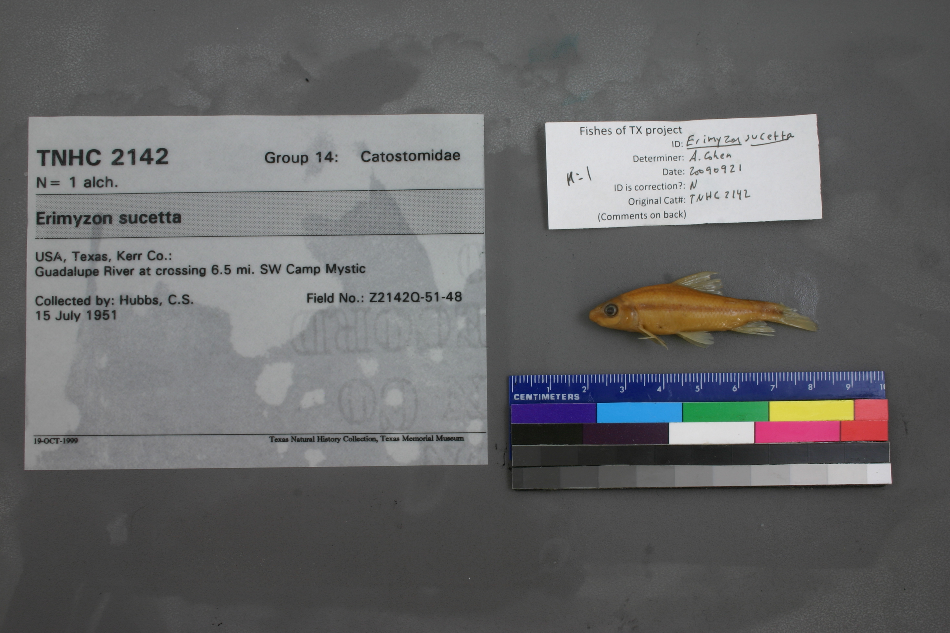
TNHCi_2142
Not suspect, examinedPhotos
Map
Location
29.98018° N, 99.44201° W
(± 1049.3
m)
Taxonomy
GenusErimyzon
Speciessucetta
Specimen
Num Specimens1
Collection Event
CollectorHubbs, C.S.
Collected Date1951.7.14
Geography
DrainageGuadalupe
CountryUnited States
StateTexas
CountyKerr
LocalityGuadalupe River at crossing 6.5 mi. SW Camp Mystic
Record Source
Source
Texas Natural History Collections
(type: specimens)
Institution
Texas Natural History Collections
(type: museum)
Curator
Dean Hendrickson
Record Added
May 13, 2010
Record Last Modified
March 23, 2026
Data Processing Track
Track 2
From Data Set Received
04/2009 to 10/2010
Identification
Suspect Notes
None
Count
1
Current Determination
Determiner
Adam Cohen
Determination Date
Feb. 11, 2016
Determination Type
specimen examination
Identification Comments
ID complete | 36 lat scales
Identification Confidence
Unknown
Collecting Event
Collected
July 15, 1951
Collector(s)
Collecting Event ID
7433
Field Notes
There are no field notes available.
Locality
Region
Edwards Plateau
Jurisdiction
Kerr, Texas
Name
South Fork Guadalupe River, 6.5 miles upstream of Camp Mystic
Hydrography
Texas-Gulf Region
Central Texas Coastal
Guadalupe
Upper Guadalupe
Headwaters Guadalupe River
Lower South Fork Guadalupe River
Captive
no
Locality Photos
No locality photos available.
flag (suspect/examine)
suspect: noexamination: yes
date
date_range: 7/15/1951-7/15/1951
collectors
collectors: Hubbs, Clark
collectors
collectors: Clark Hubbs
date
date_range: 7/14/1951-7/14/1951
staff comment
ID Status: Specimen examined and ID'ed for FoTX projectID Comments: 36 lat scales
Georef Remark: The distance given measured by road or stream indicates that the 5th crossing of SH 39 must be the crossing referred to.
Georef Annotation: This is the 'South Fork Guadalupe River' not the 'Guadalupe River'.
georeference
Error: 43.662
Remarks: The distance given measured by road or stream indicates that the 5th crossing of SH 39 must be the crossing referred to. This is the 'South Fork Guadalupe River' not the 'Guadalupe River'.
Locality: South Fork Guadalupe River at SH 39 (fifth crossing upstream of Camp Mystic)Coordinates: 29.980184384;-99.442292052Georeferencer: AECGeographic note: Inland USA TexasThe distance given measured by road or stream indicates that the 5th crossing of SH 39 must be the crossing referred to. This is the 'South Fork Guadalupe River' not the 'Guadalupe River'.
Comments On TNHCi_2142