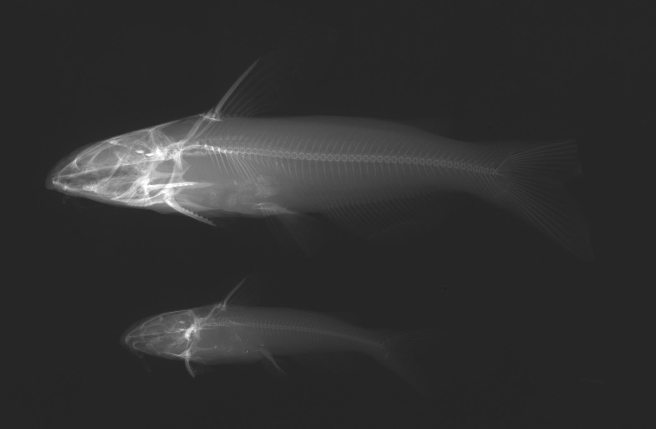
TNHCi_23049
Not suspect, not examinedPhotos
Map
Location
29.32549° N, 104.04688° W
(± 30590.4
m)
Taxonomy
GenusIctalurus
Specieslupus
Specimen
Num Specimens2
Identification
DeterminerG. P. Garrett
Collection Event
CollectorGarrett, G. P. et al.
Collected Date1993.2.8
Geography
DrainageRio Grande
CountryUnited States
StateTexas
CountyBrewster
LocalityBig Bend Ranch
Record Source
Source
Texas Natural History Collections
(type: specimens)
Institution
Texas Natural History Collections
(type: museum)
Curator
Dean Hendrickson
Record Added
May 13, 2010
Record Last Modified
March 23, 2026
Data Processing Track
Track 2
From Data Set Received
04/2009 to 10/2010
Identification
Suspect Notes
None
Count
2
Current Determination
Determiner
Fishes of Texas staff
Determination Date
Unknown
Determination Type
Unspecified
Identification Comments
None
Identification Confidence
Unknown
Collecting Event
Collected
March 9, 1993
Collector(s)
Collecting Event ID
5240
Field Notes
Locality
Region
Trans Pecos
Jurisdiction
Mexico
Name
Rio Grande at Big Bend Ranch
Hydrography
Rio Grande Region
Rio Grande-Amistad
Rio Grande-Amistad
Black Hills-Fresno
Panther Creek-Rio Grande
Rancherias Canyon-Rio Grande
Captive
no
Locality Photos
No locality photos available.
HUC 12
130402030705
Georeferencing Remarks
Original georeference was incorrect and updated
Georeferencing Annotation
Used online map for Ranch boundaries: http://www.trailridersjournalonline.com/TEXAS%20EQUESTRIAN%20TRAILS%20-%20MAPS/BIG-BEND-RANCH---PRESIDIO.jpg
Has not been Georeferenced because
—
flag (suspect/examine)
suspect: noexamination: no
date
date_range: 3/9/1993-3/9/1993
collectors
collectors: Garrett, Gary P.
collectors
collectors: Gary P. Garrett
date
date_range: 2/8/1993-2/8/1993
staff comment
ID Status: Not flagged for specimen examination. By default we accept donor specimen determinations (after synonymization to our taxonomy). If georeferenced to TX this record has been considered in spatial context with other occurences of this species and accepted as correct.
ID Comments: NAGeoref Remark: Original georeference was incorrect and updatedGeoref Annotation: Used online map for Ranch boundaries: http://www.trailridersjournalonline.com/TEXAS%20EQUESTRIAN%20TRAILS%20-%20MAPS/BIG-BEND-RANCH---PRESIDIO.jpg
georeference
Error: 30590.4107518687
Remarks: Original georeference was incorrect and updated Used online map for Ranch boundaries: http://www.trailridersjournalonline.com/TEXAS%20EQUESTRIAN%20TRAILS%20-%20MAPS/BIG-BEND-RANCH---PRESIDIO.jpg
Locality: Rio Grande River at Big Bend RanchCoordinates: 29.325486047;-104.046884787Georeferencer: MJCGeographic note: Inland USA TexasOriginal georeference was incorrect and updated Used online map for Ranch boundaries: http://www.trailridersjournalonline.com/TEXAS%20EQUESTRIAN%20TRAILS%20-%20MAPS/BIG-BEND-RANCH---PRESIDIO.jpg
Comments On TNHCi_23049