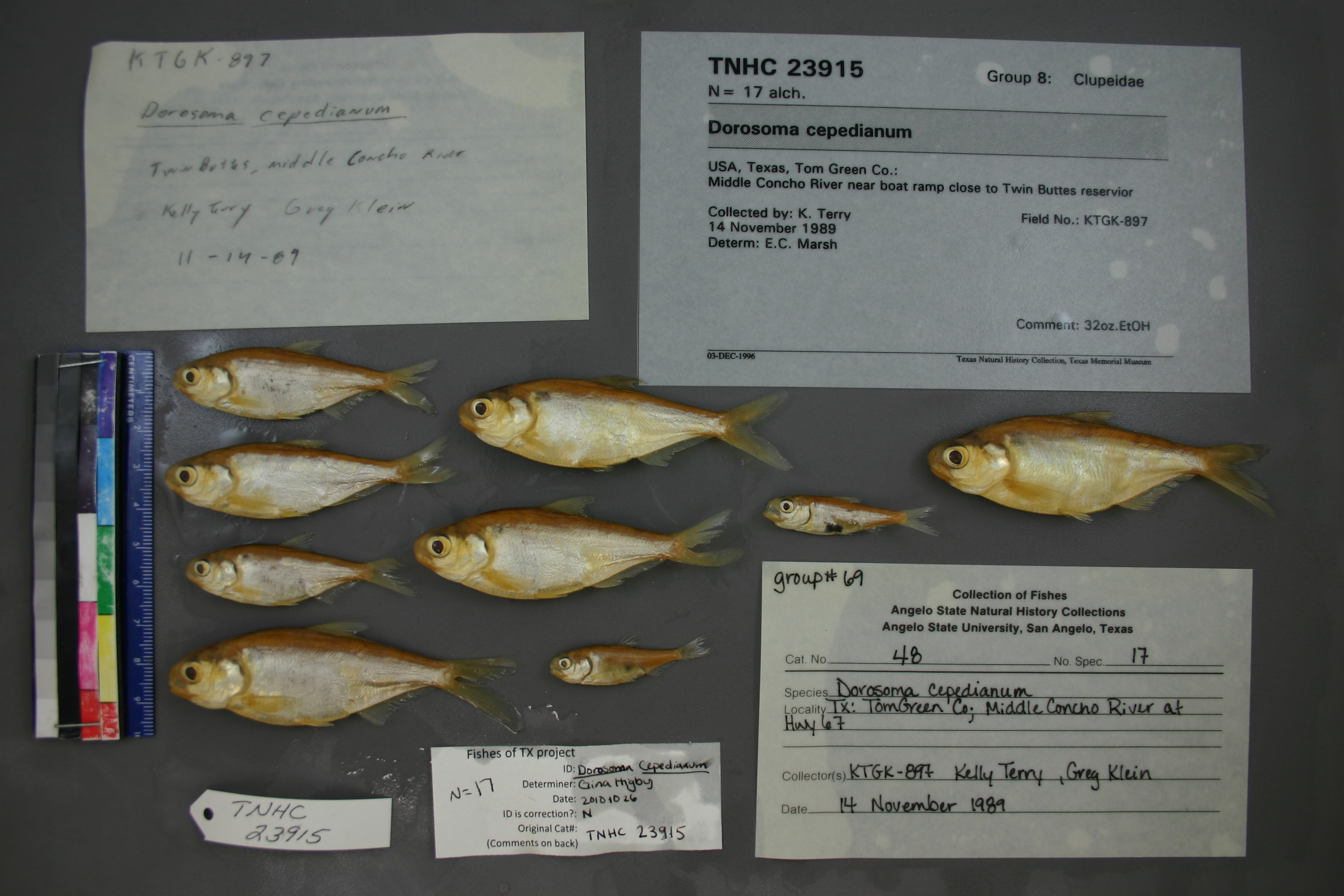
TNHCi_23915
Not suspect, examinedPhotos
Map
Location
31.41282° N, 100.64920° W
(± 4197.2
m)
Taxonomy
GenusDorosoma
Speciescepedianum
Specimen
Num Specimens17
Identification
DeterminerE.C. Marsh
Collection Event
CollectorK. Terry
Collected Date1989.11.13
Geography
DrainageColorado
CountryUnited States
StateTexas
CountyTom Green
LocalityMiddle Concho River near boat ramp close to Twin Buttes reservior
Record Source
Source
Texas Natural History Collections
(type: specimens)
Institution
Texas Natural History Collections
(type: museum)
Curator
Dean Hendrickson
Record Added
May 13, 2010
Record Last Modified
March 23, 2026
Data Processing Track
Track 2
From Data Set Received
04/2009 to 10/2010
Identification
Suspect Notes
None
Count
17
Current Determination
Determiner
Gina Cheryl Higby
Determination Date
Feb. 11, 2016
Determination Type
specimen examination
Identification Comments
Specimen examined and Id'ed for FoTX project. | ID notes: anal rays: 29; MinSL(mm): 40.5; MaxSL(mm): 95; Jar: quart; Specimen condition: good; Mutations: none; Count Male: ; Count female: ; Extern parasites:
Identification Confidence
Unknown
Collecting Event
Collected
Nov. 14, 1989
Collecting Event ID
6520
Field Notes
There are no field notes available.
Locality
Region
Rolling Plains
Jurisdiction
Tom Green, Texas
Name
Middle Concho River in Tom Green County
Hydrography
Texas-Gulf Region
Lower Colorado-San Bernard Coastal
Middle Colorado-Concho
Middle Concho
West Rocky Creek-Middle Concho River
Brushy Creek-Middle Concho River
Captive
no
Locality Photos
No locality photos available.
flag (suspect/examine)
suspect: noexamination: yes
date
date_range: 11/14/1989-11/14/1989
collectors
collectors: Terry, K. Klein, G.
collectors
collectors: K. Terry
date
date_range: 11/13/1989-11/13/1989
staff comment
ID Status: Not flagged for specimen examination. By default we accept donor specimen determinations (after synonymization to our taxonomy). If georeferenced to TX this record has been considered in spatial context with other occurences of this species and accepted as correct.
ID Comments: NA
georeference
Error: 4197.16915198199Locality: Middle Concho River in Tom Green CountyCoordinates: 31.412816024;-100.649196956Georeferencer: BJLGeographic note: Inland USA Texas
Comments On TNHCi_23915