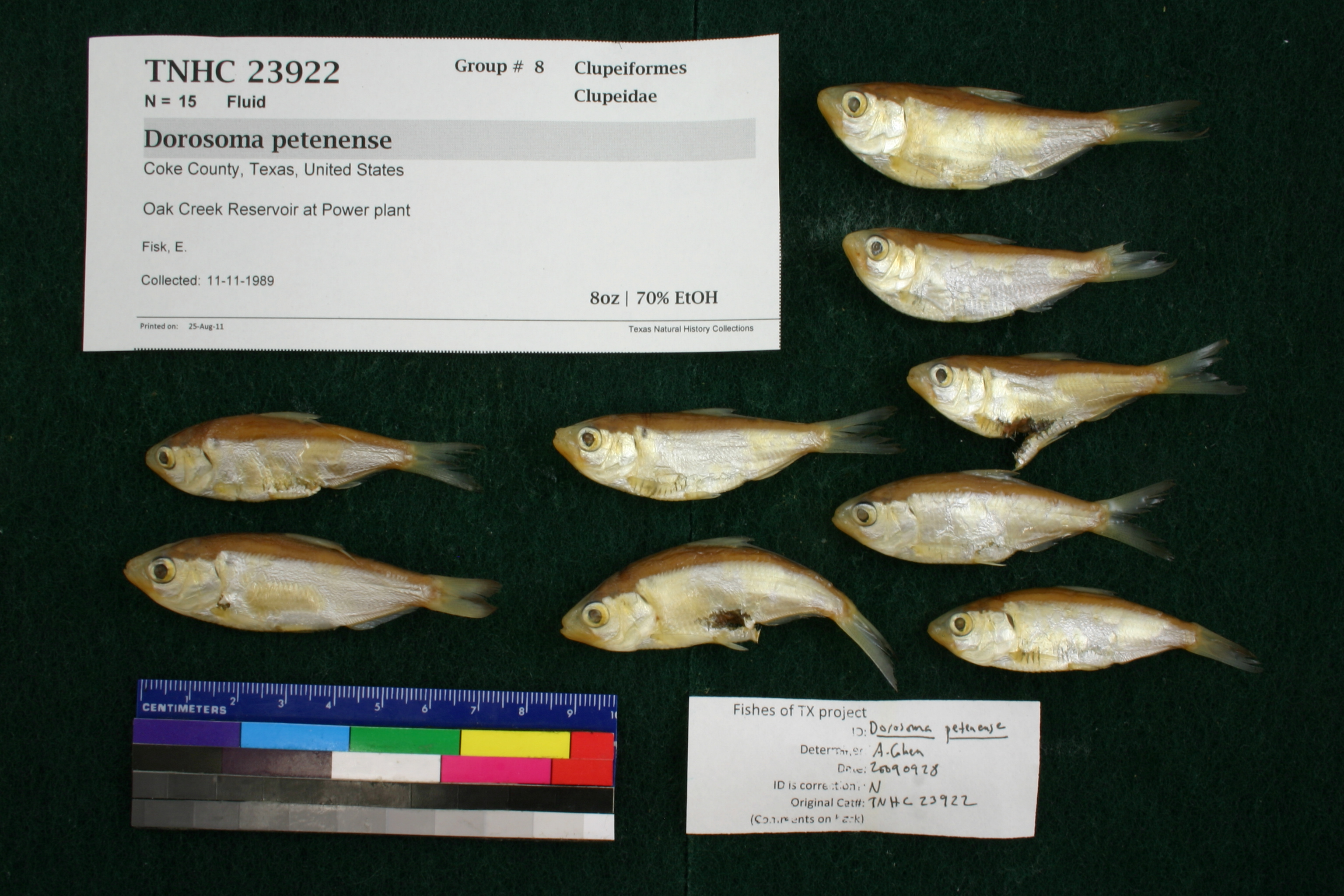
TNHCi_23922
Not suspect, examinedPhotos
Map
Location
32.04694° N, 100.29276° W
(± 5632757
m)
Taxonomy
GenusDorosoma
Speciespetenense
Specimen
Num Specimens15
Identification
DeterminerE.C. Marsh
Collection Event
CollectorE. Fisk
Collected Date1989.11.10
Geography
DrainageColorado
CountryUnited States
StateTexas
CountyCoke
LocalityOak Creek Reservoir, at power plant 3 mi S of Blackwell
Record Source
Source
Texas Natural History Collections
(type: specimens)
Institution
Texas Natural History Collections
(type: museum)
Curator
Dean Hendrickson
Record Added
May 13, 2010
Record Last Modified
March 23, 2026
Data Processing Track
Track 2
From Data Set Received
04/2009 to 10/2010
Identification
Suspect Notes
None
Count
15
Current Determination
Determiner
Adam Cohen
Determination Date
Feb. 11, 2016
Determination Type
specimen examination
Identification Comments
ID complete
Identification Confidence
Unknown
Collecting Event
Collected
Nov. 11, 1989
Collector(s)
Collecting Event ID
7175
Field Notes
There are no field notes available.
Locality
Region
Rolling Plains
Jurisdiction
Coke, Texas
Name
Oak Creek Reservoir at Power plant
Hydrography
Texas-Gulf Region
Upper Colorado
Upper Colorado
Upper Colorado
Oak Creek
Salt Creek-Oak Creek
Captive
no
Locality Photos
No locality photos available.
flag (suspect/examine)
suspect: noexamination: yes
date
date_range: 11/11/1989-11/11/1989
collectors
collectors: Fisk, E.
collectors
collectors: E. Fisk
date
date_range: 11/10/1989-11/10/1989
staff comment
ID Status: Specimen examined and ID'ed for FoTX projectGeoref Remark: Point placed on Power plant, extent covers all shoreline on island
georeference
Error: 5632757.10832783Remarks: Point placed on Power plant, extent covers all shoreline on islandLocality: Oak Creek Reservoir at Power plantCoordinates: 32.046937741;-100.292759892Georeferencer: BJLGeographic note: Inland USA Texas
Point placed on Power plant, extent covers all shoreline on island
Comments On TNHCi_23922