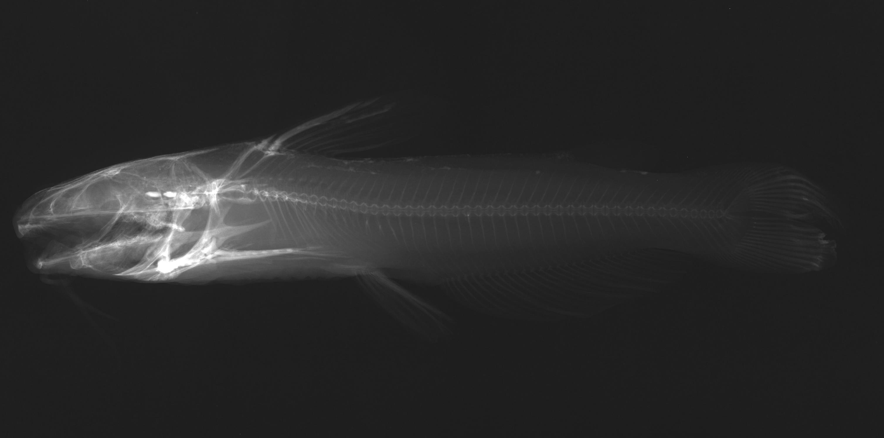
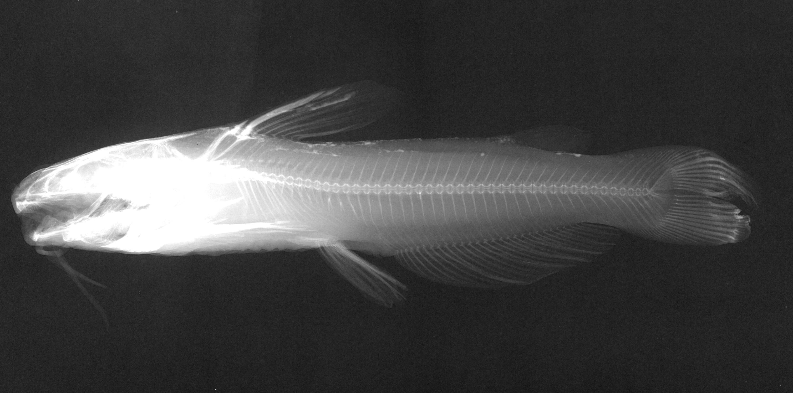
TNHCi_2589
Not suspect, not examinedPhotos
Map
Location
31.46714° N, 100.45005° W
(± 3553.4
m)
Taxonomy
GenusIctalurus
Speciespunctatus
Specimen
Num Specimens1
Collection Event
CollectorHubbs, C.S.; Strawn
Collected Date1952.2.8
Geography
DrainageColorado
CountryUnited States
StateTexas
CountyTom Green
LocalityN Fork of Concho River, near dam, San Angelo
Record Source
Source
Texas Natural History Collections
(type: specimens)
Institution
Texas Natural History Collections
(type: museum)
Curator
Dean Hendrickson
Record Added
May 13, 2010
Record Last Modified
March 23, 2026
Data Processing Track
Track 2
From Data Set Received
04/2009 to 10/2010
Identification
Suspect Notes
None
Count
1
Current Determination
Determiner
Fishes of Texas staff
Determination Date
Unknown
Determination Type
Unspecified
Identification Comments
None
Identification Confidence
Unknown
Collecting Event
Collected
Feb. 9, 1952
Collector(s)
Collecting Event ID
6803
Field Notes
There are no field notes available.
Locality
Region
Rolling Plains
Jurisdiction
Tom Green, Texas
Name
North Concho River downstream of O. C. Fisher Dam
Hydrography
Texas-Gulf Region
Lower Colorado-San Bernard Coastal
Middle Colorado-Concho
North Concho
Lower North Concho River
City of San Angelo-North Concho River
Captive
no
Locality Photos
No locality photos available.
flag (suspect/examine)
suspect: noexamination: no
date
date_range: 2/9/1952-2/9/1952
collectors
collectors: Hubbs, Clark Strawn, Kirk R. Henderson, W.D. Pyburn, W.F.
collectors
collectors: Clark Hubbs, Kirk R. Strawn, W.D. Henderson, W.F. Pyburn
date
date_range: 2/8/1952-2/8/1952
staff comment
ID Status: Not flagged for specimen examination. By default we accept donor specimen determinations (after synonymization to our taxonomy). If georeferenced to TX this record has been considered in spatial context with other occurences of this species and accepted as correct.
ID Comments: NAGeoref Remark: Reach runs from dam to a point halfway to confluence with Concho River.
georeference
Error: 3553.43155198475Remarks: Reach runs from dam to a point halfway to confluence with Concho River.Locality: North Concho River downstream of O. C. Fisher DamCoordinates: 31.467144831;-100.450052048Georeferencer: AECGeographic note: Inland USA Texas
Reach runs from dam to a point halfway to confluence with Concho River.
Comments On TNHCi_2589