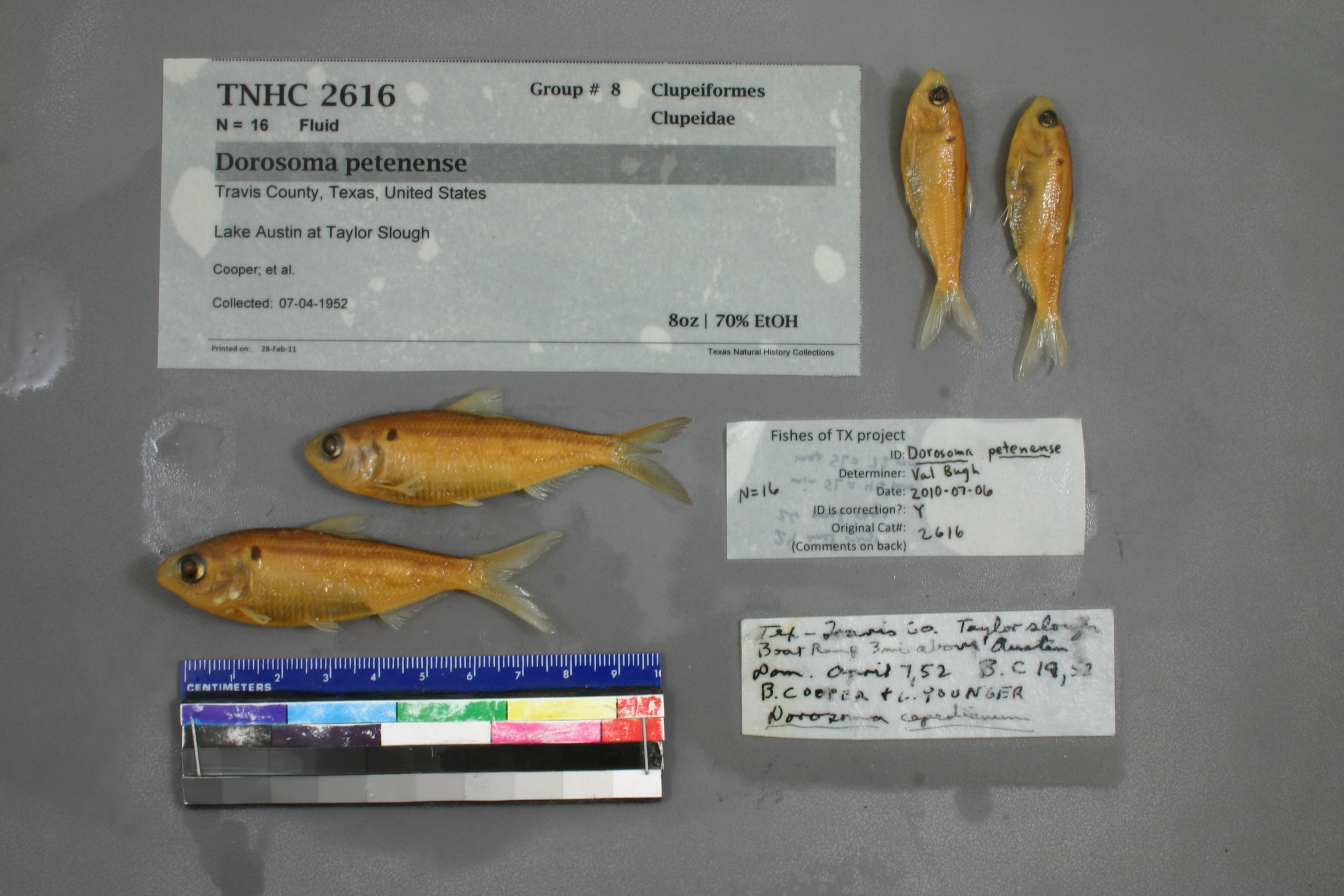
TNHCi_2616
Not suspect, examinedPhotos
Map
Location
30.31115° N, 97.77354° W
(± 379.4
m)
Taxonomy
GenusDorosoma
Speciescepedianum
Specimen
Num Specimens16
Collection Event
CollectorCooper; et al.
Collected Date1952.4.6
Geography
DrainageColorado
CountryUnited States
StateTexas
CountyTravis
LocalityTaylor Slough boat Ramp3 mi. above Austin dam, Lake, Austin
Record Source
Source
Texas Natural History Collections
(type: specimens)
Institution
Texas Natural History Collections
(type: museum)
Curator
Dean Hendrickson
Record Added
May 13, 2010
Record Last Modified
March 23, 2026
Data Processing Track
Track 2
From Data Set Received
04/2009 to 10/2010
Identification
Suspect Notes
None
Count
16
Current Determination
Determiner
Valerie Gawenda Bugh
Determination Date
Feb. 11, 2016
Determination Type
specimen examination
Identification Comments
Specimen examined and Id'ed for FoTX project. | ID notes: 24 anal rays; 26 anal rays; MinSL(mm): 46; MaxSL(mm): 72; Jar: 8 oz; Specimen condition: good; Mutations: none; Count Male: ; Count female: ; Extern parasites: n
Identification Confidence
High
Collecting Event
Collected
April 7, 1952
Collector(s)
Collecting Event ID
11297
Field Notes
There are no field notes available.
Locality
Region
Edwards Plateau
Jurisdiction
Travis, Texas
Name
Lake Austin at Taylor Slough
Hydrography
Texas-Gulf Region
Lower Colorado-San Bernard Coastal
Middle Colorado-Llano
Austin-Travis Lakes
City of Austin-Colorado River
Lake Austin-Town Lake
Captive
no
Locality Photos
No locality photos available.
flag (suspect/examine)
suspect: noexamination: yes
date
date_range: 4/7/1952-4/7/1952
collectors
collectors: Cooper, Younger, L.
collectors
collectors: Cooper, L. Younger
date
date_range: 4/6/1952-4/6/1952
staff comment
ID Status: Not flagged for specimen examination. By default we accept donor specimen determinations (after synonymization to our taxonomy). If georeferenced to TX this record has been considered in spatial context with other occurences of this species and accepted as correct.
ID Comments: NAGeoref Remark: Can't find boat ramp. Point is placed at the confluence of Taylor Slough and Lake Austin.
Georef Annotation: Taylor Slough is less than 3 miles upstream of the dam.
georeference
Error: 379.419612001518
Remarks: Can't find boat ramp. Point is placed at the confluence of Taylor Slough and Lake Austin. Taylor Slough is less than 3 miles upstream of the dam.
Locality: Lake Austin at Taylor SloughCoordinates: 30.311146755;-97.773540585Georeferencer: AECGeographic note: Inland USA TexasCan't find boat ramp. Point is placed at the confluence of Taylor Slough and Lake Austin. Taylor Slough is less than 3 miles upstream of the dam.
Comments On TNHCi_2616