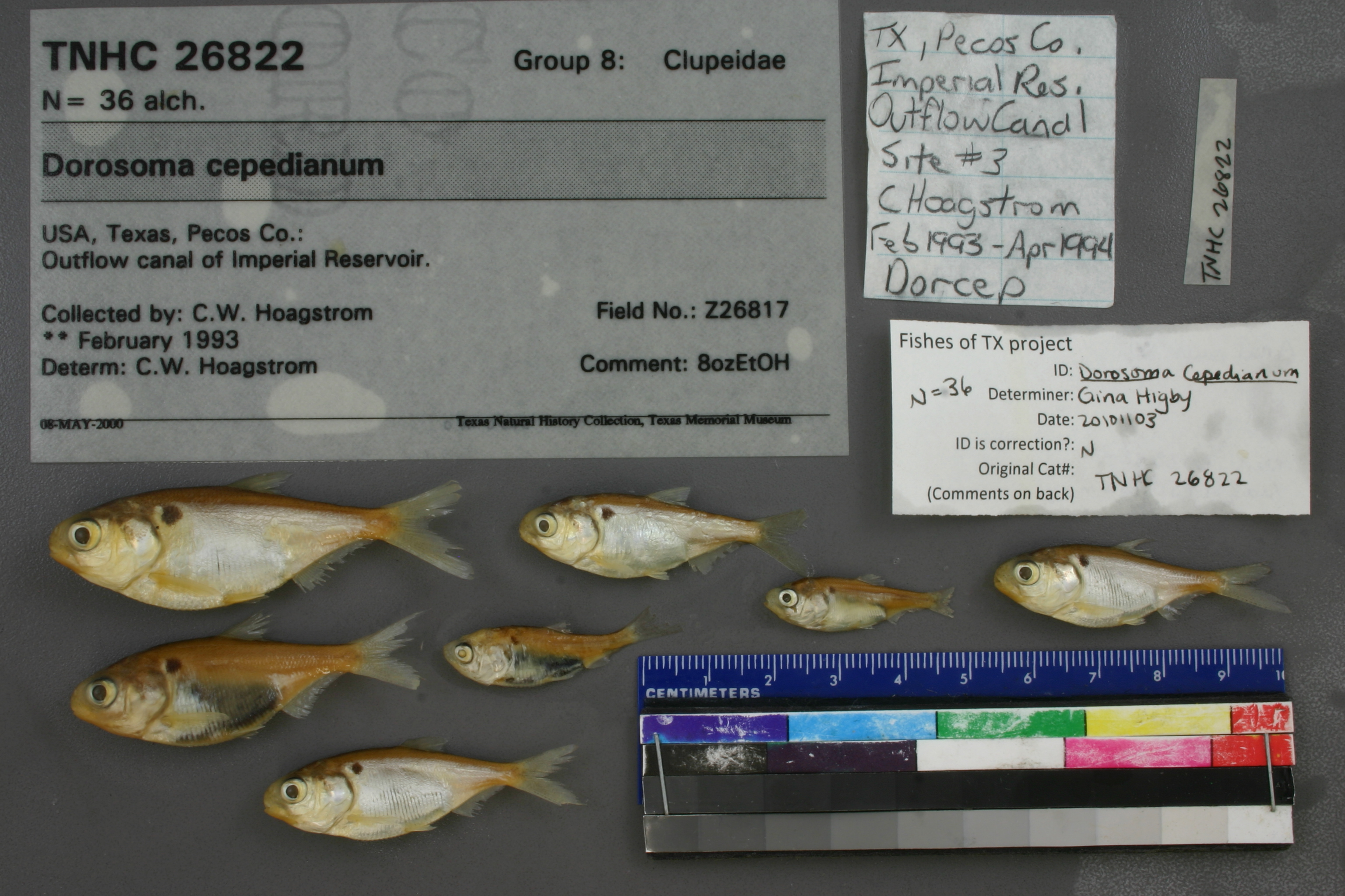
TNHCi_26822
Not suspect, examined
Gizzard Shad –
Dorosoma cepedianum
Photos
Map
Location
31.26175° N, 102.84586° W
(± 297.1
m)
Taxonomy
GenusDorosoma
Speciescepedianum
Specimen
Num Specimens36
Collection Event
CollectorHoagstrom, C. W.
Collected Date00/Feb/1993
Geography
CountryUnited States
StateTexas
CountyPecos
LocalityOutflow canal of Imperial Reservoir.
Record Source
Source
Texas Natural History Collections
(type: specimens)
Institution
Texas Natural History Collections
(type: museum)
Curator
Dean Hendrickson
Record Added
May 13, 2010
Record Last Modified
March 23, 2026
Data Processing Track
Track 2
From Data Set Received
04/2009 to 10/2010
Identification
Suspect Notes
None
Count
36
Current Determination
Determiner
Gina Cheryl Higby
Determination Date
Feb. 11, 2016
Determination Type
specimen examination
Identification Comments
Specimen examined and Id'ed for FoTX project. | ID notes: anal rays: 30; MinSL(mm): 28.92; MaxSL(mm): 50.76; Jar: 8 oz; Specimen condition: good; Mutations: none; Count Male: ; Count female: ; Extern parasites:
Identification Confidence
Unknown
Collecting Event
Collected
Feb. 1, 1993
– Feb. 28, 1993
Collector(s)
Collecting Event ID
6659
Field Notes
There are no field notes available.
Locality
Region
Trans Pecos
Jurisdiction
Pecos, Texas
Name
Outflow canal of Imperial Reservoir
Hydrography
USGS HUC
Rio Grande Region
Lower Pecos
Lower Pecos
Landreth-Monument Draws
Courtney Creek-Pecos River
Imperial Reservoir-Pecos River
HydroBASINS
7521
752161
75216178
7521617801
752161780100
Captive
no
Locality Photos
No locality photos available.
flag (suspect/examine)
suspect: noexamination: yes
date
date_range: 2/1/1993-2/28/1993
collectors
collectors: Hoagstrom, Christopher W.
collectors
collectors: Christopher W. Hoagstrom
date
date_range: 2/1/1993-2/28/1993
staff comment
ID Status: Not flagged for specimen examination. By default we accept donor specimen determinations (after synonymization to our taxonomy). If georeferenced to TX this record has been considered in spatial context with other occurences of this species and accepted as correct.
ID Comments: NA
georeference
Error: 297.117516001188Locality: Outflow canal of Imperial ReservoirCoordinates: 31.261754969;-102.84586218Georeferencer: AECGeographic note: Inland USA Texas
Comments On TNHCi_26822