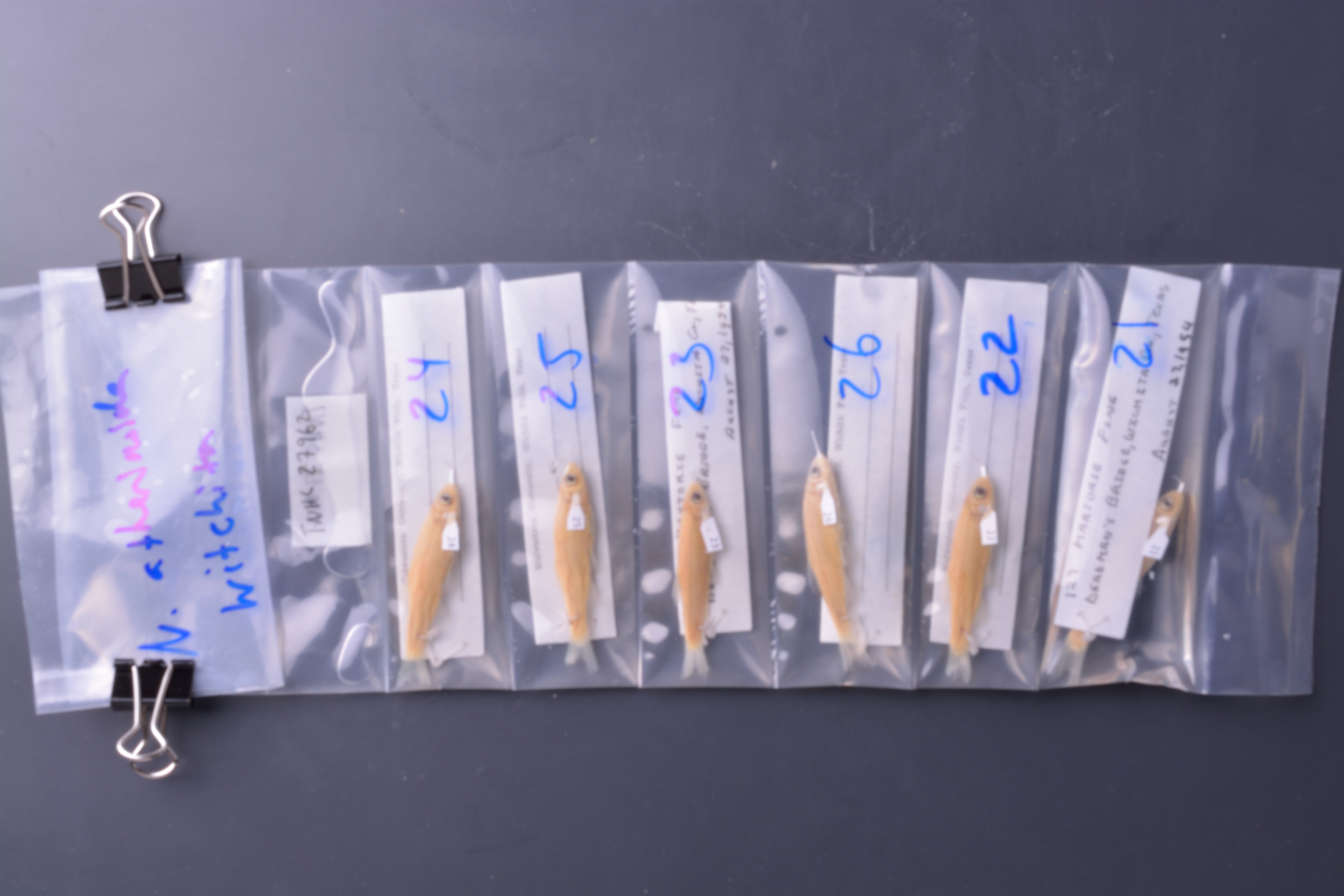
TNHCi_27962
Not suspect, examinedPhotos
Map
Location
34.01155° N, 98.69838° W
(± 32199.8
m)
Taxonomy
GenusNotropis
Speciessp.
Specimen
Num Specimens6
Collection Event
CollectorDalquest, W. W. and M. Fine
Collected Date1954.8.27
Geography
CountryUnited States
StateTexas
CountyWichita
LocalityDEADMAN'S BRIDGE
Record Source
Source
Texas Natural History Collections
(type: specimens)
Institution
Texas Natural History Collections
(type: museum)
Curator
Dean Hendrickson
Record Added
May 13, 2010
Record Last Modified
March 23, 2026
Data Processing Track
Track 2
From Data Set Received
04/2009 to 10/2010
Identification
Suspect Notes
None
Count
6
Current Determination
Determiner
Adam Cohen
Determination Date
Feb. 11, 2016
Determination Type
specimen examination
Identification Comments
ID complete
Identification Confidence
High
Collecting Event
Collected
Aug. 27, 1954
Collector(s)
Collecting Event ID
7384
Field Notes
There are no field notes available.
Locality
Region
Rolling Plains
Jurisdiction
Wichita, Texas
Name
Wichita County
Hydrography
Arkansas-White-Red Region
Red-Washita
Red-Lake Texoma
Wichita
Buffalo Creek-Wichita River
Lower Buffalo Creek
Captive
no
Locality Photos
No locality photos available.
flag (suspect/examine)
suspect: noexamination: yes
date
date_range: 8/27/1954-8/27/1954
collectors
collectors: Dalquest, Walter W. Fine, M.
collectors
collectors: Walter W. Dalquest, M. Fine
date
date_range: 8/27/1954-8/27/1954
staff comment
ID Status: Specimen examined and ID'ed for FoTX projectID Comments: 11 anal raysGeoref Remark: Can't find Deadman's Bridge so treated as shown.
georeference
Error: 32199.7547518618Remarks: Can't find Deadman's Bridge so treated as shown.Locality: Wichita CountyCoordinates: 34.011546625;-98.698384582Georeferencer: AECGeographic note: Inland USA Texas
Can't find Deadman's Bridge so treated as shown.
Comments On TNHCi_27962