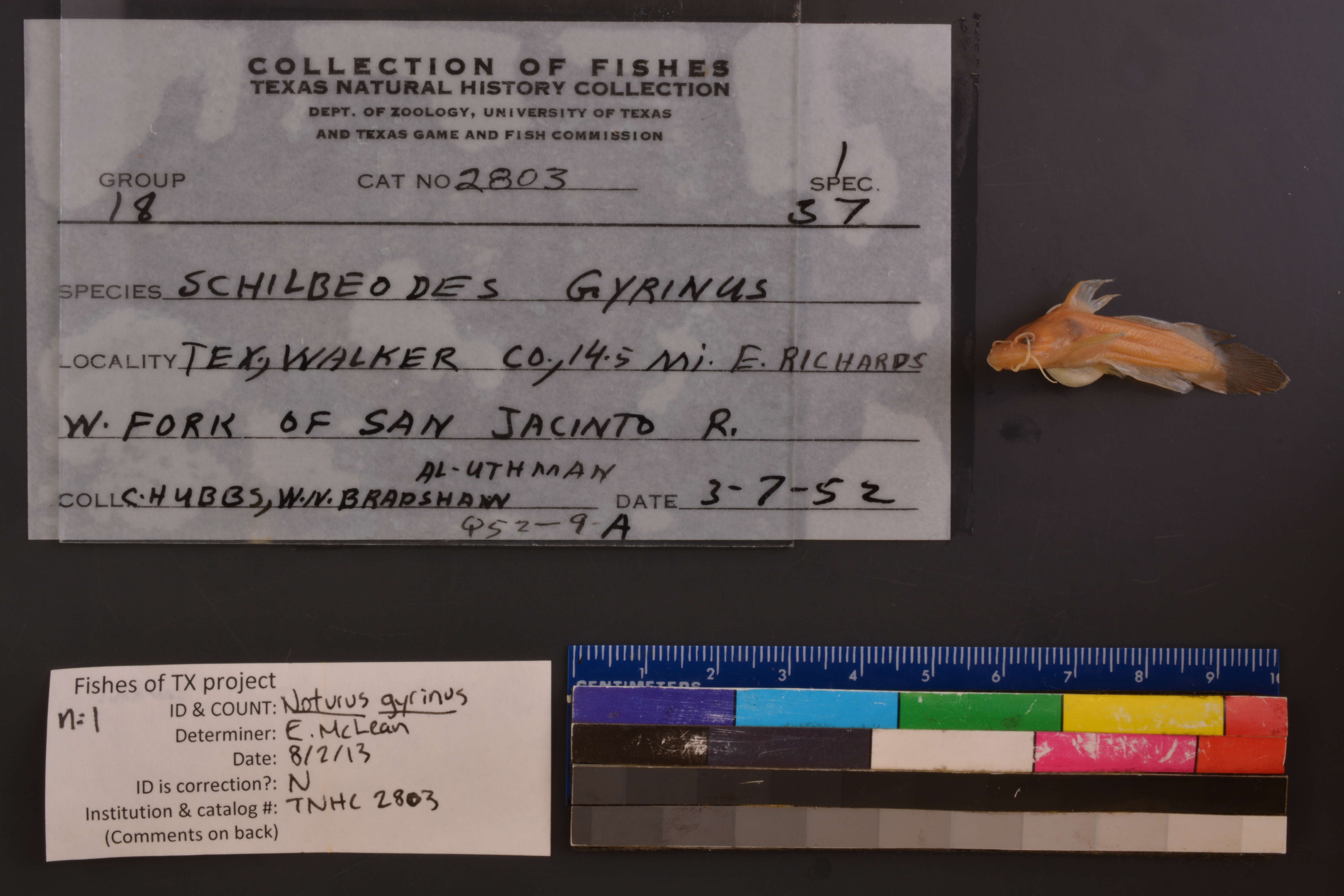
TNHCi_2803
Not suspect, examinedPhotos
Map
Location
30.53852° N, 95.61982° W
(± 15824.7
m)
Taxonomy
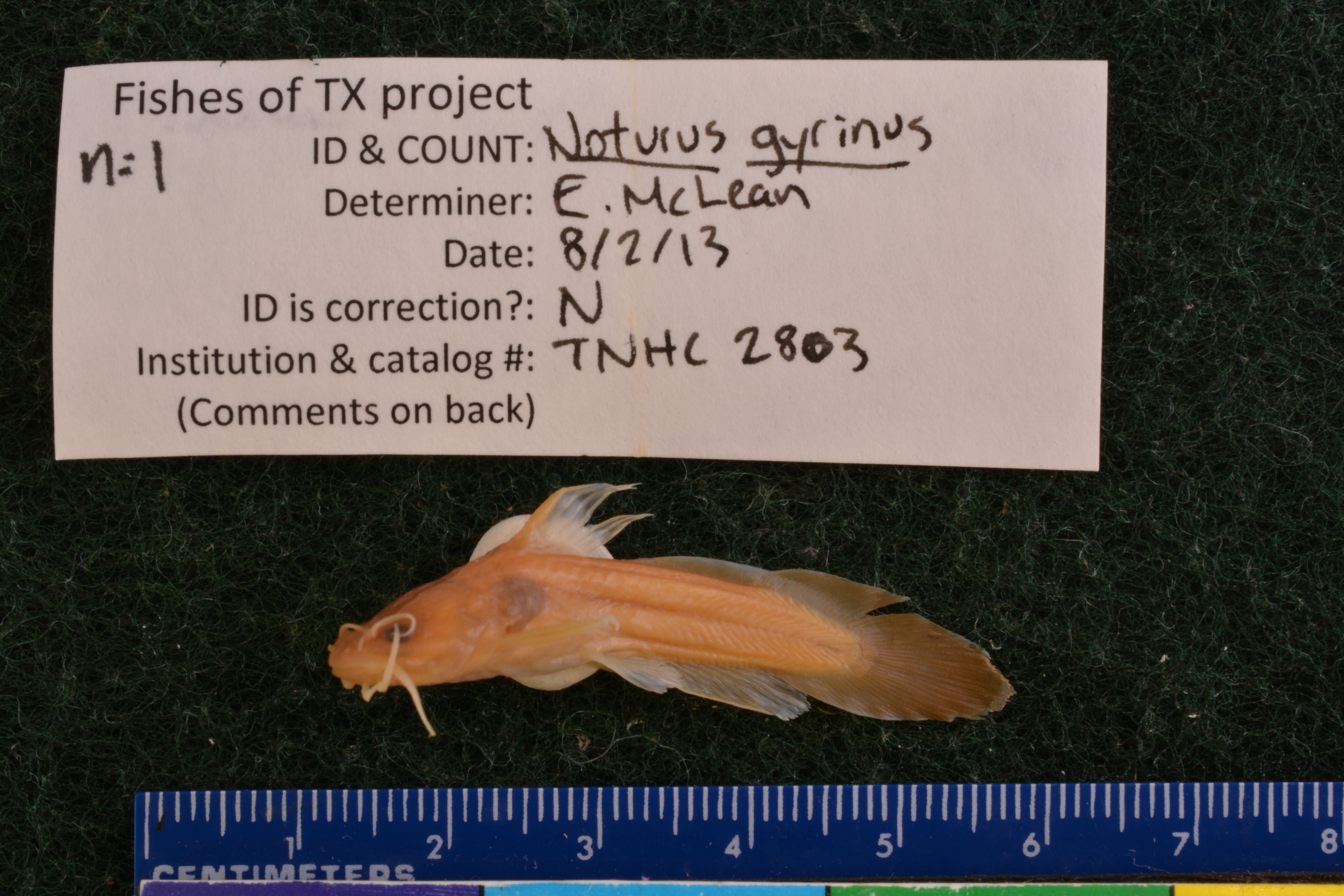
GenusNoturus
Speciesgyrinus
Specimen
Num Specimens1
Collection Event
CollectorHubbs, C.S.; et al.
Collected Date1952.3.6
Geography
DrainageSan Jacinto
CountryUnited States
StateTexas
CountyWalker
LocalityW Fork San Jacinto River, 14.5 mi. E Richards
Record Source
Source
Texas Natural History Collections
(type: specimens)
Institution
Texas Natural History Collections
(type: museum)
Curator
Dean Hendrickson
Record Added
May 13, 2010
Record Last Modified
March 23, 2026
Data Processing Track
Track 2
From Data Set Received
04/2009 to 10/2010
Identification
Suspect Notes
None
Count
1
Current Determination
Determiner
Elizabeth Sarah McLean
Determination Date
Feb. 11, 2016
Determination Type
specimen examination
Identification Comments
Specimen examined and Id'ed for FoTX project. | ID notes: even mouth, tapered caudal; MinSL(mm): 34.57; MaxSL(mm): ; Jar: 8 oz; Specimen condition: good; Mutations: none; Count Male: ; Count female: ; Extern parasites: n
Identification Confidence
High
Collecting Event
Collected
March 7, 1952
Collector(s)
Collecting Event ID
9174
Field Notes
There are no field notes available.
Locality
Region
Piney Woods
Jurisdiction
Walker, Texas
Name
Lake Conroe and West Fork San Jacinto River East of Richards
Hydrography
Texas-Gulf Region
Galveston Bay-San Jacinto
San Jacinto
West Fork San Jacinto
West Fork San Jacinto River-Conroe Lake
McDonald Creek-West Fork San Jacinto River
Captive
no
Locality Photos
No locality photos available.
flag (suspect/examine)
suspect: noexamination: yes
date
date_range: 3/7/1952-3/7/1952
collectors
collectors: Hubbs, Clark
collectors
collectors: Clark Hubbs
date
date_range: 3/6/1952-3/6/1952
staff comment
ID Status: Not flagged for specimen examination. By default we accept donor specimen determinations (after synonymization to our taxonomy). If georeferenced to TX this record has been considered in spatial context with other occurences of this species and accepted as correct.
ID Comments: NAGeoref Remark: Point placed on lake at line drawn E from town center, extent runs to river at line drawn NE from town center.
georeference
Error: 15824.6795519321
Remarks: Point placed on lake at line drawn E from town center, extent runs to river at line drawn NE from town center.
Locality: Lake Conroe and West Fork San Jacinto River East of RichardsCoordinates: 30.5385228;-95.619816018Georeferencer: BJLGeographic note: Inland USA TexasPoint placed on lake at line drawn E from town center, extent runs to river at line drawn NE from town center.
Comments On TNHCi_2803