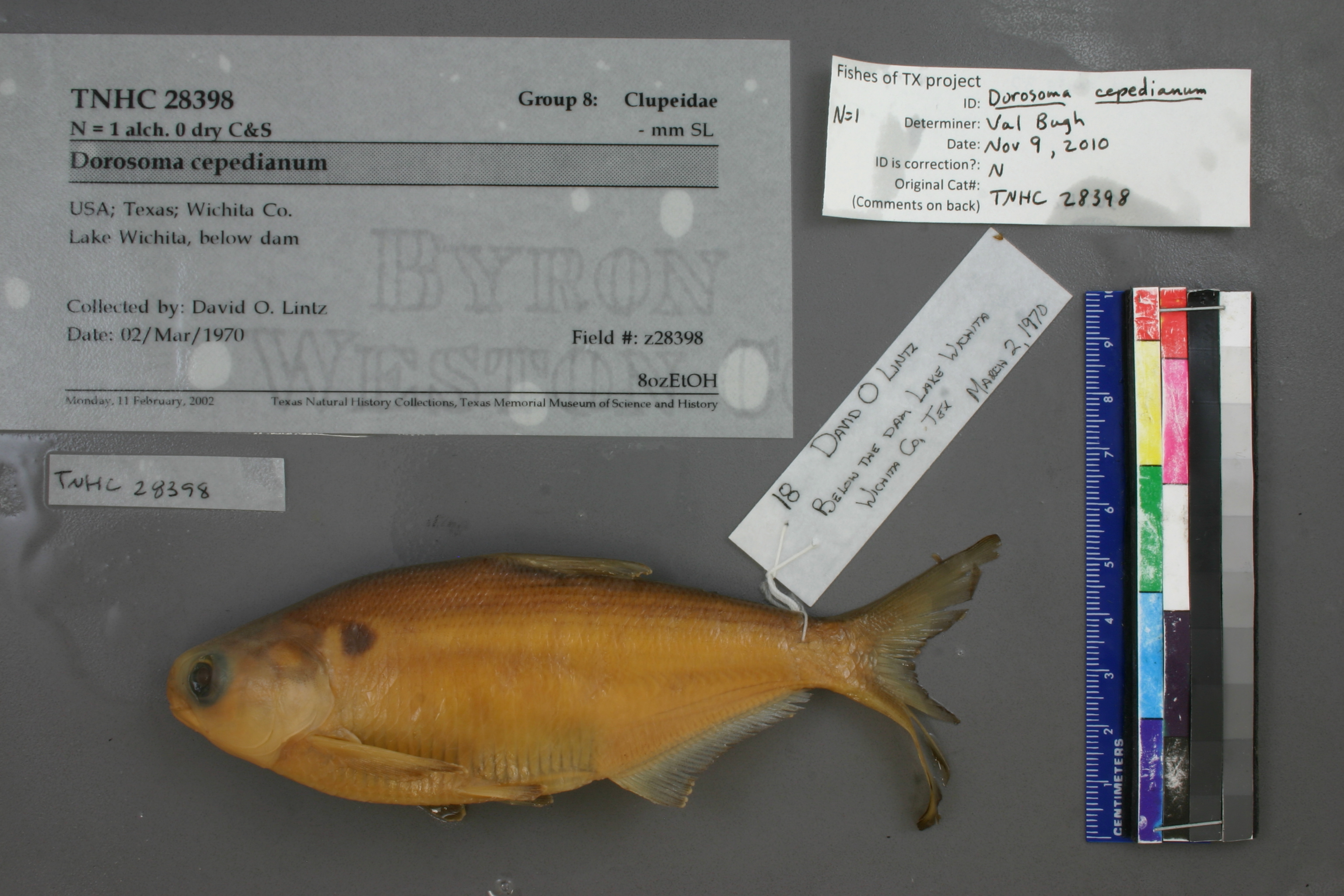
TNHCi_28398
Not suspect, examinedPhotos
Map
Location
33.84402° N, 98.53740° W
(± 1385.2
m)
Taxonomy
GenusDorosoma
Speciescepedianum
Specimen
Num Specimens1
Collection Event
CollectorLintz, D. O.
Collected Date1970.3.2
Geography
DrainageRed
CountryUnited States
StateTexas
CountyWichita
LocalityLake Wichita, below dam
Record Source
Source
Texas Natural History Collections
(type: specimens)
Institution
Texas Natural History Collections
(type: museum)
Curator
Dean Hendrickson
Record Added
May 13, 2010
Record Last Modified
March 23, 2026
Data Processing Track
Track 2
From Data Set Received
04/2009 to 10/2010
Identification
Suspect Notes
None
Count
1
Current Determination
Determiner
Valerie Gawenda Bugh
Determination Date
Feb. 11, 2016
Determination Type
specimen examination
Identification Comments
Specimen examined and Id'ed for FoTX project. | ID notes: anal rays: 30; MinSL(mm): 118; MaxSL(mm): ; Jar: 8 oz; Specimen condition: good; Mutations: none; Count Male: ; Count female: ; Extern parasites:
Identification Confidence
High
Collecting Event
Collected
March 2, 1970
Collector(s)
Collecting Event ID
10231
Field Notes
There are no field notes available.
Locality
Region
Rolling Plains
Jurisdiction
Wichita, Texas
Name
Spillway of Lake Wichita
Hydrography
Arkansas-White-Red Region
Red-Washita
Red-Lake Texoma
Wichita
Holliday Creek
Lower Holliday Creek
Captive
no
Locality Photos
No locality photos available.
flag (suspect/examine)
suspect: noexamination: yes
date
date_range: 3/2/1970-3/2/1970
collectors
collectors: Lintz, David O.
collectors
collectors: David O. Lintz
date
date_range: 3/2/1970-3/2/1970
staff comment
ID Status: Not flagged for specimen examination. By default we accept donor specimen determinations (after synonymization to our taxonomy). If georeferenced to TX this record has been considered in spatial context with other occurences of this species and accepted as correct.
ID Comments: NAGeoref Remark: point placed at pool directly below dam, extent covers the reach of the dam
georeference
Error: 1385.23675200554Remarks: point placed at pool directly below dam, extent covers the reach of the damLocality: Spillway of Lake WichitaCoordinates: 33.84402136;-98.537399816Georeferencer: BJLGeographic note: Inland USA Texas
point placed at pool directly below dam, extent covers the reach of the dam
Comments On TNHCi_28398