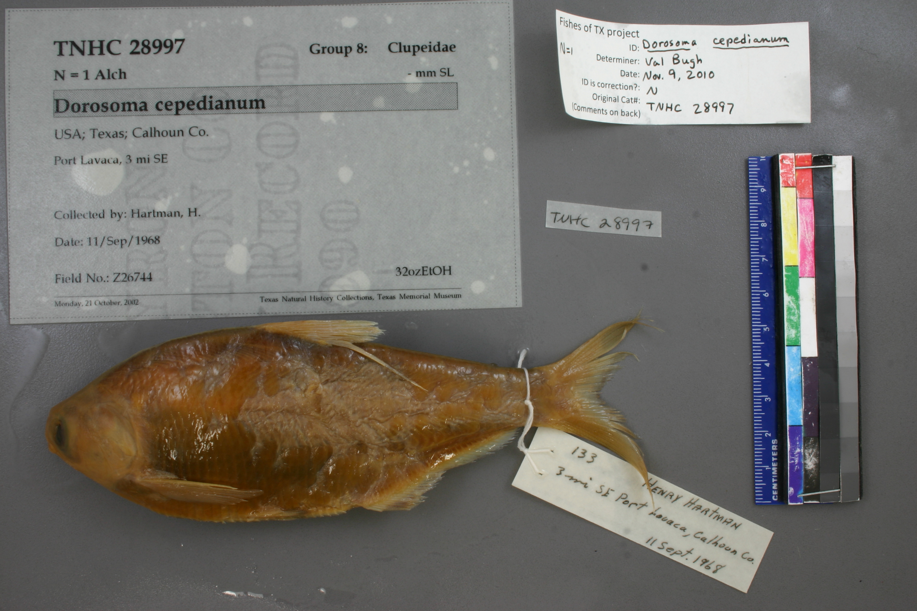
TNHCi_28997
Not suspect, examinedPhotos
Map
Location
28.58667° N, 96.59614° W
(± 5375.2
m)
Taxonomy
GenusDorosoma
Speciescepedianum
Specimen
Num Specimens1
Collection Event
CollectorHartman, H.
Collected Date1968.9.11
Geography
CountryUnited States
StateTexas
CountyCalhoun
LocalityPort Lavaca, 3 mi SE
Record Source
Source
Texas Natural History Collections
(type: specimens)
Institution
Texas Natural History Collections
(type: museum)
Curator
Dean Hendrickson
Record Added
May 13, 2010
Record Last Modified
March 23, 2026
Data Processing Track
Track 2
From Data Set Received
04/2009 to 10/2010
Identification
Suspect Notes
None
Count
1
Current Determination
Determiner
Valerie Gawenda Bugh
Determination Date
Feb. 11, 2016
Determination Type
specimen examination
Identification Comments
Specimen examined and Id'ed for FoTX project. | ID notes: anal rays: 31; MinSL(mm): 133; MaxSL(mm): ; Jar: quart; Specimen condition: fair, rather dessicated; Mutations: none; Count Male: ; Count female: ; Extern parasites:
Identification Confidence
High
Collecting Event
Collected
Sept. 11, 1968
Collector(s)
Collecting Event ID
7815
Field Notes
There are no field notes available.
Locality
Region
Gulf Coast Prairies & Marshes
Jurisdiction
Calhoun, Texas
Name
3 miles southeast of Port Lavaca
Hydrography
Texas-Gulf Region
Central Texas Coastal
Central Texas Coastal
West Matagorda Bay
Powderhorn Lake-Matagorda Bay
Powderhorn Lake-Matagorda Bay
Captive
no
Locality Photos
No locality photos available.
flag (suspect/examine)
suspect: noexamination: yes
date
date_range: 9/11/1968-9/11/1968
collectors
collectors: Hartman, H.
collectors
collectors: H. Hartman
date
date_range: 9/11/1968-9/11/1968
staff comment
ID Status: Not flagged for specimen examination. By default we accept donor specimen determinations (after synonymization to our taxonomy). If georeferenced to TX this record has been considered in spatial context with other occurences of this species and accepted as correct.
ID Comments: NA
georeference
Error: 5375.20895997694Locality: 3 miles southeast of Port LavacaCoordinates: 28.58666685;-96.596137204Georeferencer: AECGeographic note: Inland USA Texas
Comments On TNHCi_28997