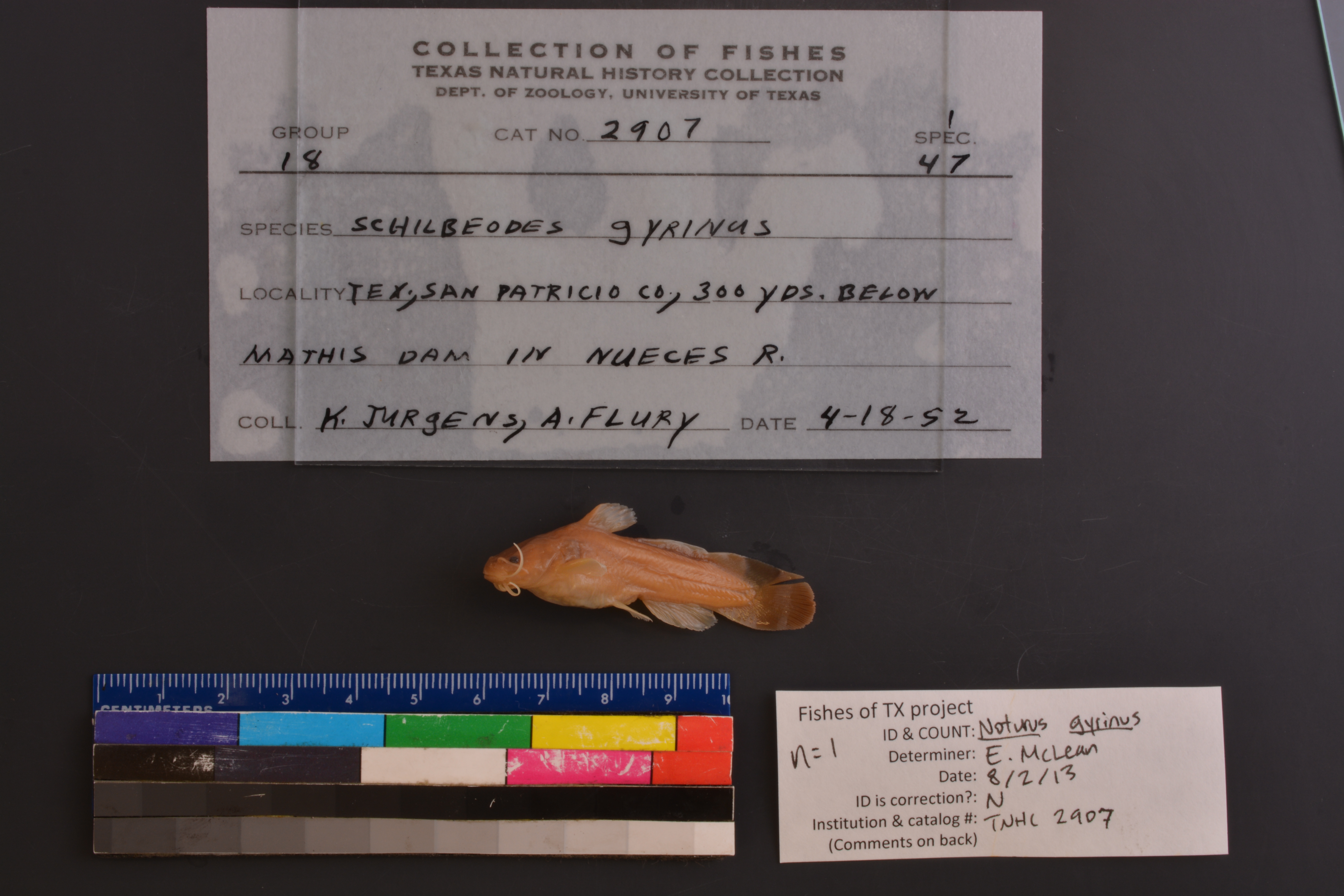
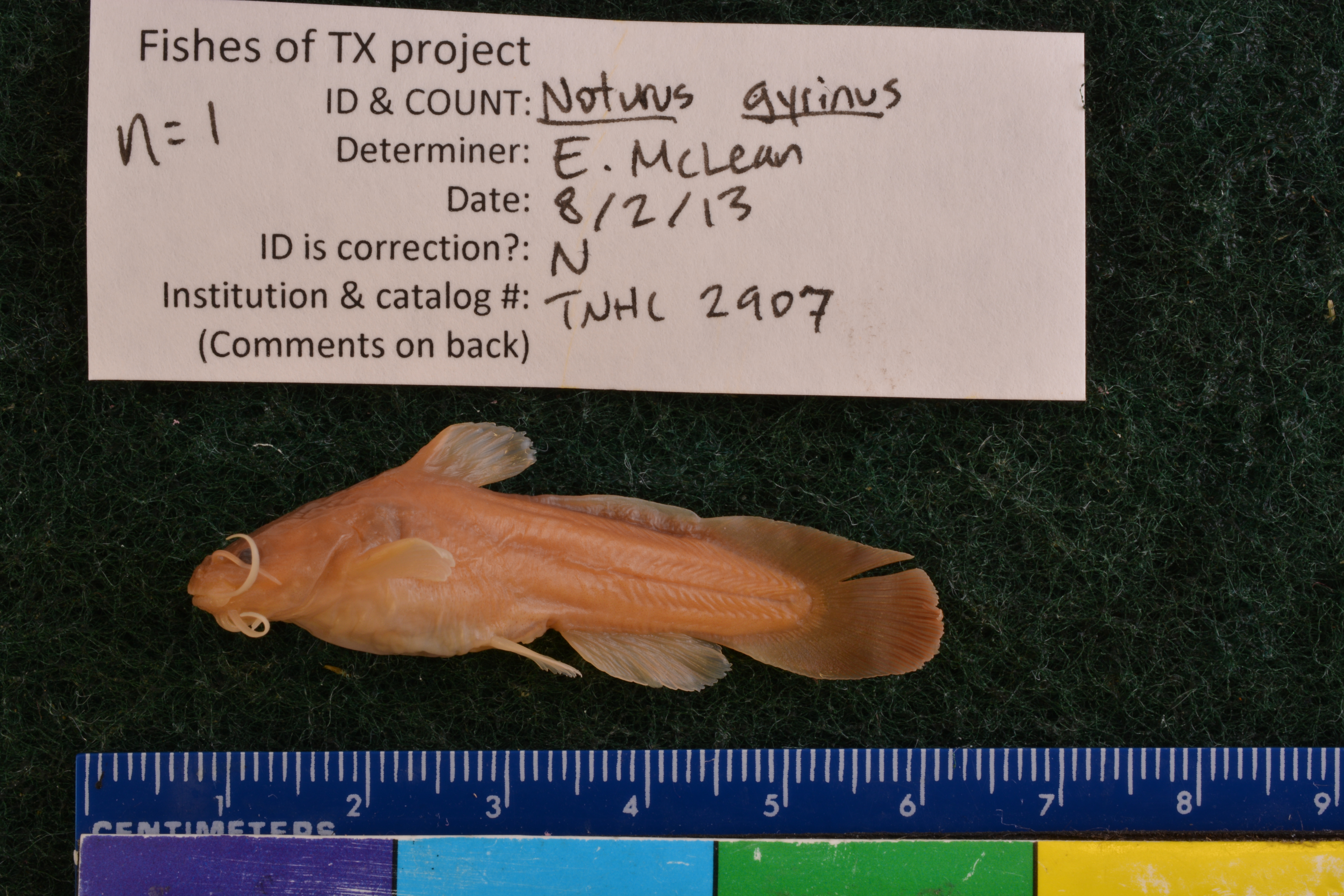
TNHCi_2907
Not suspect, examinedPhotos
Map
Location
28.04408° N, 97.87042° W
(± 498.3
m)
Taxonomy
GenusNoturus
Speciesgyrinus
Specimen
Num Specimens1
Collection Event
CollectorJurgens, K.; Flury, A.
Collected Date1952.4.17
Geography
DrainageNueces
CountryUnited States
StateTexas
CountySan Patricio
LocalityNueces River, 300 yd. below Mathis dam
Record Source
Source
Texas Natural History Collections
(type: specimens)
Institution
Texas Natural History Collections
(type: museum)
Curator
Dean Hendrickson
Record Added
May 13, 2010
Record Last Modified
March 23, 2026
Data Processing Track
Track 2
From Data Set Received
04/2009 to 10/2010
Identification
Suspect Notes
None
Count
1
Current Determination
Determiner
Elizabeth Sarah McLean
Determination Date
Feb. 11, 2016
Determination Type
specimen examination
Identification Comments
Specimen examined and Id'ed for FoTX project. | ID notes: even mouth, tapered caudal; MinSL(mm): 43.6; MaxSL(mm): ; Jar: 8 oz; Specimen condition: good; Mutations: none; Count Male: ; Count female: ; Extern parasites: n
Identification Confidence
High
Collecting Event
Collected
April 18, 1952
Collector(s)
Collecting Event ID
9202
Field Notes
There are no field notes available.
Locality
Region
Gulf Coast Prairies & Marshes
Jurisdiction
San Patricio, Texas
Name
Nueces River 300 yards downstream of Mathis Dam
Hydrography
USGS HUC
Texas-Gulf Region
Nueces-Southwestern Texas Coastal
Nueces
Lower Nueces
Penitas Creek-Lake Corpus Christi
Barbone Creek-Lake Corpus Christi
HydroBASINS
7519
751961
75196101
7519610105
751961010500
Captive
no
Locality Photos
No locality photos available.
HUC 12
121101110605
Georeferencing Remarks
Mathis Dam reference found on internet (http://www.twdb.state.tx.us/RWPG/rpgm_rpts/2003483001.pdf):\"the construction of the Mathis Dam, built near\nthe current site of the Wesley Seale Dam\". Aerial photo from Google Earth shows what is likely the Mathis
Georeferencing Annotation
—
Has not been Georeferenced because
—
flag (suspect/examine)
suspect: noexamination: yes
date
date_range: 4/18/1952-4/18/1952
collectors
collectors: Jurgens, Kenneth C. Flury, A.G.
collectors
collectors: Kenneth C. Jurgens, A.G. Flury
date
date_range: 4/17/1952-4/17/1952
staff comment
ID Status: Not flagged for specimen examination. By default we accept donor specimen determinations (after synonymization to our taxonomy). If georeferenced to TX this record has been considered in spatial context with other occurences of this species and accepted as correct.
ID Comments: NAGeoref Remark: Mathis Dam reference found on internet (http://www.twdb.state.tx.us/RWPG/rpgm_rpts/2003483001.pdf):'the construction of the Mathis Dam, built near the current site of the Wesley Seale Dam''. Aerial photo from Google Earth shows what is likely the Mathis
georeference
Error: 498.305023217181
Remarks: Mathis Dam reference found on internet (http://www.twdb.state.tx.us/RWPG/rpgm_rpts/2003483001.pdf):'the construction of the Mathis Dam, built near the current site of the Wesley Seale Dam''. Aerial photo from Google Earth shows what is likely the Mathis
Locality: Nueces River 300 yards downstream of Mathis DamCoordinates: 28.044084;-97.870418Georeferencer: AECMathis Dam reference found on internet (http://www.twdb.state.tx.us/RWPG/rpgm_rpts/2003483001.pdf):'the construction of the Mathis Dam, built near the current site of the Wesley Seale Dam''. Aerial photo from Google Earth shows what is likely the Mathis
Comments On TNHCi_2907