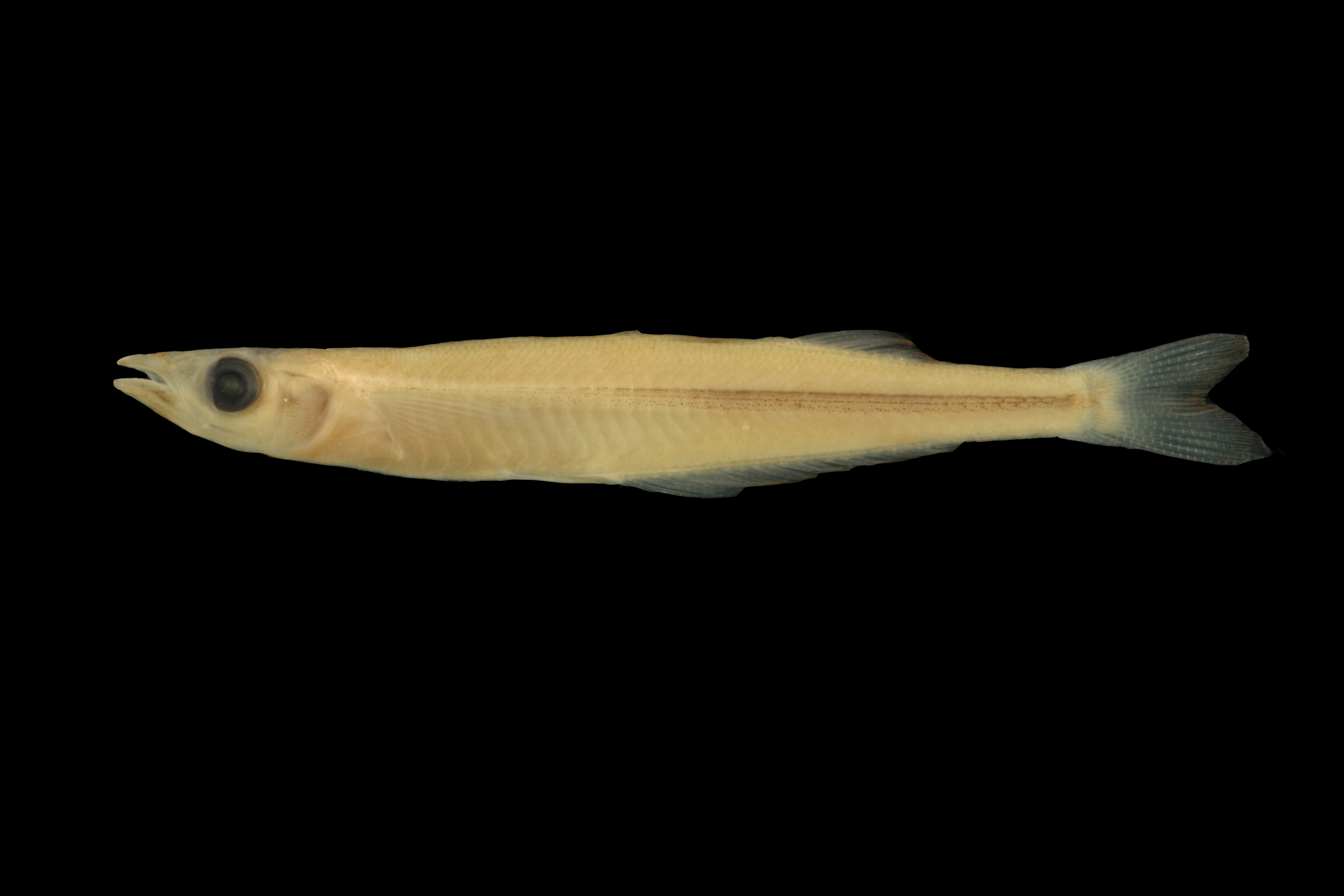
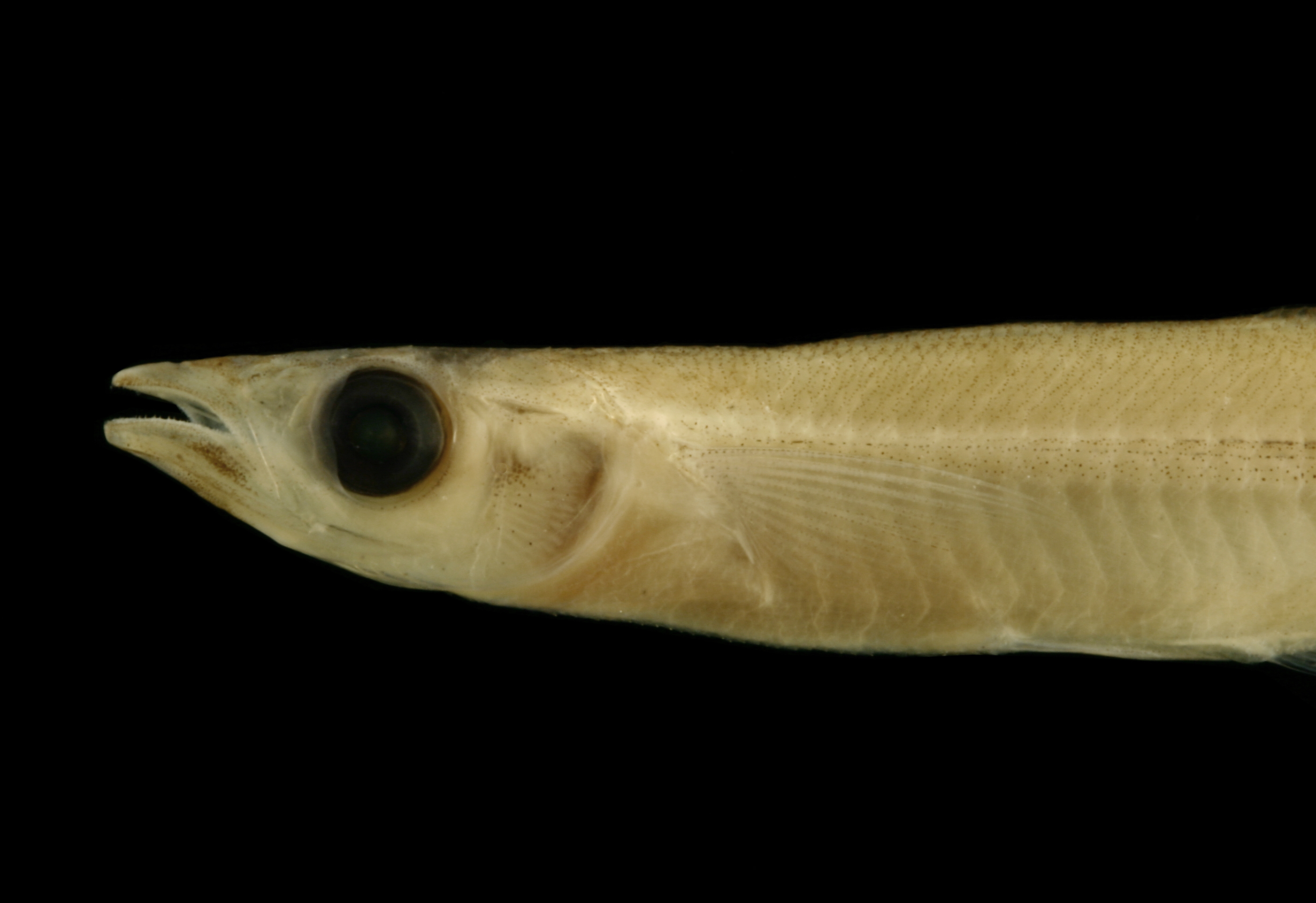
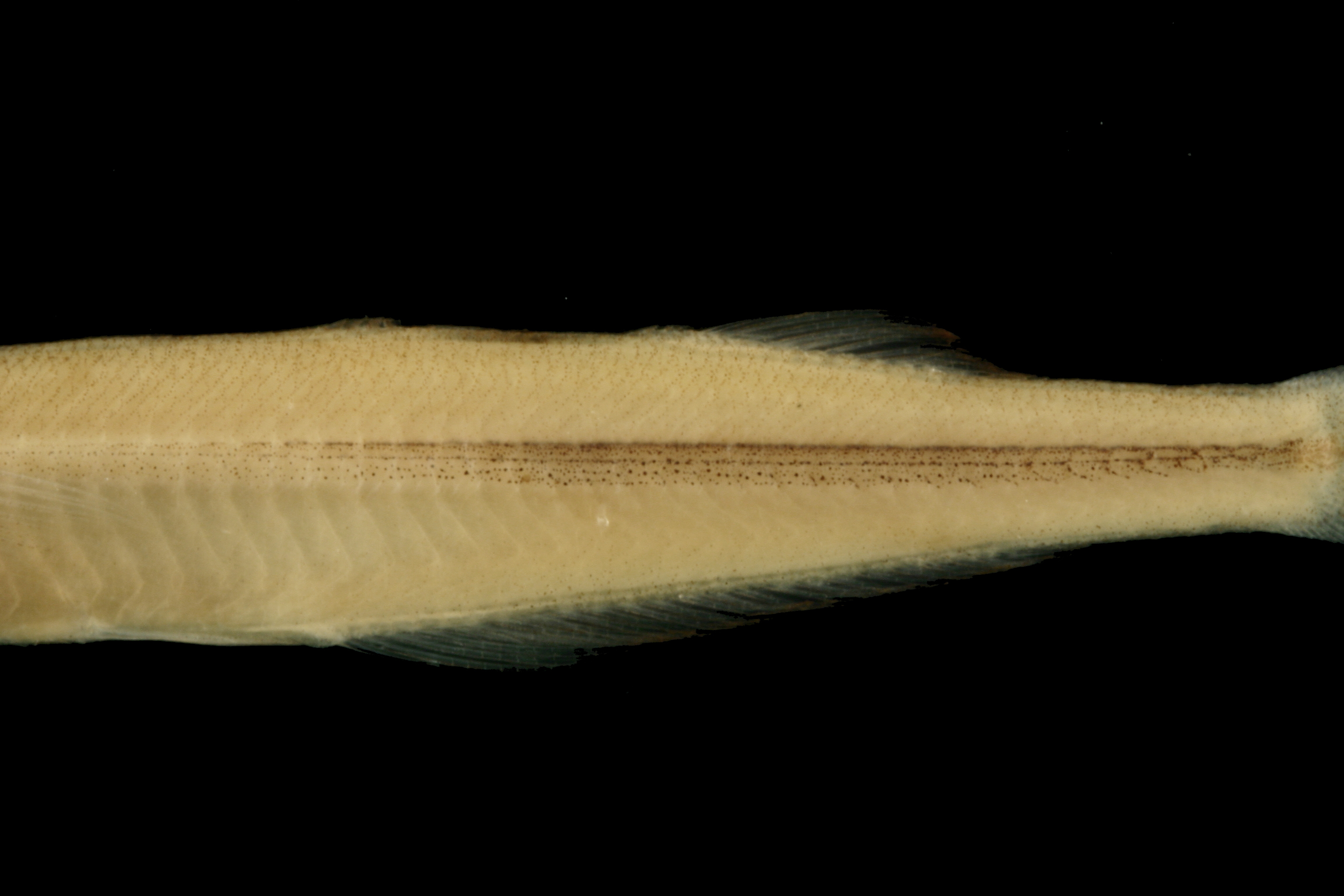
TNHCi_29991
Not suspect, not examinedPhotos
Map
Location
30.34751° N, 95.55877° W
(± 42016.8
m)
Taxonomy
GenusLabidesthes
Speciessicculus
Specimen
Num Specimens3
Identification
DeterminerRosendale, J.
Collection Event
CollectorRosendale, J.
Collected Date00/___/1998
Geography
DrainageSan Jacinto
CountryUnited States
StateTexas
LocalityWest Fork San Jacinto, Houston
Record Source
Source
Texas Natural History Collections
(type: specimens)
Institution
Texas Natural History Collections
(type: museum)
Curator
Dean Hendrickson
Record Added
May 13, 2010
Record Last Modified
March 23, 2026
Data Processing Track
Track 2
From Data Set Received
04/2009 to 10/2010
Identification
Suspect Notes
None
Count
3
Current Determination
Determiner
Fishes of Texas staff
Determination Date
Unknown
Determination Type
Unspecified
Identification Comments
None
Identification Confidence
Unknown
Collecting Event
Collected
Jan. 1, 1998
– Dec. 31, 1998
Collector(s)
Collecting Event ID
8973
Field Notes
There are no field notes available.
Locality
Region
Piney Woods
Jurisdiction
Montgomery, Texas
Name
West Fork San Jacinto River
Hydrography
Texas-Gulf Region
Galveston Bay-San Jacinto
San Jacinto
West Fork San Jacinto
West Fork San Jacinto River-Conroe Lake
White Oak Creek-West Fork San Jacinto River
Captive
no
Locality Photos
No locality photos available.
flag (suspect/examine)
suspect: noexamination: no
date
date_range: 1/1/1998-12/31/1998
collectors
collectors: Rosendale, John
collectors
collectors: John Rosendale
date
date_range: 1/1/1998-12/31/1998
staff comment
ID Status: Not flagged for specimen examination. By default we accept donor specimen determinations (after synonymization to our taxonomy). If georeferenced to TX this record has been considered in spatial context with other occurences of this species and accepted as correct.
ID Comments: NA
georeference
Error: 42016.7531518197Locality: West Fork San Jacinto RiverCoordinates: 30.347509008;-95.558774112Georeferencer: BJLGeographic note: Inland USA Texas
Comments On TNHCi_29991