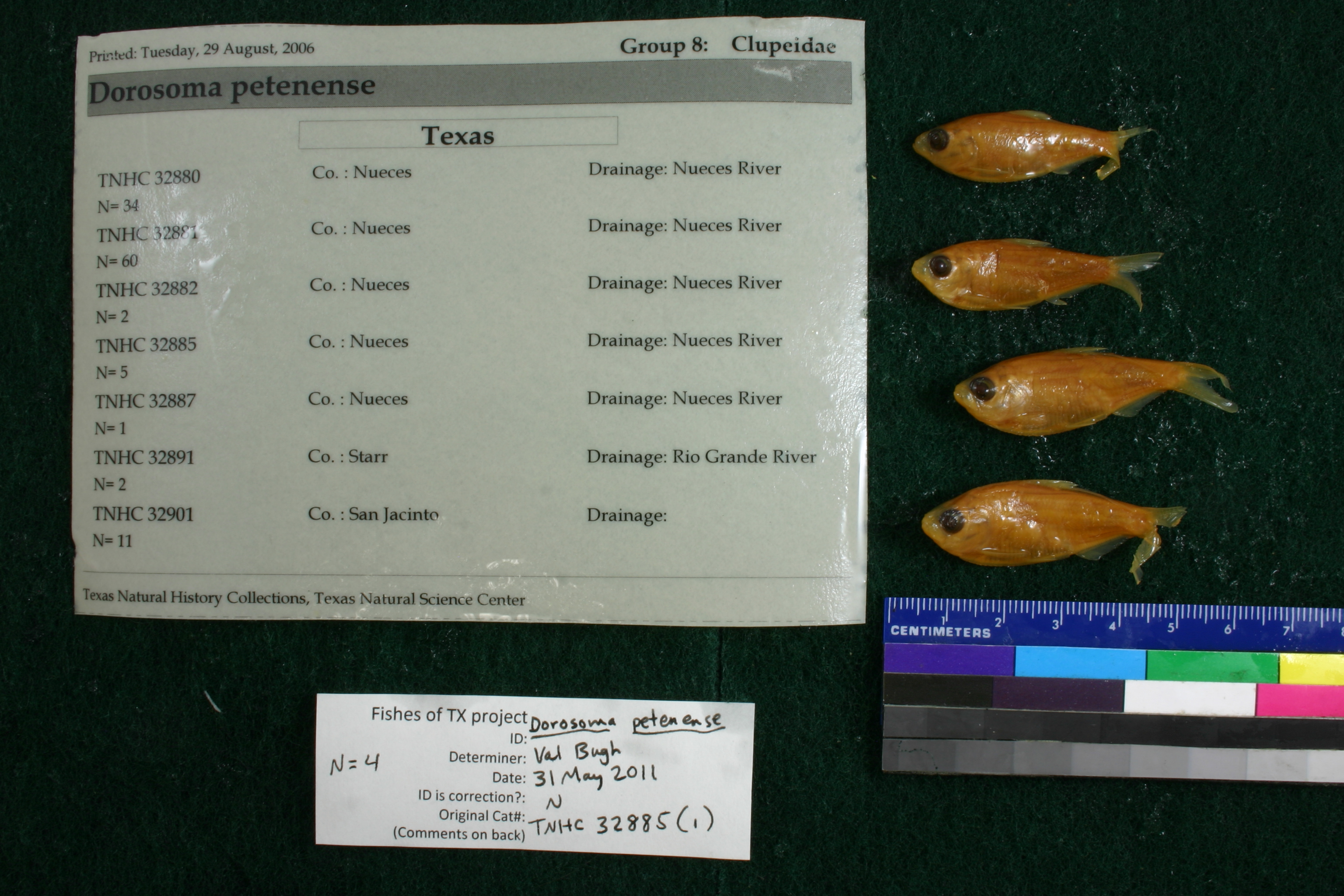
TNHCi_32885(1)
Not suspect, examinedPhotos
Map
Location
27.89556° N, 97.62907° W
(± 489.2
m)
Taxonomy
FamilyClupeidae
GenusDorosoma
Speciespetenense
Specimen
Num Specimens5
Collection Event
CollectorKihn, H., Blasienz, T.
Collected Date1971.7.13-1971.7.13
Field Numberz32885
Geography
CountryUSA
StateTexas
CountyNueces
LocalityNueces River, Sta. 1a
Other
QuestionableNo
CurrentYes
NoTAIC 949
YearEH/2006
SalinityF
Record Source
Source
Texas Natural History Collections
(type: specimens)
Institution
Texas Natural History Collections
(type: museum)
Curator
Dean Hendrickson
Record Added
April 23, 2015
Record Last Modified
March 23, 2026
Data Processing Track
Track 1
From Data Set Received
11/1997 to 05/2006
Identification
Suspect Notes
None
Count
5
Current Determination
Determiner
Valerie Gawenda Bugh
Determination Date
Feb. 11, 2016
Determination Type
specimen examination
Identification Comments
Specimen examined and Id'ed for FoTX project. | ID notes: anal rays: 23,23; MinSL(mm): 34.21; MaxSL(mm): 38.54; Jar: 32 oz; Specimen condition: good; Mutations: none; Count Male: ; Count female: ; Extern parasites: n
Identification Confidence
High
Collecting Event
Collected
July 13, 1971
Collector(s)
Collecting Event ID
18833
Field Notes
There are no field notes available.
Locality
Region
Gulf Coast Prairies & Marshes
Jurisdiction
San Patricio, Texas
Name
Jct Nueces River and U. S. Hwy 77
Hydrography
Texas-Gulf Region
Nueces-Southwestern Texas Coastal
Nueces
Lower Nueces
Bayou Creek-Nueces River
City of Calallen-Nueces River
Captive
no
Locality Photos
No locality photos available.
Comments On TNHCi_32885(1)