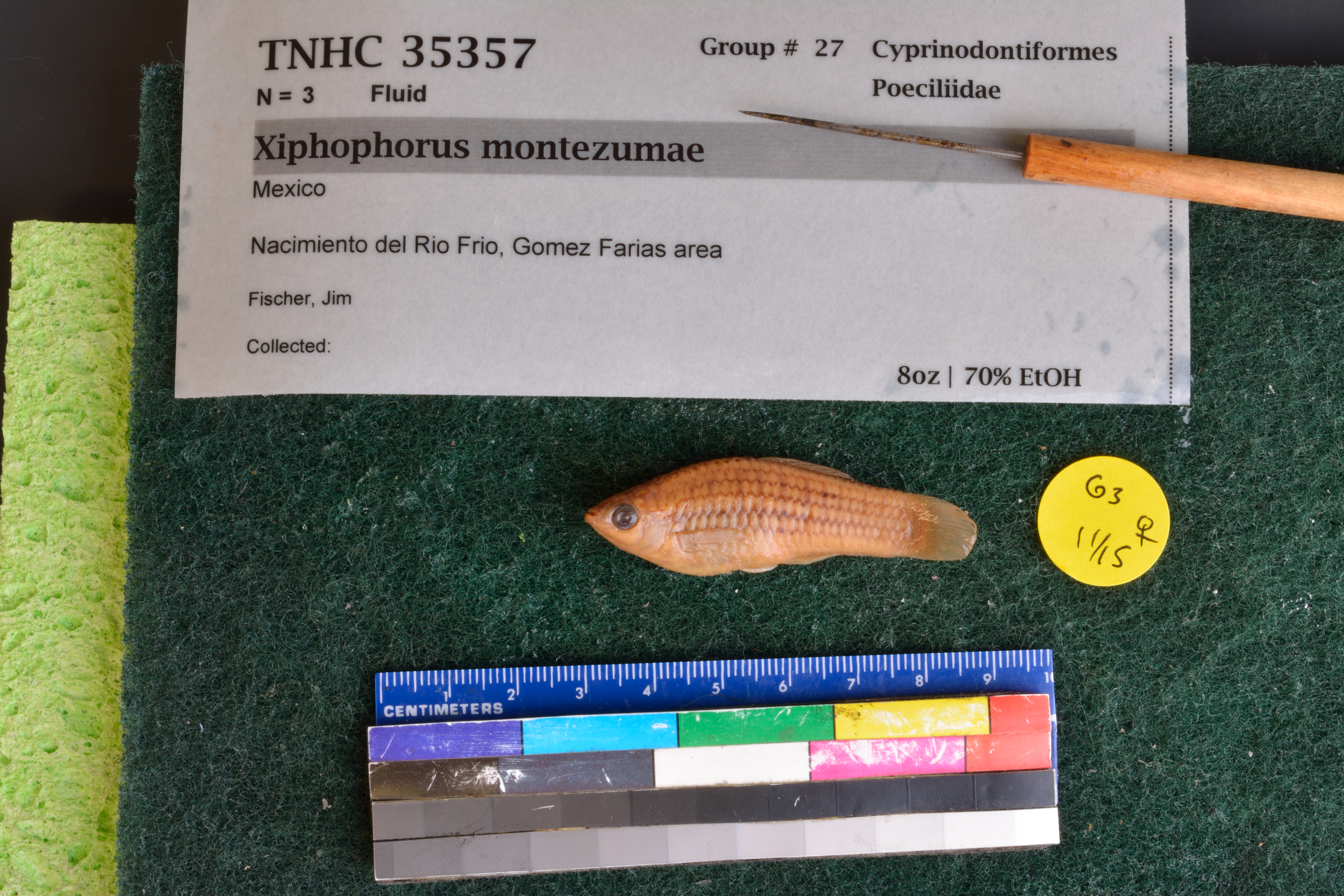
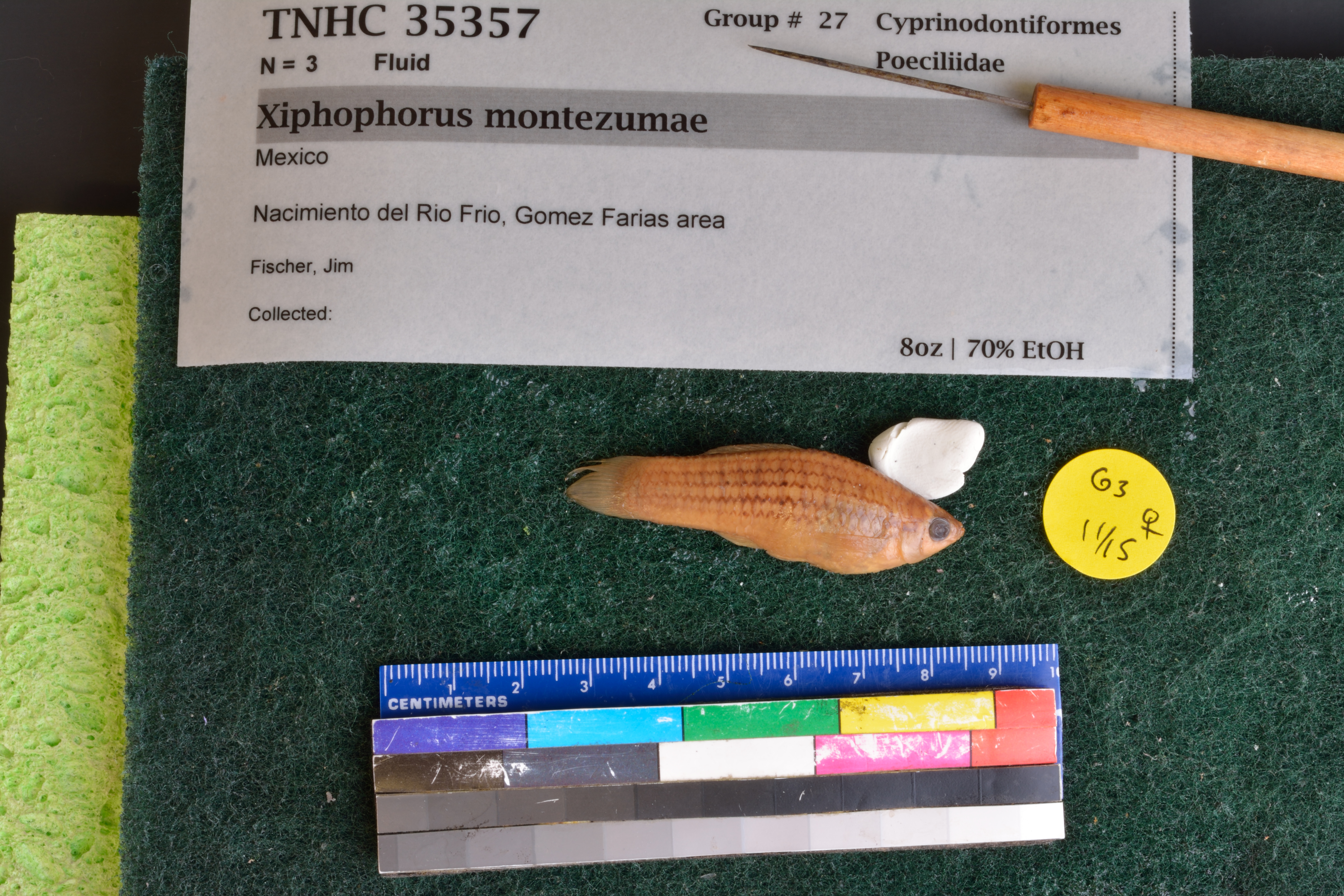
TNHCi_35357
Not suspect, examinedPhotos
Map
Location
29.35981° N, 107.73961° W
(± 10630
m)
Taxonomy
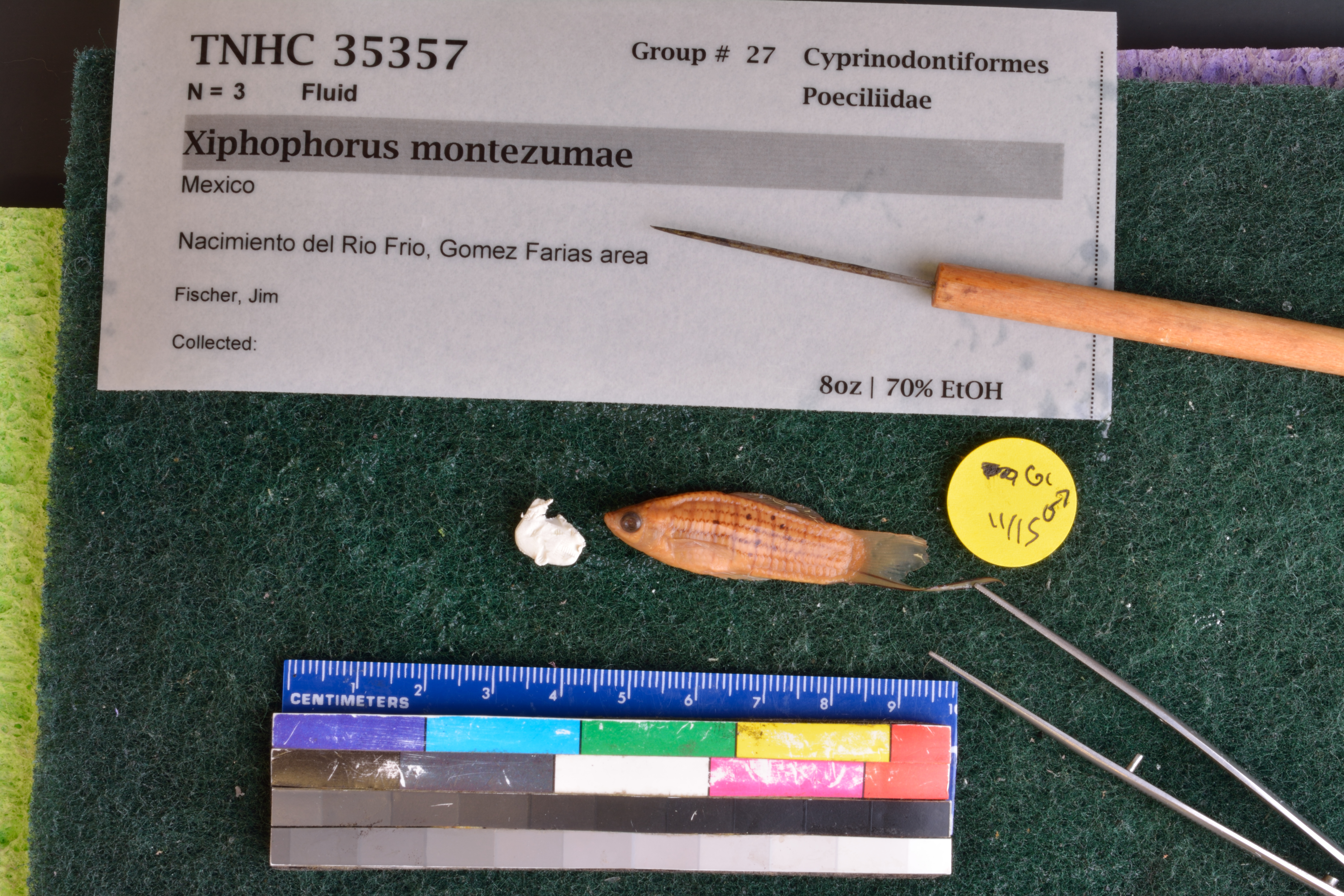
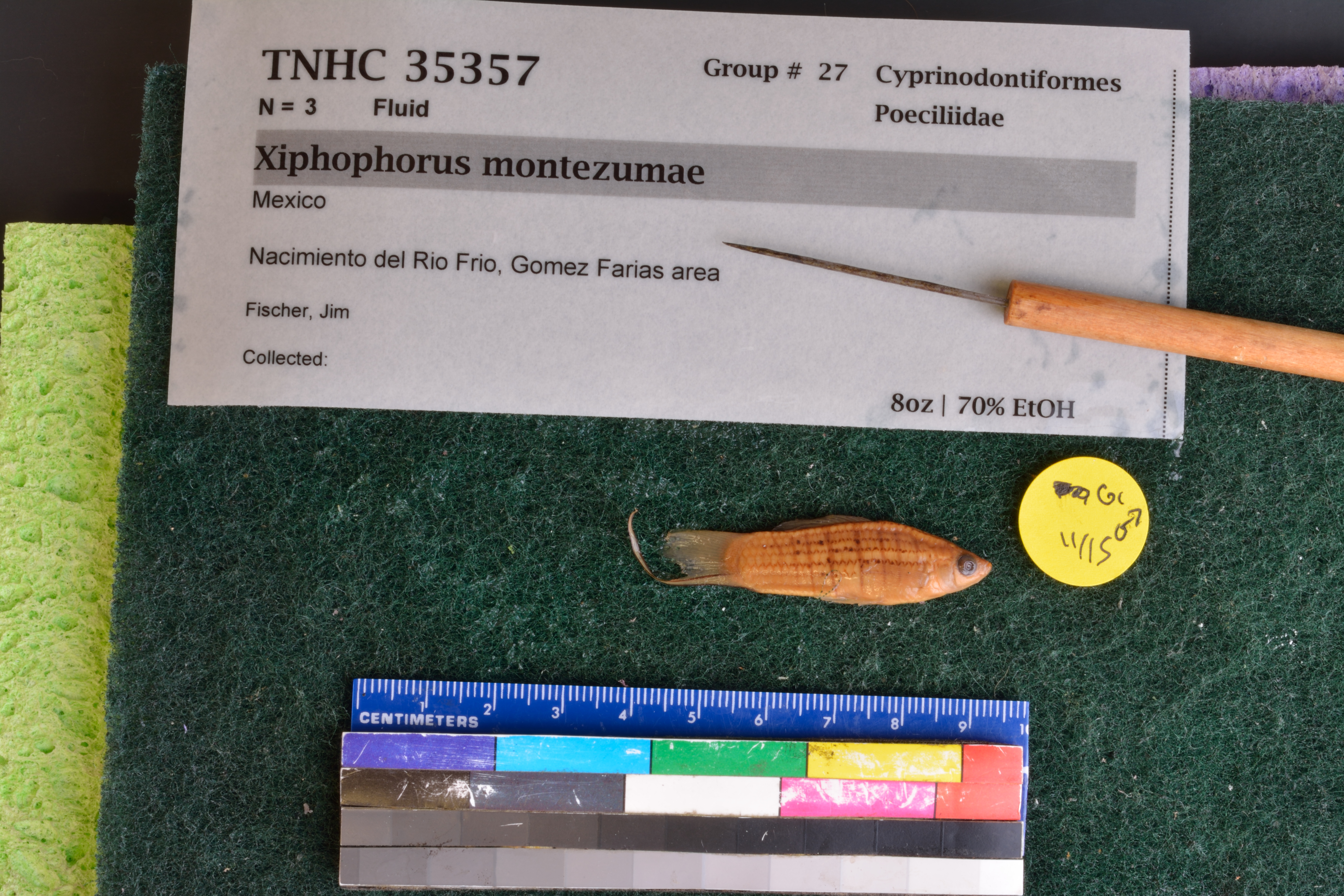
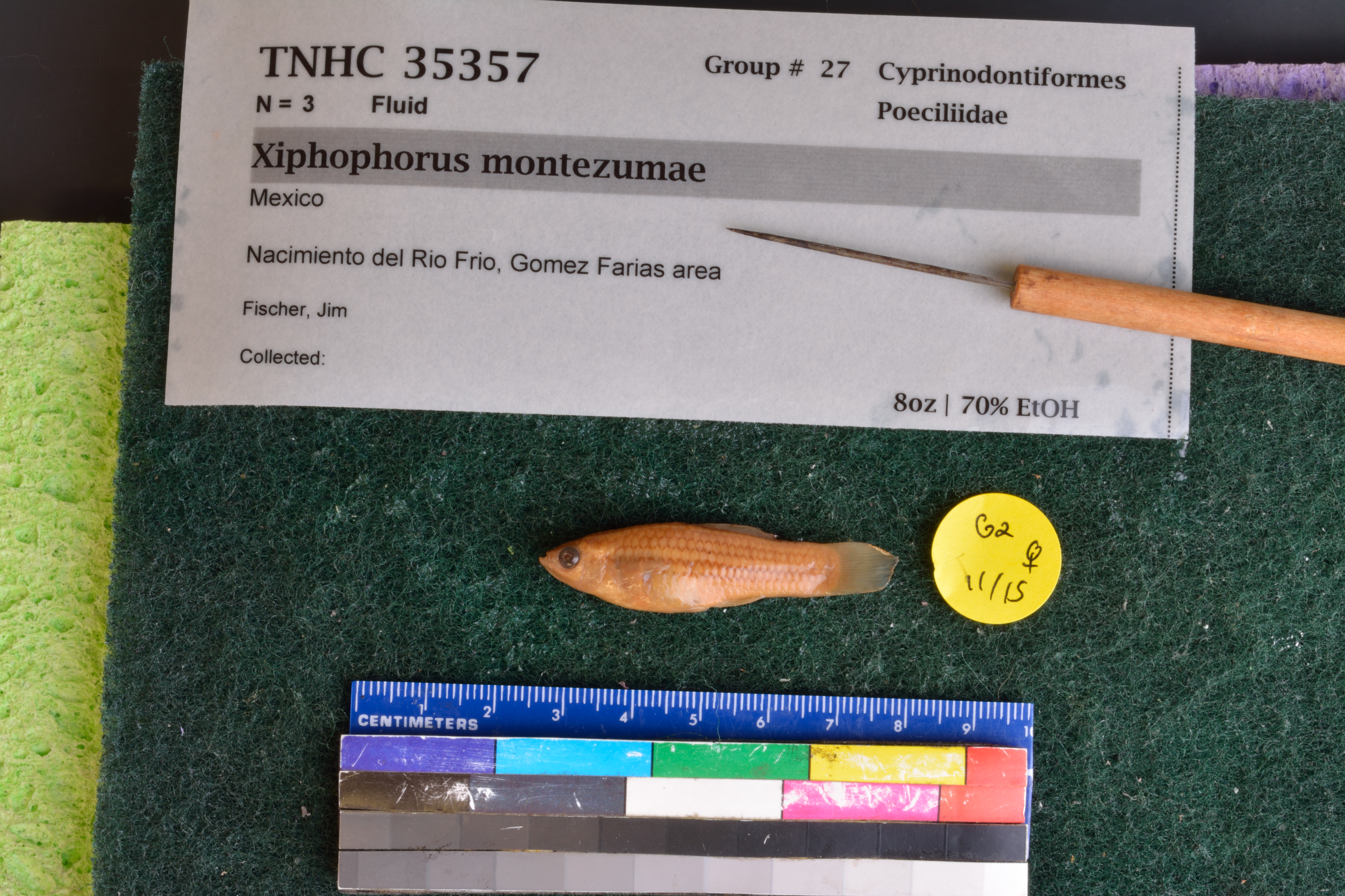
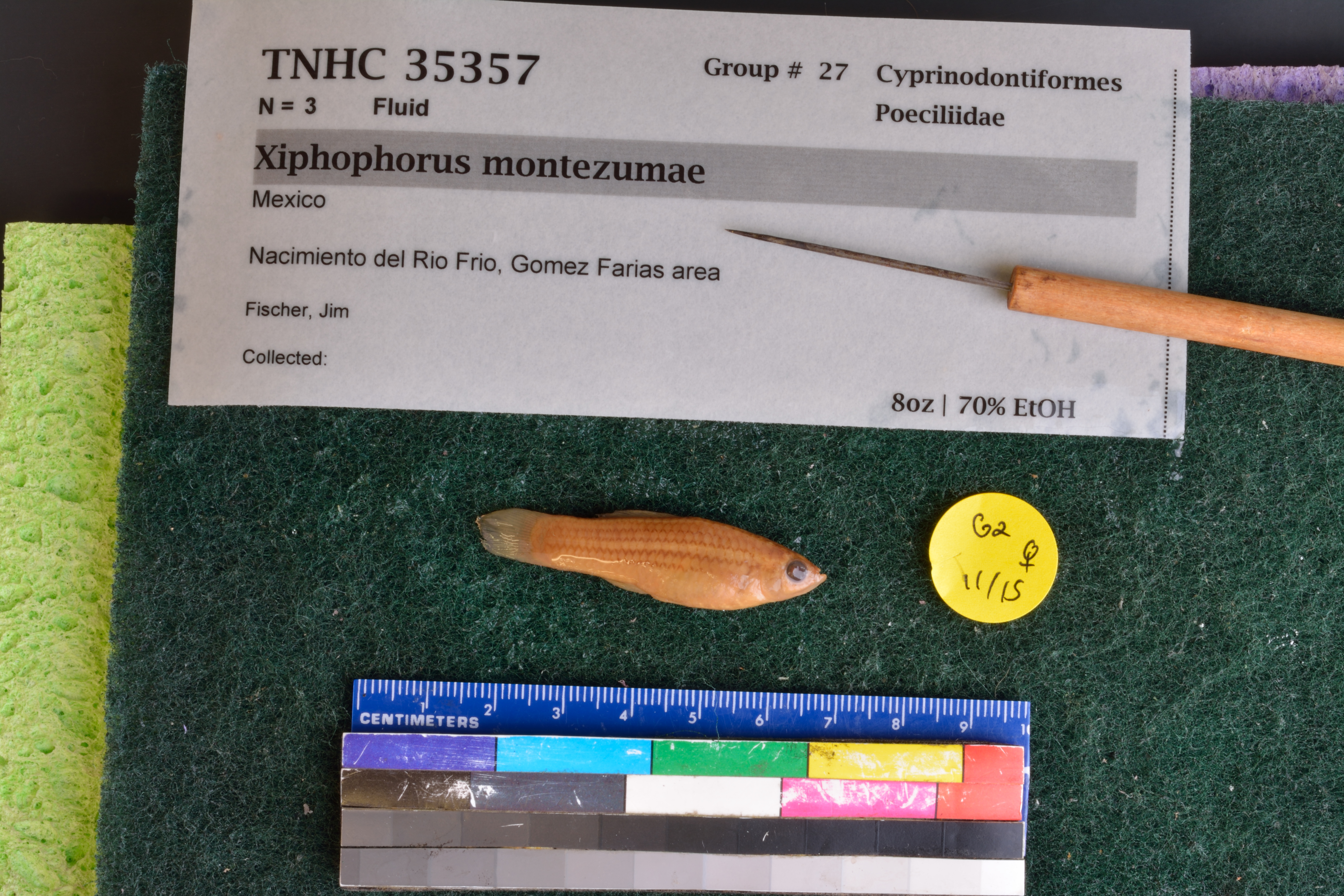
FamilyPoeciliidae
GenusXiphophorus
Speciesvariatus
Specimen
Num Specimens3
Collection Event
CollectorFischer, Jim
Field Numberz35357
Geography
CountryMexico
LocalityNacimiento del Rio Frio, Gomez Farias area
Other
QuestionableNo
CurrentYes
NoTAIC 2875
YearLC/2007
RemarksLedger states that specimen "died in captivity 20 Mar 1977 "
Record Source
Source
Texas Natural History Collections
(type: specimens)
Institution
Texas Natural History Collections
(type: museum)
Curator
Dean Hendrickson
Record Added
April 23, 2015
Record Last Modified
March 23, 2026
Data Processing Track
Track 2
From Data Set Received
04/2009 to 10/2010
Identification
Suspect Notes
None
Count
3
Current Determination
Determiner
Floyd Douglas Martin
Determination Date
Feb. 11, 2016
Determination Type
specimen examination
Identification Comments
Specimen examined and Id'ed for FoTX project. | male sword length matches description; sword composed of unbranched rays; multiple zigzag lines on sides; ray 4p of gonopodium with unreduced distal serrae
Identification Confidence
High
Collecting Event
Collected
Jan. 1, 1830
– Dec. 31, 2010
Collector(s)
Collecting Event ID
42500
Field Notes
There are no field notes available.
Locality
Jurisdiction
Gomez Farias, Chihuahua
Name
Unknown
Hydrography
Not available
Captive
no
Locality Photos
No locality photos available.
georeference
Error: 45
Remarks: Coordinates recovered from TPWD GoFish database and shifted slightly off the bank into the creek.
Locality: Salado Creek at given coordinatesCoordinates: -98.411265, 29.360982Georeferencer: Adam CohenCoordinates recovered from TPWD GoFish database and shifted slightly off the bank into the creek.
flag (suspect/examine)
suspect: noexamination: yes
date
date_range: 1/1/1830-12/31/2010
collectors
collectors: Fischer, Jim
Comments On TNHCi_35357