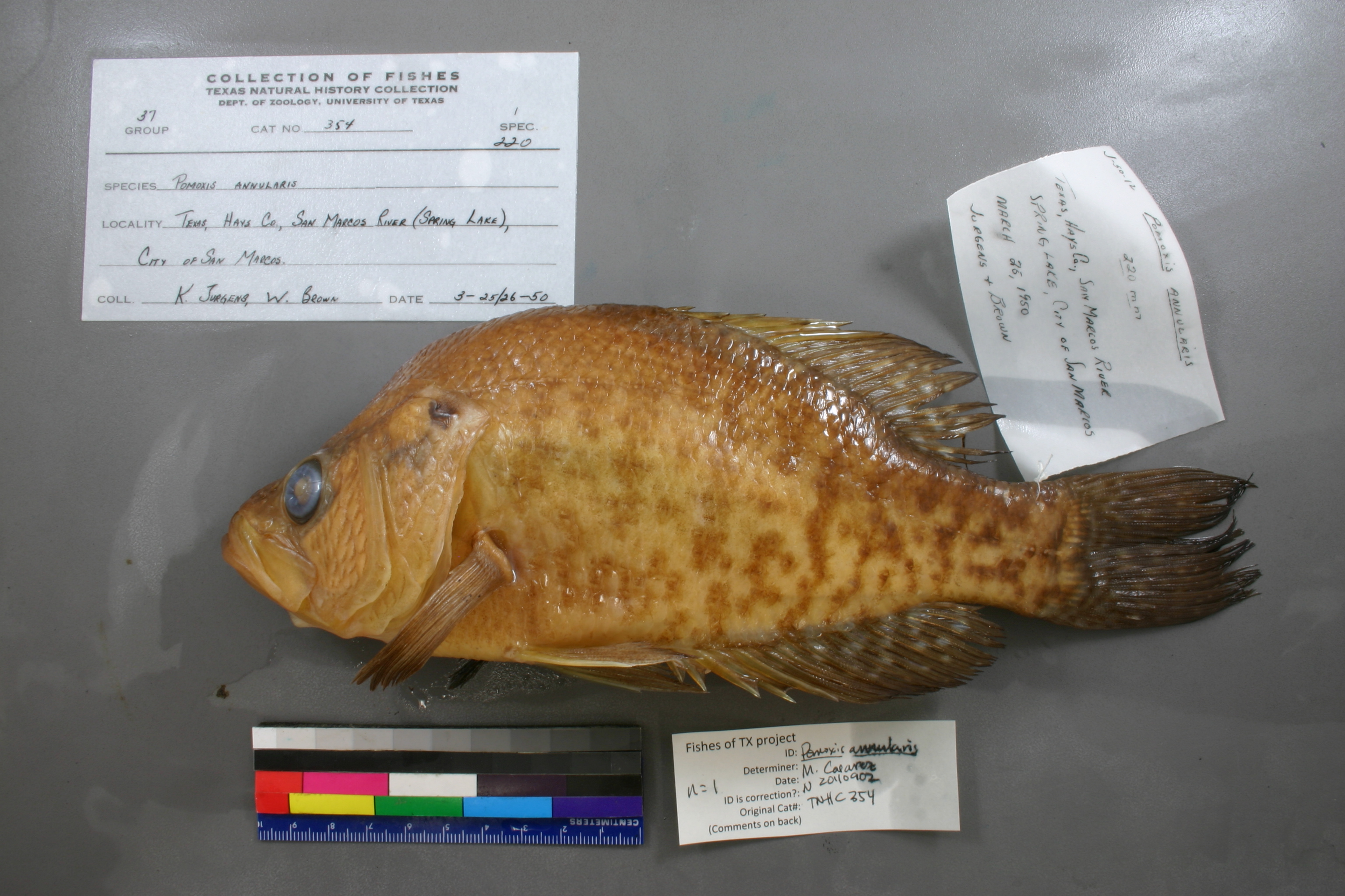
TNHCi_354
Not suspect, examinedPhotos
Map
Location
29.89151° N, 97.93099° W
(± 531.8
m)
Taxonomy
GenusPomoxis
Speciesannularis
Specimen
Num Specimens1
Collection Event
CollectorJurgens, K. and W. Brown
Collected Date1950.3.24
Geography
DrainageGuadalupe
CountryUnited States
StateTexas
CountyHays
LocalitySan Marcos River, San Marcos (spring Lake)
Record Source
Source
Texas Natural History Collections
(type: specimens)
Institution
Texas Natural History Collections
(type: museum)
Curator
Dean Hendrickson
Record Added
May 13, 2010
Record Last Modified
March 23, 2026
Data Processing Track
Track 2
From Data Set Received
04/2009 to 10/2010
Identification
Suspect Notes
None
Count
1
Current Determination
Determiner
Melissa Casarez
Determination Date
Feb. 11, 2016
Determination Type
specimen examination
Identification Comments
Specimen examined and Id'ed for FoTX project. | ID notes: dorsal spines: 6; MinSL(mm): 221.5; MaxSL(mm): ; Jar: 1 gallon; Specimen condition: good; Mutations: none; Count Male: ; Count female: ; Extern parasites: n
Identification Confidence
High
Collecting Event
Collected
March 25, 1950
Collector(s)
Collecting Event ID
6818
Field Notes
There are no field notes available.
Locality
Region
Blackland Prairies
Jurisdiction
Hays, Texas
Name
Spring Lake
Hydrography
Texas-Gulf Region
Central Texas Coastal
Guadalupe
San Marcos
Upper San Marcos River
Purgatory Creek-San Marcos River
Captive
no
Locality Photos
No locality photos available.
flag (suspect/examine)
suspect: noexamination: yes
date
date_range: 3/25/1950-3/25/1950
collectors
collectors: Jurgens, Kenneth C. Brown, W.
collectors
collectors: Kenneth C. Jurgens, W. Brown
date
date_range: 3/24/1950-3/24/1950
staff comment
ID Status: Not flagged for specimen examination. By default we accept donor specimen determinations (after synonymization to our taxonomy). If georeferenced to TX this record has been considered in spatial context with other occurences of this species and accepted as correct.
ID Comments: NAGeoref Remark: Updated coordinates as they were incorrect - error in latitude (was originally mapped as 39.8913, as opposed to 29.8913)
georeference
Error: 531.822355202127
Remarks: Updated coordinates as they were incorrect - error in latitude (was originally mapped as 39.8913, as opposed to 29.8913)
Locality: Spring LakeCoordinates: 29.891510213;-97.930993604Georeferencer: MJCGeographic note: Inland USA TexasUpdated coordinates as they were incorrect - error in latitude (was originally mapped as 39.8913, as opposed to 29.8913)
Comments On TNHCi_354