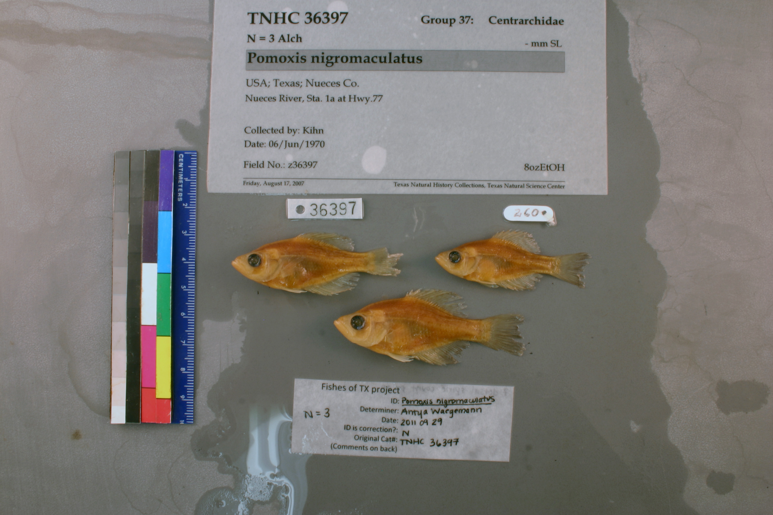
TNHCi_36397
Not suspect, examinedPhotos
Map
Location
27.89556° N, 97.62907° W
(± 489.2
m)
Taxonomy
FamilyCentrarchidae
GenusPomoxis
Speciesnigromaculatus
Specimen
Num Specimens3
Collection Event
CollectorKihn,
Collected Date1970.6.6-1970.6.6
Field Numberz36397
Geography
CountryUSA
StateTexas
CountyNueces
LocalityNueces River, Sta. 1a at Hwy.77
Latitude DMS27.8925000°
Longitude DMS-97.6272222°
Other
QuestionableNo
CurrentYes
NoTAIC 260
YearLC/2007
RemarksCounty was added during cataloging based on locality information from similar field numbers.
Record Source
Source
Texas Natural History Collections
(type: specimens)
Institution
Texas Natural History Collections
(type: museum)
Curator
Dean Hendrickson
Record Added
April 23, 2015
Record Last Modified
March 23, 2026
Data Processing Track
Track 2
From Data Set Received
04/2009 to 10/2010
Identification
Suspect Notes
None
Count
3
Current Determination
Determiner
Antya E. Waegemann
Determination Date
Feb. 11, 2016
Determination Type
specimen examination
Identification Comments
Specimen examined and Id'ed for FoTX project. | ID notes: dorsal spines: 7; MinSL(mm): 40.89; MaxSL(mm): 51.34; Jar: 8 oz; Specimen condition: good; Mutations: none; Count Male: ; Count female: ; Extern parasites: n
Identification Confidence
High
Collecting Event
Collected
June 6, 1970
Collector(s)
Collecting Event ID
18831
Field Notes
There are no field notes available.
Locality
Region
Gulf Coast Prairies & Marshes
Jurisdiction
San Patricio, Texas
Name
Jct Nueces River and U. S. Hwy 77
Hydrography
Texas-Gulf Region
Nueces-Southwestern Texas Coastal
Nueces
Lower Nueces
Bayou Creek-Nueces River
City of Calallen-Nueces River
Captive
no
Locality Photos
No locality photos available.
HUC 12
121101110707
Georeferencing Remarks
Mapped coordinates did not quite lie on the Nueces River. Referenced point on the river at the jct. with U. S. Hwy 77 and used distance to given coordinates as the extent.
Georeferencing Annotation
—
Has not been Georeferenced because
—
flag (suspect/examine)
suspect: noexamination: yes
date
date_range: 6/6/1970-6/6/1970
date
date_range: 6\6\1970-6\6\1970
collectors
collectors: Kihn
Comments On TNHCi_36397