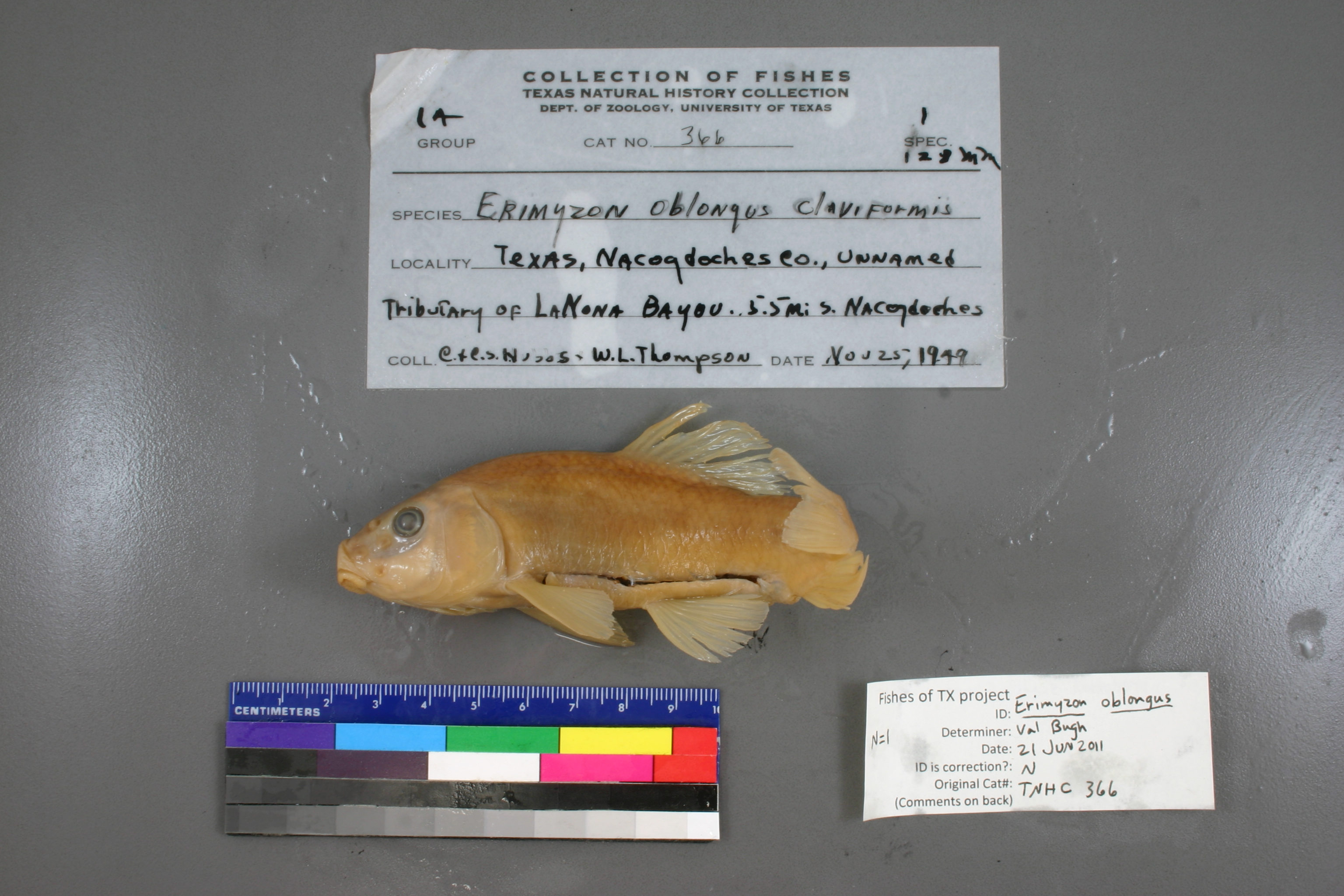
TNHCi_366
Not suspect, examinedPhotos
Map
Location
31.53141° N, 94.65023° W
(± 11838.3
m)
Taxonomy
GenusErimyzon
Speciesoblongus
Hybrid Speciesclaviformis
Specimen
Num Specimens1
Collection Event
CollectorHubbs, C., C.S. Hubbs and K. Thompson
Collected Date1949.11.24
Geography
DrainageNeches
CountryUnited States
StateTexas
CountyNacogdoches
LocalityUnnamed tributary of Lanoma Bayou, 5.5 mi S of Nacogdoches
Record Source
Source
Texas Natural History Collections
(type: specimens)
Institution
Texas Natural History Collections
(type: museum)
Curator
Dean Hendrickson
Record Added
May 13, 2010
Record Last Modified
March 23, 2026
Data Processing Track
Track 2
From Data Set Received
04/2009 to 10/2010
Identification
Suspect Notes
None
Count
1
Current Determination
Determiner
Unknown
Determination Date
July 11, 2022
Determination Type
taxonomic adjustment
Identification Comments
Determination found in FoTX database and determined to be the most recent determination. However, since the date of determination is not recorded in the database we hereby assign the date of our determination reconciliation effort, which makes it the most recent determination for this record.
Identification Confidence
Unknown
Previous Determination
Determiner
Valerie Gawenda Bugh
Determination Date
Feb. 11, 2016
Determination Type
specimen examination
Identification Comments
Specimen examined and Id'ed for FoTX project. | ID notes: predorsal scales: > 15; MinSL(mm): 118; MaxSL(mm): ; Jar: 32 oz; Specimen condition: poor; Mutations: none; Count Male: ; Count female: ; Extern parasites: n
Identification Confidence
High
Collecting Event
Collected
Nov. 25, 1949
Collector(s)
Collecting Event ID
4698
Field Notes
There are no field notes available.
Locality
Region
Piney Woods
Jurisdiction
Nacogdoches, Texas
Name
5.5 miles South of Nacogdoches
Hydrography
Texas-Gulf Region
Neches
Neches
Lower Angelina
La Nana Bayou-Angerlina River
Black Bayou-La Nana Bayou
Captive
no
Locality Photos
No locality photos available.
flag (suspect/examine)
suspect: noexamination: yes
date
date_range: 11/25/1949-11/25/1949
collectors
collectors: Hubbs, Clark Hubbs, Catherine S. Thompson, K.
collectors
collectors: Clark Hubbs, Catherine S. Hubbs, K. Thompson
date
date_range: 11/24/1949-11/24/1949
staff comment
ID Status: Not flagged for specimen examination. By default we accept donor specimen determinations (after synonymization to our taxonomy). If georeferenced to TX this record has been considered in spatial context with other occurences of this species and accepted as correct.
ID Comments: NAGeoref Remark: measured by air
georeference
Error: 11838.3344639492Remarks: measured by airLocality: 5.5 miles South of NacogdochesCoordinates: 31.53141319;-94.650232701Georeferencer: BJLGeographic note: Inland USA Texas
measured by air
Comments On TNHCi_366