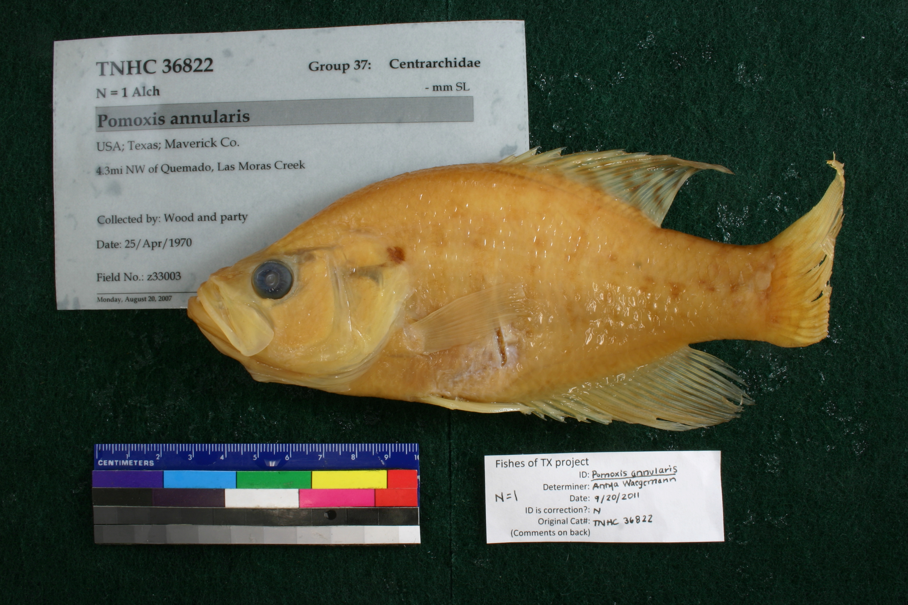
TNHCi_36822
Not suspect, examinedPhotos
Map
Location
29.00543° N, 100.63918° W
(± 1434.3
m)
Taxonomy
FamilyCentrarchidae
GenusPomoxis
Speciesannularis
Specimen
Num Specimens1
Collection Event
CollectorWood and party
Collected Date1970.4.25-1970.4.25
Field Numberz33003
Geography
CountryUSA
StateTexas
CountyMaverick
Locality4.3mi NW of Quemado, Las Moras Creek
Other
QuestionableNo
CurrentYes
NoTAIC 1255
YearLC/2007
SalinityF
Record Source
Source
Texas Natural History Collections
(type: specimens)
Institution
Texas Natural History Collections
(type: museum)
Curator
Dean Hendrickson
Record Added
April 23, 2015
Record Last Modified
March 23, 2026
Data Processing Track
Track 2
From Data Set Received
04/2009 to 10/2010
Identification
Suspect Notes
None
Count
1
Current Determination
Determiner
Antya E. Waegemann
Determination Date
Feb. 11, 2016
Determination Type
specimen examination
Identification Comments
Specimen examined and Id'ed for FoTX project. | ID notes: dorsal spines: 6; MinSL(mm): 161.92; MaxSL(mm): ; Jar: 32 oz; Specimen condition: good; Mutations: none; Count Male: ; Count female: ; Extern parasites: n
Identification Confidence
High
Collecting Event
Collected
April 25, 1970
Collector(s)
Collecting Event ID
17023
Field Notes
There are no field notes available.
Locality
Region
South Texas Brush Country
Jurisdiction
Maverick, Texas
Name
Jct US Hwy 277 and Las Moras Creek
Hydrography
Rio Grande Region
Rio Grande-Falcon
Rio Grande-Falcon
Elm-Sycamore
Las Moras Creek
Outlet Las Moras Creek
Captive
no
Locality Photos
No locality photos available.
HUC 12
130800011305
Georeferencing Remarks
Referenced the jct. of US Hwy 277 and Las Moras Creek, which is NNW of Quemado. Las Moras Creek runs into the Rio Grande 4661 ft to the SW (by air) of this jct and never lies to the NW of Quemado. Used distance from road-creek jct to creek-river jct as e
Georeferencing Annotation
Direction is NNW.
Has not been Georeferenced because
—
flag (suspect/examine)
suspect: noexamination: yes
date
date_range: 4/25/1970-4/25/1970
date
date_range: 4\25\1970-4\25\1970
collectors
collectors: Wood
Comments On TNHCi_36822