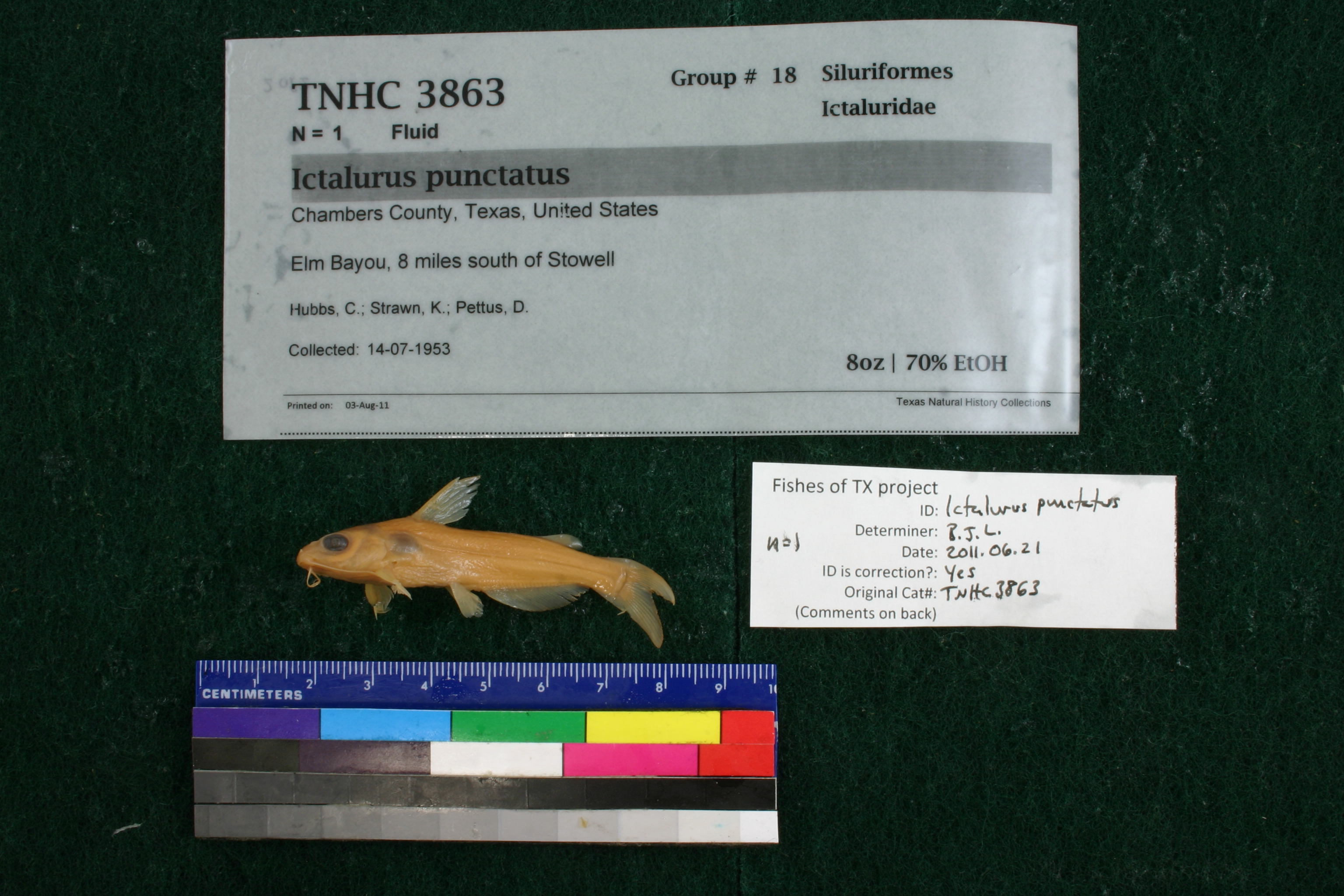
TNHCi_3863
Not suspect, examinedPhotos
Map
Location
29.67199° N, 94.37357° W
(± 2821.2
m)
Taxonomy
GenusIctalurus
Speciesfurcatus
Specimen
Num Specimens1
Collection Event
CollectorHubbs, C., K. Strawn and D. Pettus
Collected Date1953.7.13
Geography
DrainageNeches-Trinity
CountryUnited States
StateTexas
CountyChambers
LocalityElm Bayou, 8 mi. S Stowell
Record Source
Source
Texas Natural History Collections
(type: specimens)
Institution
Texas Natural History Collections
(type: museum)
Curator
Dean Hendrickson
Record Added
May 13, 2010
Record Last Modified
March 23, 2026
Data Processing Track
Track 2
From Data Set Received
04/2009 to 10/2010
Identification
Suspect Notes
None
Count
1
Current Determination
Determiner
Ben Labay
Determination Date
Feb. 11, 2016
Determination Type
specimen examination
Identification Comments
Specimen examined and Id'ed for FoTX project. | ID notes: anal rays: 27; MinSL(mm): 55; MaxSL(mm): ; Jar: 8 oz; Specimen condition: good; Mutations: none; Count Male: ; Count female: ; Extern parasites: n
Identification Confidence
High
Collecting Event
Collected
July 14, 1953
Collector(s)
Collecting Event ID
9713
Field Notes
There are no field notes available.
Locality
Region
Gulf Coast Prairies & Marshes
Jurisdiction
Chambers, Texas
Name
Elm Bayou, 8 miles south of Stowell
Hydrography
Texas-Gulf Region
Galveston Bay-San Jacinto
Galveston Bay-Sabine Lake
East Galveston Bay
Spindletop Ditch
Spindletop Ditch
Captive
no
Locality Photos
No locality photos available.
flag (suspect/examine)
suspect: noexamination: yes
date
date_range: 7/14/1953-7/14/1953
collectors
collectors: Hubbs, Clark Strawn, Kirk R. Pettus, D.
collectors
collectors: Clark Hubbs, Kirk R. Strawn, D. Pettus
date
date_range: 7/13/1953-7/13/1953
staff comment
ID Status: Not flagged for specimen examination. By default we accept donor specimen determinations (after synonymization to our taxonomy). If georeferenced to TX this record has been considered in spatial context with other occurences of this species and accepted as correct.
ID Comments: NAGeoref Remark: Measured via SH 124 and point is placed at the nearest point on Elm Bayou.
georeference
Error: 2821.18003198789Remarks: Measured via SH 124 and point is placed at the nearest point on Elm Bayou.Locality: Elm Bayou, 8 miles south of StowellCoordinates: 29.67199256;-94.373572763Georeferencer: AECGeographic note: Inland USA Texas
Measured via SH 124 and point is placed at the nearest point on Elm Bayou.
Comments On TNHCi_3863