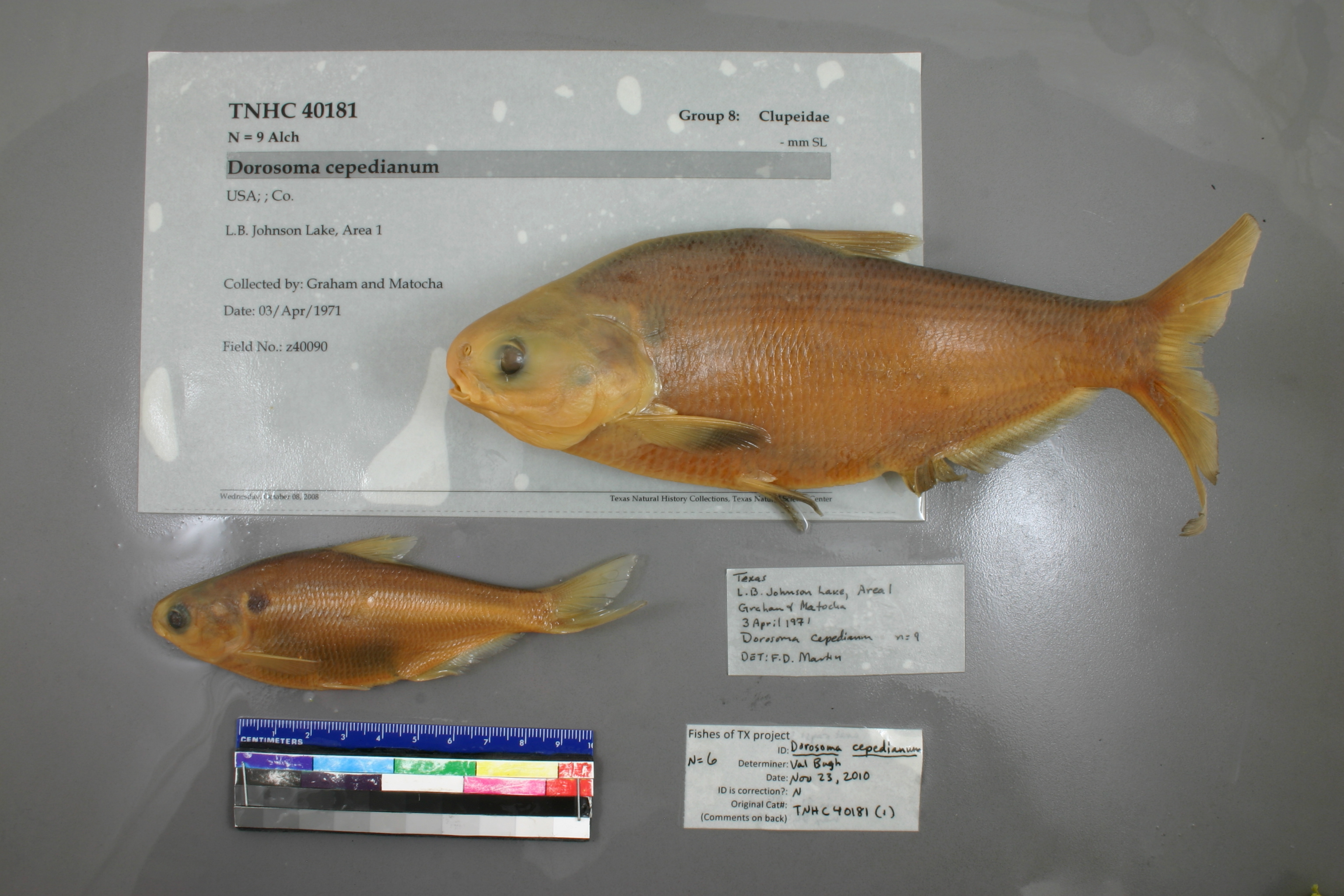
TNHCi_40181(1)
Not suspect, examinedPhotos
Map
Location
30.60963° N, 98.40801° W
(± 9508.0
m)
Taxonomy
FamilyClupeidae
GenusDorosoma
Speciescepedianum
Specimen
Num Specimens9
Identification
DeterminerMartin, F.
Collection Event
CollectorGraham and Matocha
Collected Date1971.4.3-1971.4.3
Field Numberz40090
Geography
CountryUSA
LocalityL.B. Johnson Lake, Area 1
Other
QuestionableNo
CurrentYes
YearMC/2008
RemarksDonation from Texas Tech University originally in jar with 40180, 40182 - 40187, and 40207 original tag in 40180
Remarksno county or state info provided
Record Source
Source
Texas Natural History Collections
(type: specimens)
Institution
Texas Natural History Collections
(type: museum)
Curator
Dean Hendrickson
Record Added
April 23, 2015
Record Last Modified
March 23, 2026
Data Processing Track
Track 1
From Data Set Received
11/1997 to 05/2006
Identification
Suspect Notes
None
Count
9
Current Determination
Determiner
Valerie Gawenda Bugh
Determination Date
Feb. 11, 2016
Determination Type
specimen examination
Identification Comments
Specimen examined and Id'ed for FoTX project. | ID notes: anal rays: 32; MinSL(mm): 84; MaxSL(mm): 200; Jar: gallon; Specimen condition: good; Mutations: none; Count Male: ; Count female: ; Extern parasites:
Identification Confidence
High
Collecting Event
Collected
April 3, 1971
Collector(s)
Collecting Event ID
18098
Field Notes
There are no field notes available.
Locality
Region
Llano Uplift
Jurisdiction
Burnet, Texas
Name
Lake Lyndon B. Johnson
Hydrography
Texas-Gulf Region
Lower Colorado-San Bernard Coastal
Middle Colorado-Llano
Buchanan-Lyndon B. Johnson Lakes
Inks Lake-Lake Lyndon B Johnson
Mill Creek-Lake Lyndon B Johnson
Captive
no
Locality Photos
No locality photos available.
HUC 12
120902010403
Georeferencing Remarks
Unsure which part of lake is \"Area 1\", so extent covers all of lake. As for previous georeference, I don\'t think entire body and stream are covered in extent, so redid.
Georeferencing Annotation
—
Has not been Georeferenced because
—
flag (suspect/examine)
suspect: noexamination: yes
date
date_range: 4/3/1971-4/3/1971
date
date_range: 4\3\1971-4\3\1971
collectors
collectors: Graham, Matocha
Comments On TNHCi_40181(1)