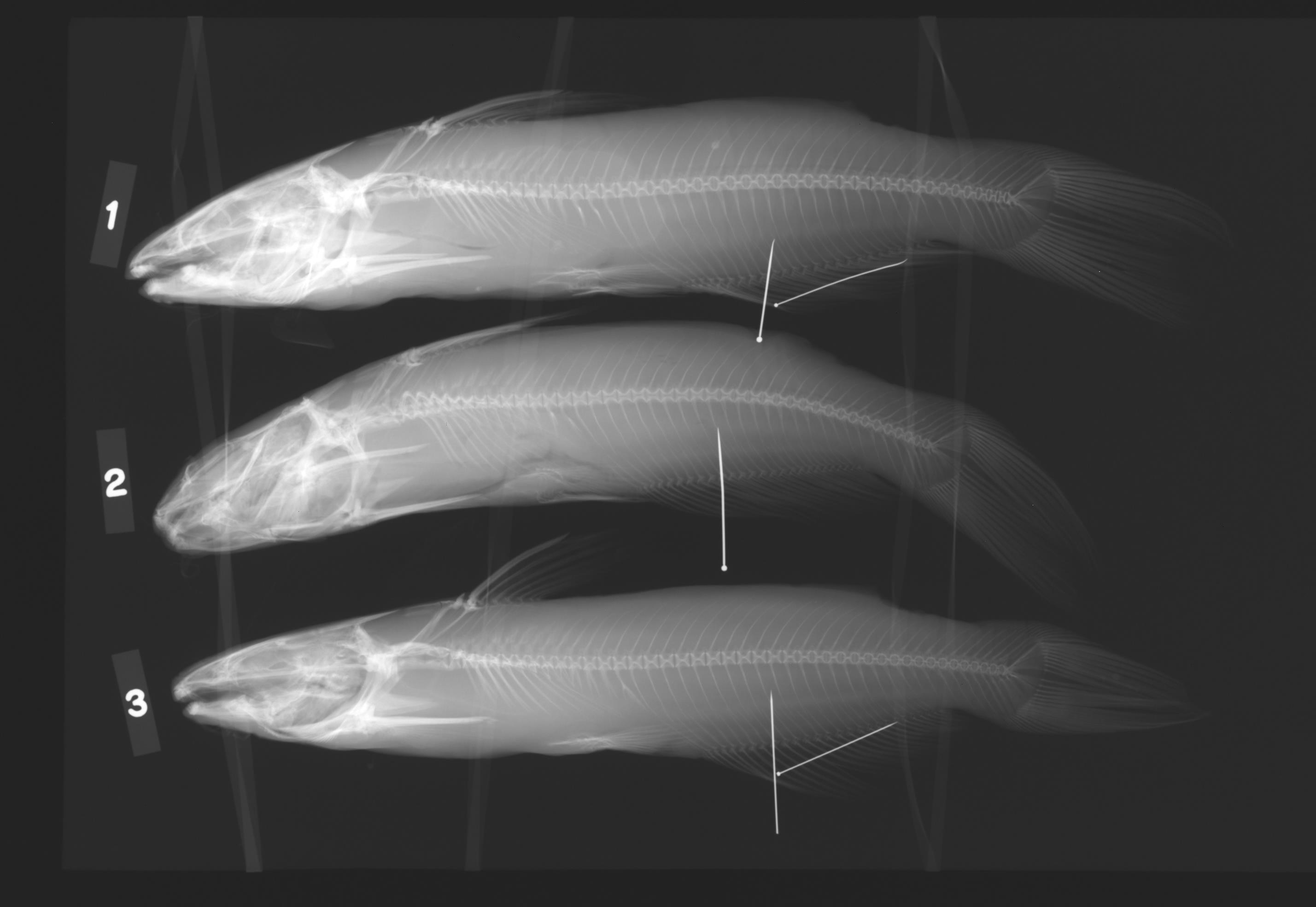
TNHCi_43185
Suspect, pending examinationPhotos
Map
Location
29.87896° N, 100.99292° W
(± 630.9
m)
Taxonomy
GenusIctalurus
Specieslupus x punctatus
Specimen
Num Specimens3
Collection Event
CollectorGarrett, G.
Collected Date2002.8.1-2002.8.1
Field Numberz43185
Geography
DrainageRio Grande
CountryUSA
StateTexas
CountyVal Verde
LocalityDevils River downstream of Dolan Falls
Other
QuestionableNo
DataHybrid
CurrentYes
YearJR/2009
SalinityF
RemarksLat/Long from field notes: 29deg 41' 02.87"/100deg 39' 55.04".
Record Source
Source
Texas Natural History Collections
(type: specimens)
Institution
Texas Natural History Collections
(type: museum)
Curator
Dean Hendrickson
Record Added
April 23, 2015
Record Last Modified
March 23, 2026
Data Processing Track
Track 2
From Data Set Received
04/2009 to 10/2010
Identification
Suspect Notes
added as bulk process; species not known from study area
Count
3
Current Determination
Determiner
Fishes of Texas staff
Determination Date
Unknown
Determination Type
Unspecified
Identification Comments
None
Identification Confidence
Unknown
Collecting Event
Collected
Aug. 1, 2002
Collector(s)
Collecting Event ID
11567
Field Notes
Locality
Region
Edwards Plateau
Jurisdiction
Val Verde, Texas
Name
Devils River, downstream of Dolan Falls
Hydrography
USGS HUC
Rio Grande Region
Rio Grande-Amistad
Devils
Lower Devils
Devils River-Amistad Reservoir
Indian Creek-Devils River
HydroBASINS
7521
752156
75215630
7521563010
752156301000
Captive
no
Locality Photos
No locality photos available.
flag (suspect/examine)
note: suspect record needs to be examinedExamination: Pending
flag (suspect/examine)
suspect: noexamination: no
georeference
Error: 630.8823552Remarks: Point is placed halfway to next downstream crossing (Grass Patch Springs)Locality: Devils River, downstream of Dolan FallsCoordinates: 29.87876;-100.99261Georferencer: MJCGeographic note: Inland USA Texas
Point is placed halfway to next downstream crossing (Grass Patch Springs)
date
date_range: 8/1/2002-8/1/2002
date
date_range: 8\1\2002-8\1\2002
collectors
collectors: Garrett, Gary P.
Comments On TNHCi_43185