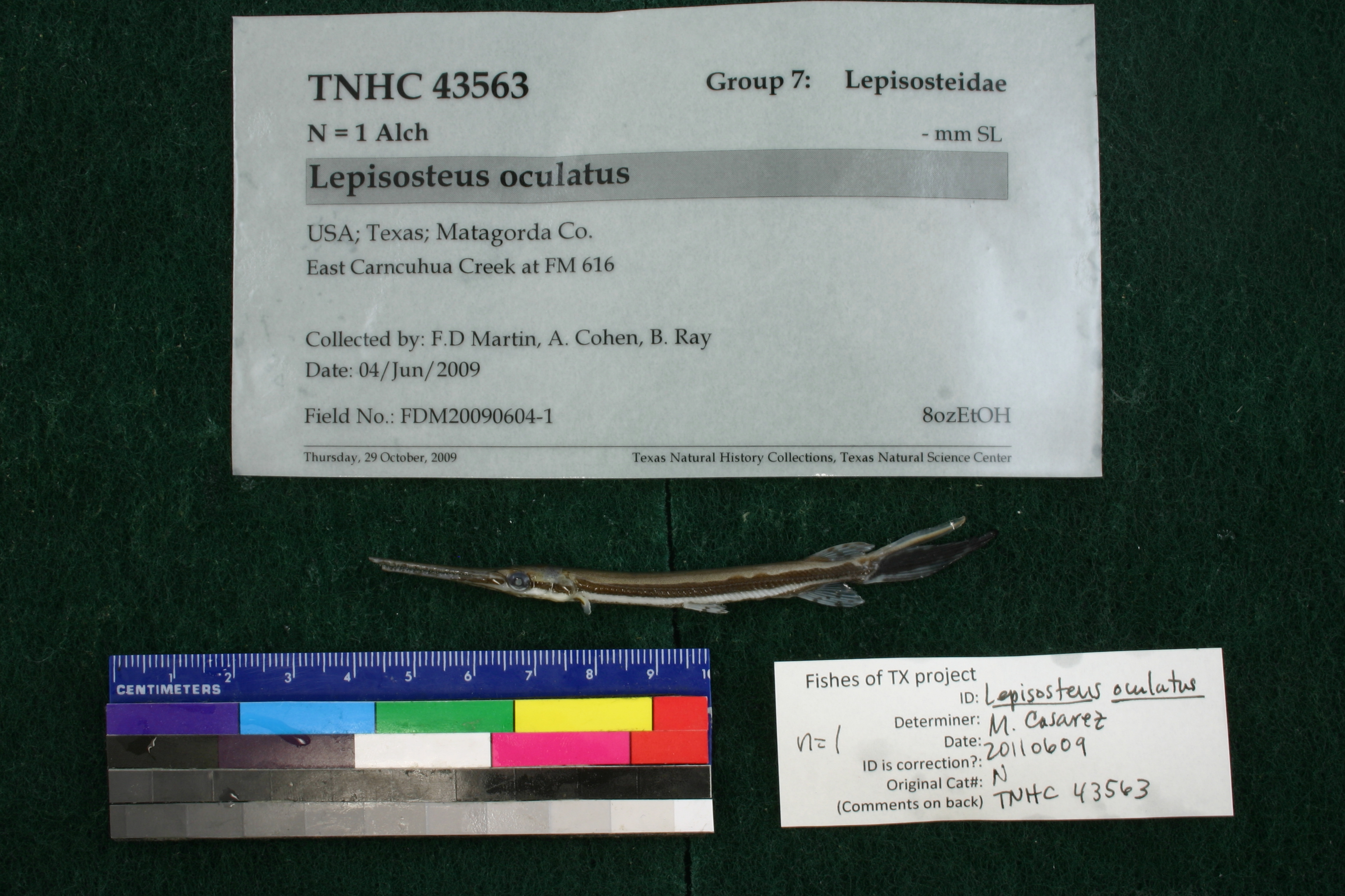
TNHCi_43563
Not suspect, examined
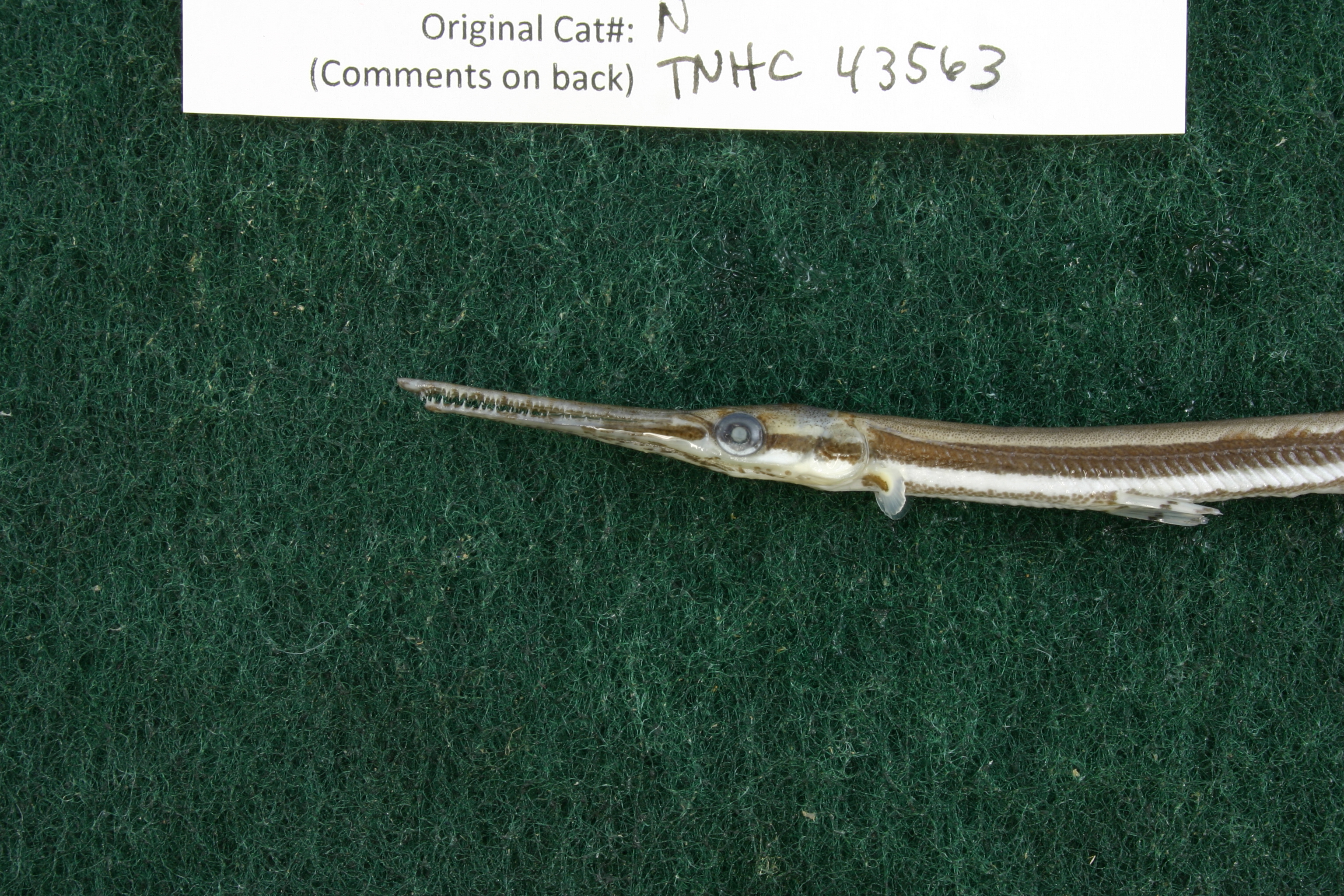
Spotted Gar –
Lepisosteus oculatus
Photos
Map
Location
28.86384° N, 96.28490° W
(± 43.7
m)
Taxonomy
FamilyLepisosteidae
GenusLepisosteus
Speciesoculatus
Specimen
Num Specimens1
Collection Event
CollectorF.D Martin, A. Cohen, B. Ray
Collected Date2009.6.4-2009.6.4
Field NumberFDM20090604-1
Geography
CountryUSA
StateTexas
CountyMatagorda
LocalityEast Carncuhua Creek at FM 616
Other
QuestionableNo
CurrentYes
YearRH/2009
GearSeine
Record Source
Source
Texas Natural History Collections
(type: specimens)
Institution
Texas Natural History Collections
(type: museum)
Curator
Dean Hendrickson
Record Added
April 23, 2015
Record Last Modified
March 23, 2026
Data Processing Track
Track 2
From Data Set Received
04/2009 to 10/2010
Identification
Suspect Notes
None
Count
1
Current Determination
Determiner
Melissa Casarez
Determination Date
Feb. 11, 2016
Determination Type
specimen examination
Identification Comments
Specimen examined and Id'ed for FoTX project. | ID notes: lateral line scales: 56; *note for SL measurements that gar have heterocercal tails - all length measurements are based on SL and are approximate; MinSL(mm): 82.24; MaxSL(mm): ; Jar: 8 oz; Specimen condition: good; Mutations: none; Count Male: ; Count female: ; Extern parasites: n
Identification Confidence
Medium
Collecting Event
Collected
June 4, 2009
Collector(s)
Collecting Event ID
15511
Field Notes
There are no field notes available.
Locality
Region
Gulf Coast Prairies & Marshes
Jurisdiction
Matagorda, Texas
Name
East Carancahua Creek at FM 616
Hydrography
USGS HUC
Texas-Gulf Region
Central Texas Coastal
Central Texas Coastal
East Matagorda Bay
East Carancahua Creek
East Carancahua Creek
HydroBASINS
7519
751910
75191000
7519100042
751910004210
Captive
no
Locality Photos
No locality photos available.
flag (suspect/examine)
suspect: noexamination: yes
georeference
Error: 43.669Locality: East Carancahua Creek at FM 616Coordinates: 28.86359;-96.28471Georferencer: MJCGeographic note: Inland USA Texas
date
date_range: 6/4/2009-6/4/2009
date
date_range: 6\4\2009-6\4\2009
collectors
collectors: Martin, F. Douglas Cohen, Adam Espelee Ray, Brandon
Comments On TNHCi_43563