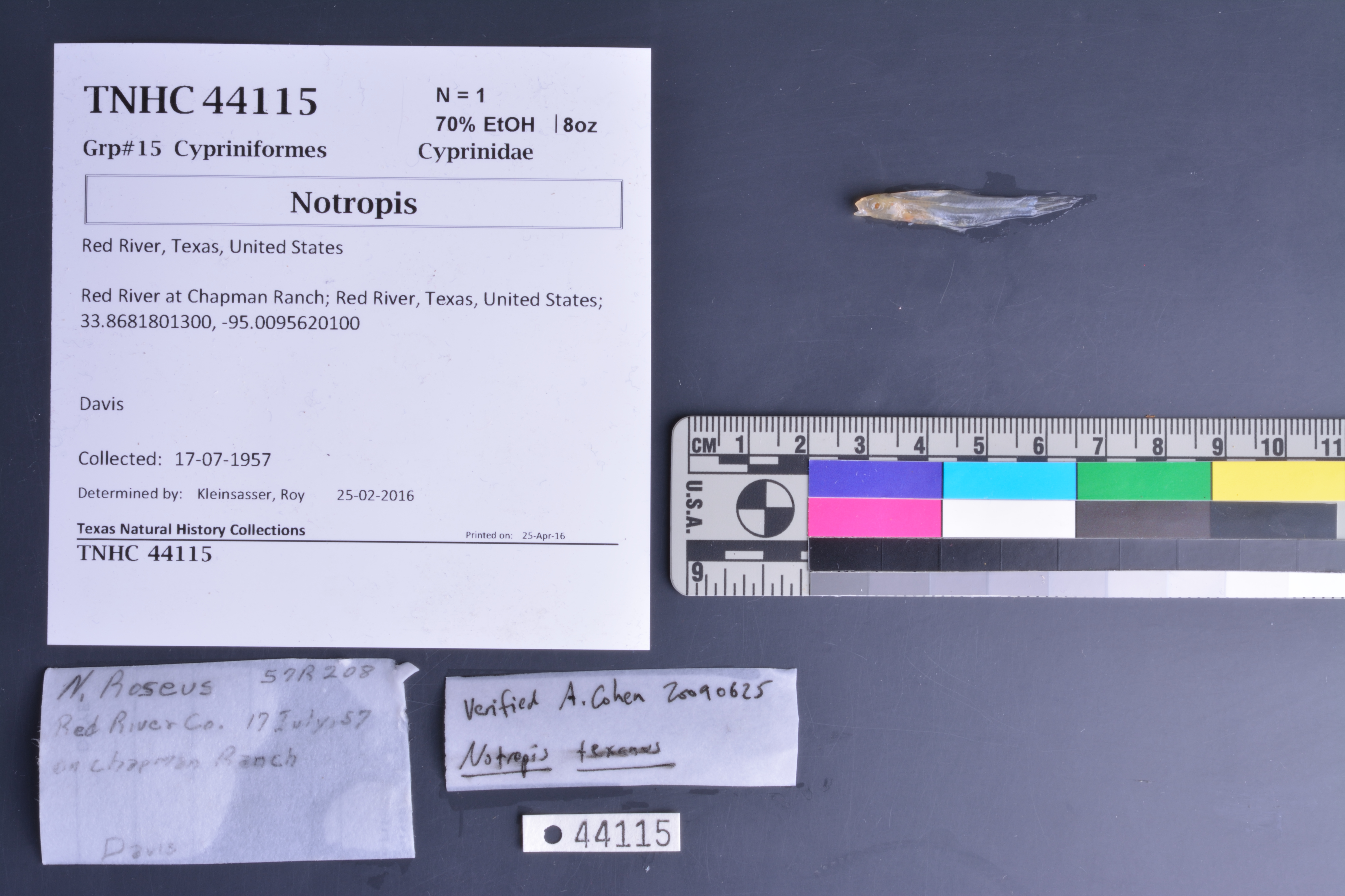
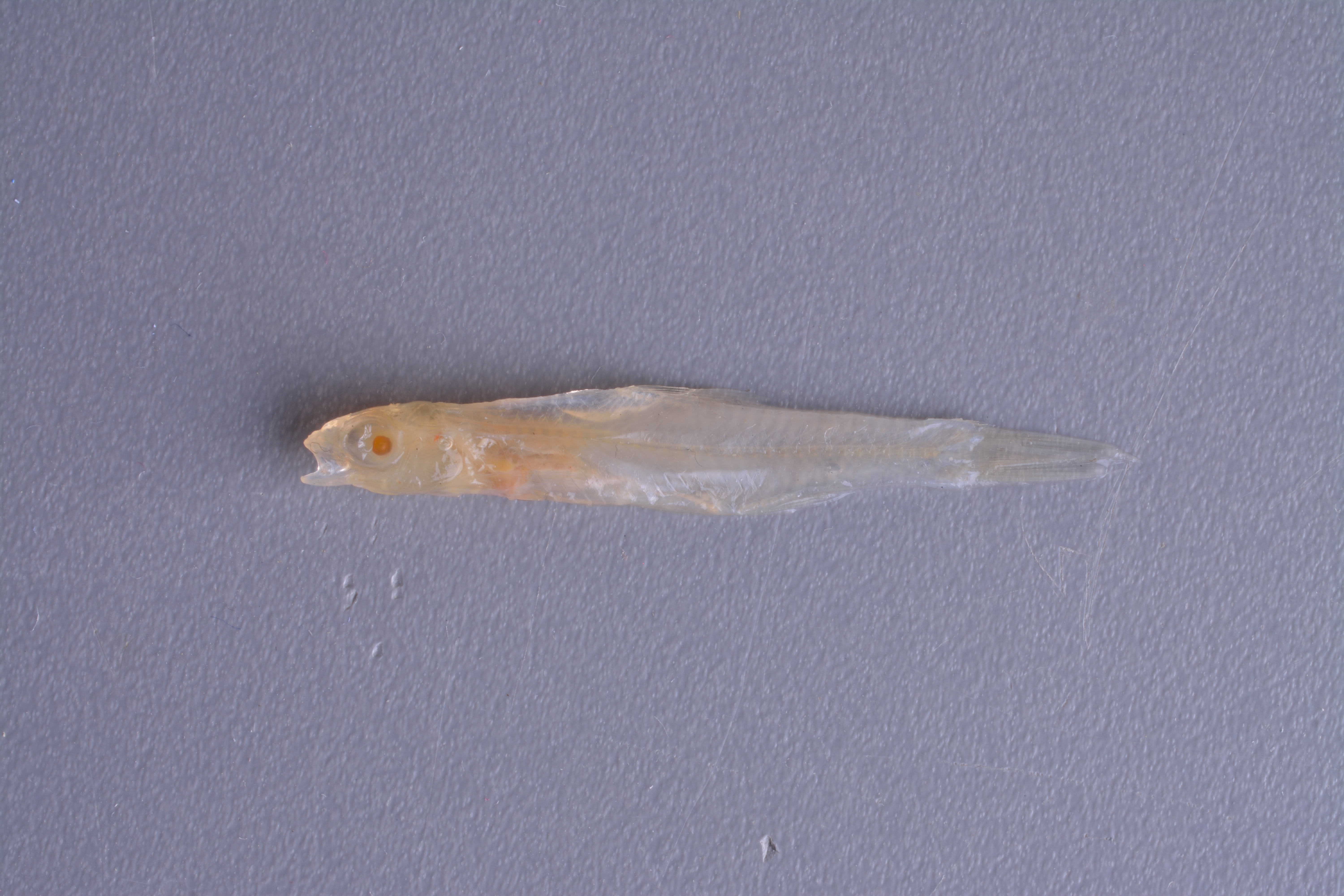
TNHCi_44115
Not suspect, examinedPhotos
Map
Location
33.86818° N, 95.00956° W
(± 2105.0
m)
Taxonomy
FamilyCyprinidae
GenusNotropis
Speciestexanus
Specimen
Num Specimens1
Collection Event
CollectorDavis,
Collected Date1957.7.17-1957.7.17
Field Numberz44115
Geography
CountryUSA
StateTexas
CountyRed River
LocalityChapman Ranch
Other
QuestionableNo
DataMultiple Lot Jar
CurrentYes
YearMC/2010
Remarksno state info provided - assuming TX because of locality tag read: N. Rosues 57R208 - not sure what N. Roseus refers to?
Record Source
Source
Texas Natural History Collections
(type: specimens)
Institution
Texas Natural History Collections
(type: museum)
Curator
Dean Hendrickson
Record Added
April 23, 2015
Record Last Modified
March 23, 2026
Data Processing Track
Track 2
From Data Set Received
04/2009 to 10/2010
Identification
Suspect Notes
None
Count
1
Current Determination
Determiner
Leroy J. Kleinsasser
Determination Date
Feb. 11, 2016
Determination Type
specimen examination
Identification Comments
ID complete | 7 anal rays/unable to verify N. texanus; possibly N. bairdi
Identification Confidence
High
Collecting Event
Collected
July 17, 1957
Collector(s)
Collecting Event ID
21935
Field Notes
There are no field notes available.
Locality
Region
Oak Woods & Prairies
Jurisdiction
McCurtain, Oklahoma
Name
Red River at Chapman Ranch
Hydrography
Arkansas-White-Red Region
Red-Sulphur
Red-Little
Pecan-Waterhole
Whitegrass Creek-Red River
Greenwood Branch-Red River
Captive
no
Locality Photos
No locality photos available.
HUC 12
111401060304
Georeferencing Remarks
Original georeference taken from locality ID#29265. Original notes: Extent covers along Red River within Chapman Ranch area
Georeferencing Annotation
Found Chapman Ranch location online from site: http://www.chapmanfamilyranches.com/Primary_Directions_to_the_Clarksville_Ranch.pdf
Has not been Georeferenced because
—
flag (suspect/examine)
note: Previously examined and can't resolve to species level. ID cannot be made to species level at this time
Examination: Examined
flag (suspect/examine)
suspect: noexamination: yes
flag (suspect/examine)
mark as unexamined (or perhaps we now wish to re-examine) and suspect
flag (suspect/examine) note
This lot in need of examination, but not yet examined. Work in progress.
georeference
Error: 2105.01672
Remarks: Original georeference taken from locality ID#29265. Original notes: Extent covers along Red River within Chapman Ranch area Found Chapman Ranch location online from site: http://www.chapmanfamilyranches.com/Primary_Directions_to_the_Clarksville_Ranch.pdf
Locality: Red River at Chapman RanchCoordinates: 33.8680833;-95.0093957Georferencer: MJCGeographic note: Inland USA TexasOriginal georeference taken from locality ID#29265. Original notes: Extent covers along Red River within Chapman Ranch area Found Chapman Ranch location online from site: http://www.chapmanfamilyranches.com/Primary_Directions_to_the_Clarksville_Ranch.pdf
date
date_range: 7/17/1957-7/17/1957
collectors
collectors: Davis
date
date_range: 7\17\1957-7\17\1957
Comments On TNHCi_44115