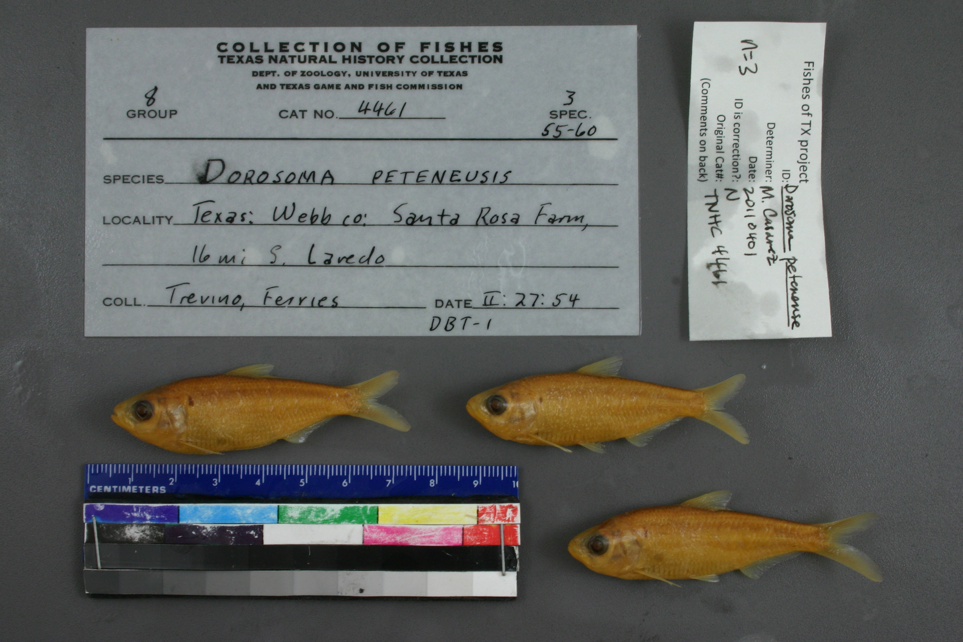
TNHCi_4461
Not suspect, examinedPhotos
Map
Location
27.28883° N, 99.48612° W
(± 23770.0
m)
Taxonomy
GenusDorosoma
Speciespetenense
Specimen
Num Specimens3
Collection Event
CollectorTrevino, D. B. and D. Ferries
Collected Date1954.2.26
Geography
DrainageRio Grande
CountryUnited States
StateTexas
CountyWebb
LocalitySanta Rosa Farm, 16 mi. S Laredo
Record Source
Source
Texas Natural History Collections
(type: specimens)
Institution
Texas Natural History Collections
(type: museum)
Curator
Dean Hendrickson
Record Added
May 13, 2010
Record Last Modified
March 23, 2026
Data Processing Track
Track 2
From Data Set Received
04/2009 to 10/2010
Identification
Suspect Notes
None
Count
3
Current Determination
Determiner
Melissa Casarez
Determination Date
Feb. 11, 2016
Determination Type
specimen examination
Identification Comments
Specimen examined and Id'ed for FoTX project. | ID notes: anal rays: 24,25; MinSL(mm): 53.03; MaxSL(mm): 58.28; Jar: 8 oz; Specimen condition: good; Mutations: none; Count Male: ; Count female: ; Extern parasites: n
Identification Confidence
High
Collecting Event
Collected
Feb. 27, 1954
Collector(s)
Collecting Event ID
7390
Field Notes
There are no field notes available.
Locality
Region
South Texas Brush Country
Jurisdiction
Webb, Texas
Name
16 miles south of Laredo
Hydrography
Rio Grande Region
Rio Grande-Falcon
Rio Grande-Falcon
International Falcon Reservoir
Cavasara Creek-Rio Grande
Mendez Hills-Rio Grande
Captive
no
Locality Photos
No locality photos available.
HUC 12
130800030601
Georeferencing Remarks
Can\'t find Santa Rosa Farm. 16 miles south of Laredo is in Mexico. Point is placed in Webb County at the closest point to 16 miles due south of Laredo. Error is calculated as if measured by air.
Georeferencing Annotation
—
Has not been Georeferenced because
—
flag (suspect/examine)
suspect: noexamination: yes
date
date_range: 2/27/1954-2/27/1954
collectors
collectors: Trevino, D. Ferries, D.
collectors
collectors: D. Trevino, D. Ferries
date
date_range: 2/26/1954-2/26/1954
staff comment
ID Status: Not flagged for specimen examination. By default we accept donor specimen determinations (after synonymization to our taxonomy). If georeferenced to TX this record has been considered in spatial context with other occurences of this species and accepted as correct.
ID Comments: NAGeoref Remark: Can't find Santa Rosa Farm. 16 miles south of Laredo is in Mexico. Point is placed in Webb County at the closest point to 16 miles due south of Laredo. Error is calculated as if measured by air.
georeference
Error: 23770.010879898
Remarks: Can't find Santa Rosa Farm. 16 miles south of Laredo is in Mexico. Point is placed in Webb County at the closest point to 16 miles due south of Laredo. Error is calculated as if measured by air.
Locality: 16 miles south of LaredoCoordinates: 27.288828933;-99.486116275Georeferencer: AECGeographic note: Inland USA TexasCan't find Santa Rosa Farm. 16 miles south of Laredo is in Mexico. Point is placed in Webb County at the closest point to 16 miles due south of Laredo. Error is calculated as if measured by air.
Comments On TNHCi_4461