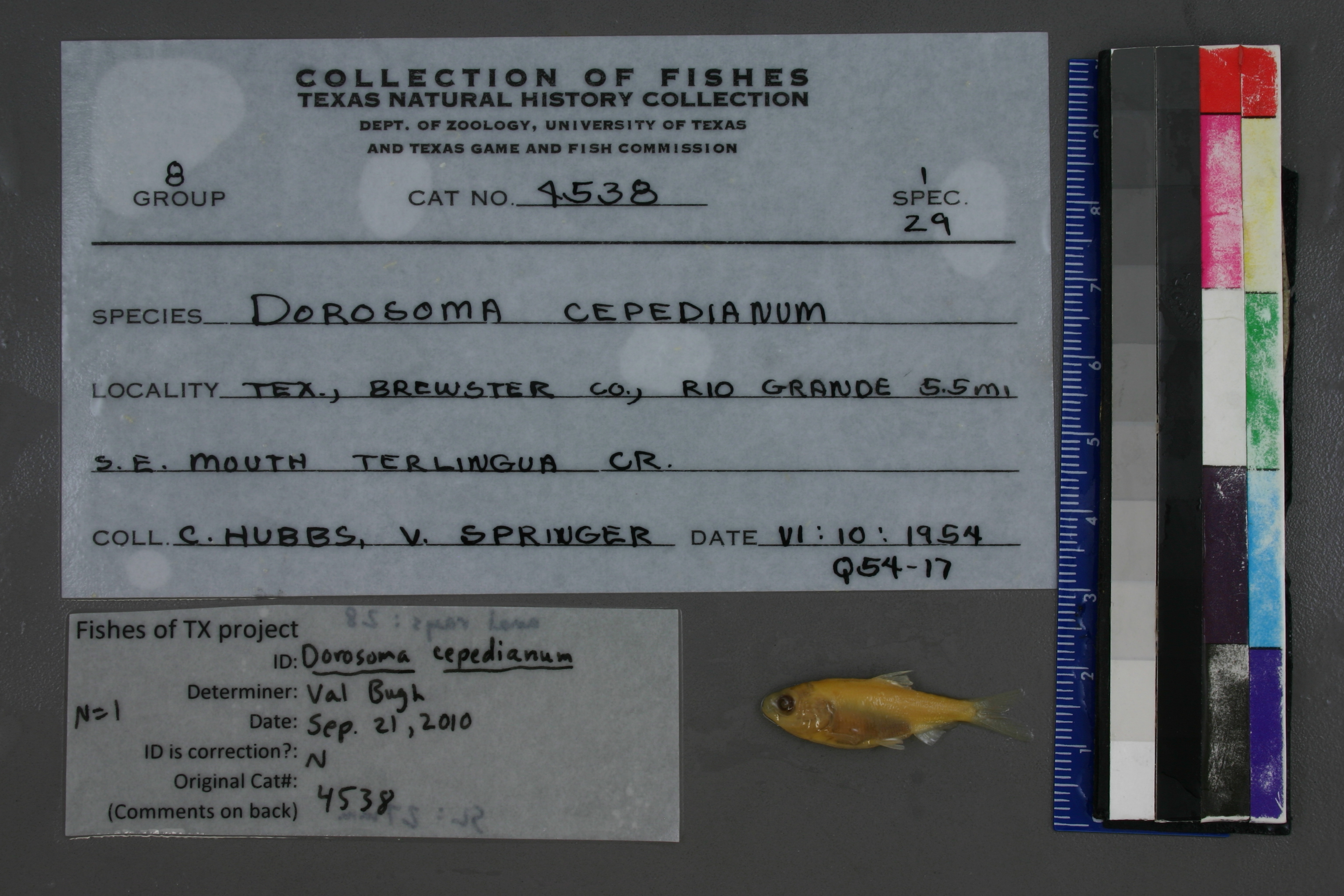
TNHCi_4538
Not suspect, examinedPhotos
Map
Location
29.14417° N, 103.54613° W
(± 848
m)
Taxonomy
GenusDorosoma
Speciescepedianum
Specimen
Num Specimens1
Collection Event
CollectorHubbs, C. and V. Springer
Collected Date1954.6.9
Geography
DrainageRio Grande
CountryUnited States
StateTexas
CountyBrewster
LocalityRio Grande 5.5 mi. SE mouth Terlingeua Creek
Record Source
Source
Texas Natural History Collections
(type: specimens)
Institution
Texas Natural History Collections
(type: museum)
Curator
Dean Hendrickson
Record Added
May 13, 2010
Record Last Modified
March 23, 2026
Data Processing Track
Track 2
From Data Set Received
04/2009 to 10/2010
Identification
Suspect Notes
None
Count
1
Current Determination
Determiner
Valerie Gawenda Bugh
Determination Date
Feb. 11, 2016
Determination Type
specimen examination
Identification Comments
Specimen examined and Id'ed for FoTX project. | ID notes: anal rays: 28; MinSL(mm): 27; MaxSL(mm): ; Jar: 8 oz; Specimen condition: good; Mutations: none; Count Male: ; Count female: ; Extern parasites:
Identification Confidence
High
Collecting Event
Collected
June 10, 1954
Collector(s)
Collecting Event ID
5230
Field Notes
There are no field notes available.
Locality
Region
Trans Pecos
Jurisdiction
Manuel Benavides, Chihuahua
Name
Rio Grande, 5.5 miles downstream of Terlingua Creek
Hydrography
Rio Grande Region
Rio Grande-Amistad
Rio Grande-Amistad
Big Bend
Alamo Creek-Rio Grande
Rancho Estelle-Rio Grande
Captive
no
Locality Photos
No locality photos available.
flag (suspect/examine)
suspect: noexamination: yes
georeference
Error: 848Remarks: Measured by riverLocality: Rio Grande, 5.5 miles downstream of Terlingua CreekCoordinates: -103.546131, 29.144172Georeferencer: Adam Cohen
Measured by river
date
date_range: 6/10/1954-6/10/1954
collectors
collectors: Hubbs, Clark Springer, Victor G.
staff comment
ID Status: Not flagged for specimen examination. By default we accept donor specimen determinations (after synonymization to our taxonomy). If georeferenced to TX this record has been considered in spatial context with other occurences of this species and accepted as correct.
ID Comments: NAGeoref Remark: Measured by riverGeoref Annotation: Should be 'Terlingua' not 'Terlingeua'
collectors
collectors: Clark Hubbs, Victor G. Springer
date
date_range: 6/9/1954-6/9/1954
georeference
Error: 848.124287996361Remarks: Measured by river Should be 'Terlingua' not 'Terlingeua'Locality: Rio Grande River, 5.5 miles downstream of Terlingua CreekCoordinates: 29.143922738;-103.545941782Georeferencer: AECGeographic note: Inland USA Texas
Measured by river Should be 'Terlingua' not 'Terlingeua'
Comments On TNHCi_4538