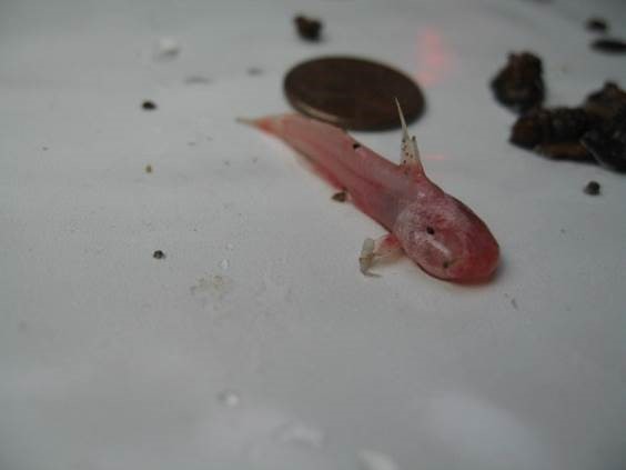
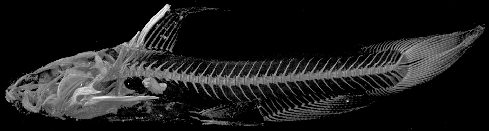
TNHCi_45860
Not suspect, not examinedPhotos
Map
Location
29.28128° N, 98.69811° W
(± 297.1
m)
Taxonomy
FamilyIctaluridae
GenusTrogloglanis
Speciespattersoni
Specimen
Num Specimens1
PreparationFluid - 1
Identification
Identification RemarksConfirmed by D. Hendrickson, 26 July 2010.
Identified ByMcDermid, Krista
Date Identified..
Collection Event
CollectorLarson, Bill
Collected Date2010.7.22
Field NumberZara-5921
Geography
CountryUnited States
StateTexas
CountyBexar
LocalityAldridge Nursery, 10440 Jarratt Rd.
Latitude29.2812777
Longitude-98.6981076
DatumWGS84
Error297.1300128
Georeferencing
Georeference RemarksReferenced at the address 10440 Jarratt Rd, which is Aldridge Nursery.
Record Source
Source
Texas Natural History Collections
(type: specimens)
Institution
Texas Natural History Collections
(type: museum)
Curator
Dean Hendrickson
Record Added
June 24, 2020
Record Last Modified
March 23, 2026
Data Processing Track
Track 3
From Data Set Received
5/2017 to 11/2017
Identification
Suspect Notes
None
Count
1
Current Determination
Determiner
Unknown
Determination Date
Unknown
Determination Type
Unspecified
Identification Comments
None
Identification Confidence
Unknown
Collecting Event
Collected
July 22, 2010
Collector(s)
Collecting Event ID
399560
Field Notes
There are no field notes available.
Locality
Jurisdiction
Bexar, Texas
Name
Aldridge Nursery, 10440 Jarratt Rd.
Hydrography
Texas-Gulf Region
Central Texas Coastal
San Antonio
Medina
Lower Medina River
Post Oak Creek-Elm Creek
Captive
no
Locality Photos
No locality photos available.
HUC 12
121003020506
Georeferencing Remarks
Georeference needs verification/refinement; coordinates provided by donor
Georeferencing Annotation
—
Has not been Georeferenced because
This record, being part of the track 3 import, is not formally georeferenced by FoTX staff at this time. However, to allow mapping and visualization of this record, locality information has been provisionally accepted if provided by the donor or if location text could be matched to previously georeferenced records by FoTX team or donor data. For many records spatial error is either accepted from the donor (when provided) or derived based on coordinate precision.
Comments On TNHCi_45860