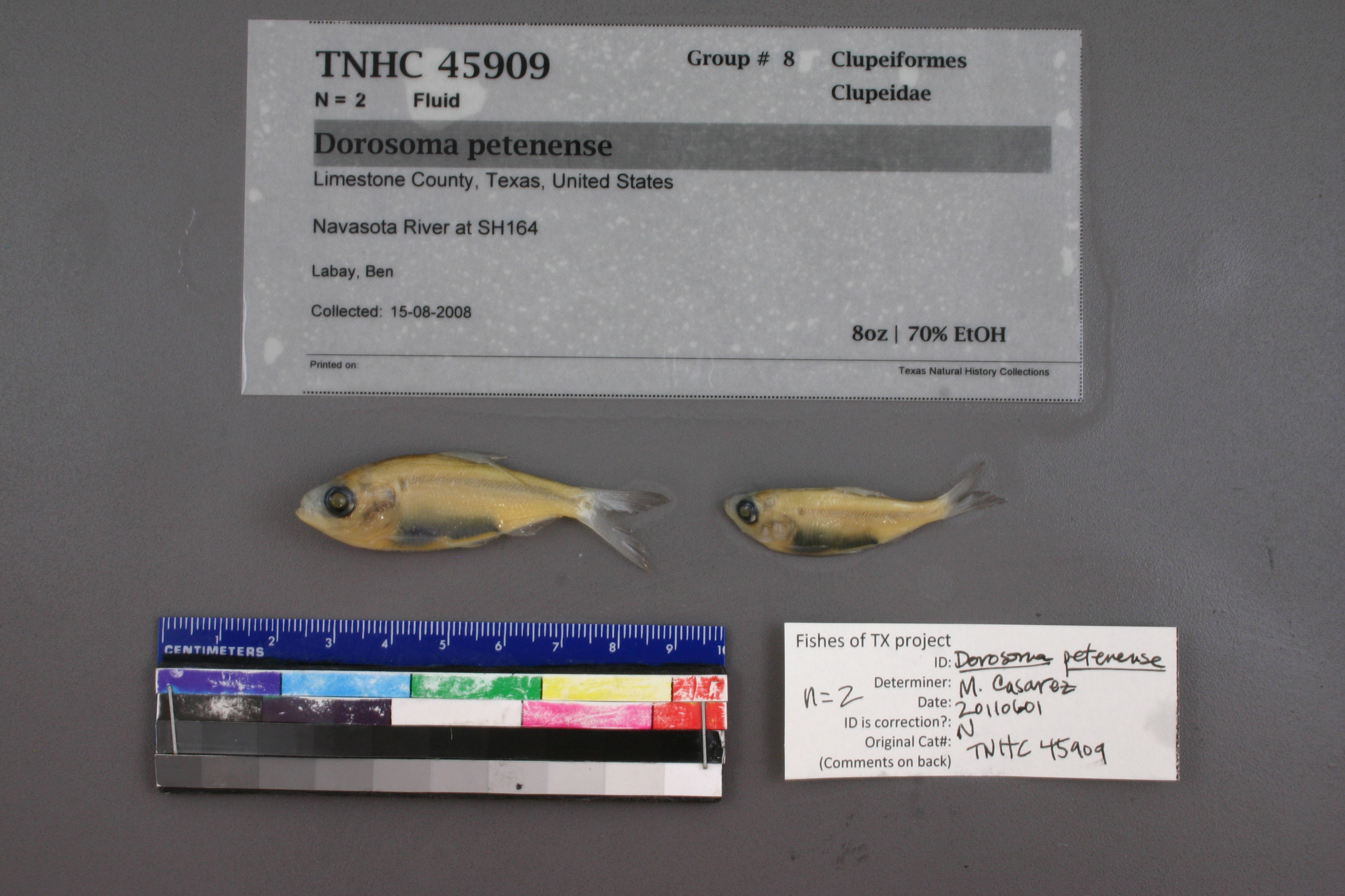
TNHCi_45909
Not suspect, not examinedPhotos
Map
Location
31.51263° N, 96.45120° W
(± 90
m)
Taxonomy
FamilyClupeidae
GenusDorosoma
Speciespetenense
Specimen
Num Specimens2
PreparationFluid - 2
Identification
Identified ByLabay, Ben
Date Identified..
Collection Event
CollectorLabay, Ben
Collected Date2008.8.15
Field Numberz45908
Event RemarksElevation: 371 ft.
Geography
CountryUnited States
StateTexas
CountyLimestone
LocalityNavasota River at TX 164
Latitude31.512626
Longitude-96.451197
DatumWGS84
Error90.0
Record Source
Source
Texas Natural History Collections
(type: specimens)
Institution
Texas Natural History Collections
(type: museum)
Curator
Dean Hendrickson
Record Added
June 24, 2020
Record Last Modified
March 23, 2026
Data Processing Track
Track 3
From Data Set Received
5/2017 to 11/2017
Identification
Suspect Notes
None
Count
2
Current Determination
Determiner
Melissa Casarez
Determination Date
Feb. 11, 2016
Determination Type
specimen examination
Identification Comments
Specimen examined and Id'ed for FoTX project. | ID notes: anal rays:21,24; MinSL(mm): 39.36; MaxSL(mm): 51.38; Jar: 8 oz; Specimen condition: good; Mutations: none; Count Male: ; Count female: ; Extern parasites: n
Identification Confidence
High
Collecting Event
Collected
Aug. 15, 2008
Collector(s)
Collecting Event ID
394996
Field Notes
There are no field notes available.
Locality
Jurisdiction
Limestone, Texas
Name
Navasota River at TX 164
Hydrography
Texas-Gulf Region
Lower Brazos
Lower Brazos
Navasota
Christmas Creek-Navasota River
Pin Oak Creek-Navasota River
Captive
no
Locality Photos
No locality photos available.
HUC 12
120701030108
Georeferencing Remarks
Georeference needs verification/refinement; coordinates provided by donor
Georeferencing Annotation
—
Has not been Georeferenced because
This record, being part of the track 3 import, is not formally georeferenced by FoTX staff at this time. However, to allow mapping and visualization of this record, locality information has been provisionally accepted if provided by the donor or if location text could be matched to previously georeferenced records by FoTX team or donor data. For many records spatial error is either accepted from the donor (when provided) or derived based on coordinate precision.
Comments On TNHCi_45909